13.0 miles
Distance
3,289 ft
Climb
-3,282 ft
Descent
1,985 ft
High Point
5 ft
Altitude change
675 ft
Altitude min
675 ft
Altitude start
679 ft
Altitude end
-56%
Grade max
66.1%
Grade min
7 miles
Distance climb
5 miles
Distance down
3,540 ft
Distance flat

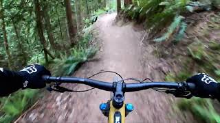
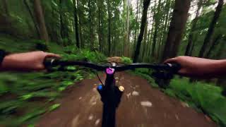
A great loop that covers some of the best trails of the region. The climbing is taxing but not ferocious, and one is well rewarded by some incredible downhilll trails.

Detailed Description
Diamond Head Loop is a highly rated 13 mile popular intermediate route located near Squamish British Columbia. This mountain bike only route and has a moderate overall physical rating. This route includes 18 trails. This route climbs 3,289 ft with a max elevation of 1,985 ft then descends -3,282 ft.

Trail Issues on Route

  • Minor Issue / Yellow: 2 trails (newest: May 31, 2026)
Local Trail Association
Local trail association
Squamish Off-Road Cycling Association (www.sorca.ca)
Please consider joining or donating to the local riding association to support trail development & maintenance.
Donate to earn trail karma!

Stats

  • Distance
    13 miles
  • Avg time
    2 hr 8 min
  • Altitude min
    675 ft
  • Altitude start
    675 ft
  • Altitude end
    679 ft
  • Climb
    3,289 ft
  • Descent
    -3,282 ft
  • Grade max
    -56%
  • Grade min
    66.1%
  • Distance climb
    7 miles
  • Distance down
    5 miles
  • Distance flat
    3,540 ft

116 Reviews & Comments


We hope you've been enjoying Trailforks!

Create a FREE account to view route comments and much more.

Details

  • Riding area
  • Primary Activity
    Mountain Bike
  • Difficulty rating
    Blue
  • Route Type
    Loop
  • Bike type
    AM
  • Physical rating
    Moderate
  • Ridelogs
    134
Avg: 4 (7 votes)
close
3D
Trail Conditions
  • Unknown
  • Snow Groomed
  • Snow Packed
  • Snow Covered
  • Snow Cover Partial
  • Freeze/thaw Cycle
  • Icy
  • Prevalent Mud
  • Wet
  • Variable
  • Ideal
  • Dry
  • Very Dry
Trail Flow (Ridden Direction)
Trailforks scans users ridelogs to determine the most popular direction each trail is ridden. A good flowing trail network will have most trails flowing in a single direction according to their intension.
The colour categories are based on what percentage of riders are riding a trail in its intended direction.
  • > 96%
  • > 90%
  • > 80%
  • > 70%
  • > 50%
  • < 50%
  • bi-directional trail
  • no data
Trail Last Ridden
Trailforks scans ridelogs to determine the last time a trail was ridden.
  • < 2 days
  • < 1 week
  • < 2 weeks
  • < 1 month
  • < 6 months
  • > 6 months
Trail Ridden Direction
The intended direction a trail should be ridden.
  • Downhill Only
  • Downhill Primary
  • Both Directions
  • Uphill Primary
  • Uphill Only
  • One Direction
Contribute Details
Colors indicate trail is missing specified detail.
  • Description
  • Photos
  • Description & Photos
  • Videos
Trail Popularity ?
Trailforks scans ridelogs to determine which trails are ridden the most in the last 9 months. Trails are compared with nearby trails in the same city region with a possible 25 colour shades. Think of this as a heatmap, more rides = more kinetic energy = warmer colors.
  • most popular
  • popular
  • less popular
  • not popular
ATV/ORV/OHV Filter
Max Vehicle Width
inches
US Cell Coverage
Legend
cell carrier legend

Radar Time
Activity Recordings
Trailforks uses anonymized public activity data. ?
Activity Recordings
Trailforks uses anonymized public activity data. ?
Personal Heatmap
Activity Types
all / none
Options
2
Date range month
Winter Trails
Warning A routing network for winter maps does not exist. Selecting trails using the winter trails layer has been disabled.
Missing Trails
Most Popular
Least Popular
Trails are colored based on popularity. The more popular a trail is, the more red. Less popular trails trend towards green.
Jump Magnitude Heatmap
Heatmap of where riders jump on trails. Zoom in to see individual jumps, click circles to view jump details.
BC Backroad Status

Service Road Atlas is a free to use, community-driven service for viewing and creating reports on the numerous back-country service roads around B.C. and Alberta.

map legend
Slope Aspect
Direction the slope faces
Flat N NE E SE S SW W NW
Trails Deemphasized
Trails are shown in grey.
disable
Only show trails with no bike usage.
Enable
Suggested Layers
Based on selected activity type

    Save the current map location and zoom level as your default home location whenever this page is loaded.

    Save
    Trail transparency
    • Singletrack
    • Unpaved
    465
    1,330
    4,210 | 2 faves
    822
    HALF NELSONHalf Nelson full trail
    HALF NELSONHalf Nelson full trail
    9:16 | 18 | comments: 0 | favs:
    Jun 12, 2026
    HALF NELSON x LOWER ANGRY M | Diamond Head -...
    HALF NELSON x LOWER ANGRY M | Diamond Head - Squamish
    7:04 | 42 | comments: 0 | favs:
    May 19, 2026

    Recent Trail Reports Along Route

    statustraildateconditiondescription
    Pseudo-Tsuga - Part 3
    Jun 25, 2026 @ 12:34pm (America/Vancouver)
    16 hours
    Pseudo-Tsuga - Part 1
    Jun 25, 2026 @ 12:34pm (America/Vancouver)
    16 hours
    Pseudo-Tsuga - Part 2
    Jun 25, 2026 @ 12:34pm (America/Vancouver)
    16 hours
    Climb Trail - Stl'lhalem Sintl'
    Jun 21, 2026 @ 9:16am (America/Vancouver)
    Jun 21, 2026
    Phil & Cam's
    Jun 21, 2026 @ 9:16am (America/Vancouver)
    Jun 21, 2026
    more reports »
    • By waldverlorenTF Pro & contributors
    • #5168 - 13,368 views

    Hit the Trail

    Open in App

    Get this route on your phone instantly.

    Download Route

    Save to wishlist, Garmin & download.