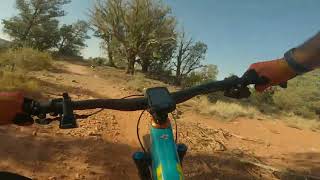
This route is not to miss if you like wide open descending and a more XC feel. Startat the AZ Cypress Trailhead and head towards Dawa. Climb around the north and northwest side of Doe Mountain via Cockscomb and Aerie - a fun and mellow climb (for Sedona). Aerie will continue around the southwest side of the mountain with some traversing and descending. You'll continue south along Cockscomb trail which will give you some fast and flowy downhills mixed with some punchy ups. Link back to Dawa and AZ Cypress to return to the Trail Head.
Local Trail Association
Trail Products
Stats
-
Distance9 miles
-
Avg time2 hr 30 min
-
Altitude change0 ft
-
Altitude min4,385 ft
-
Altitude start4,431 ft
-
Altitude end4,432 ft
-
Climb601 ft
-
Descent-602 ft
-
Grade max-18.3%
-
Grade min18.4%
-
Distance climb4 miles
-
Distance down3 miles
-
Distance flat2 miles
25 Reviews & Comments
We hope you've been enjoying Trailforks!
Create a FREE account to view route comments and much more.
- Unknown
- Snow Groomed
- Snow Packed
- Snow Covered
- Snow Cover Partial
- Freeze/thaw Cycle
- Icy
- Prevalent Mud
- Wet
- Variable
- Ideal
- Dry
- Very Dry
The colour categories are based on what percentage of riders are riding a trail in its intended direction.
- > 96%
- > 90%
- > 80%
- > 70%
- > 50%
- < 50%
- bi-directional trail
- no data
- < 2 days
- < 1 week
- < 2 weeks
- < 1 month
- < 6 months
- > 6 months
- Downhill Only
- Downhill Primary
- Both Directions
- Uphill Primary
- Uphill Only
- One Direction
- Description
- Photos
- Description & Photos
- Videos
- most popular
- popular
- less popular
- not popular
Service Road Atlas is a free to use, community-driven service for viewing and creating reports on the numerous back-country service roads around B.C. and Alberta.
Save the current map location and zoom level as your default home location whenever this page is loaded.
Save- Singletrack
Photos
Videos
Recent Trail Reports Along Route
- By MollyJoyce
& contributors - #17584 - 1,051 views

