9.9 miles
Distance
1,108 ft
Climb
-915 ft
Descent
406 ft
High Point
194 ft
Altitude change
119 ft
Altitude min
141 ft
Altitude start
335 ft
Altitude end
0.4%
Grade
-67.1%
Grade max
56.9%
Grade min
5 miles
Distance climb
4 miles
Distance down
1 mile
Distance flat

Looking for an easy outing in the Encinitas area? Well, this might be it. You can leave the enduro bike at home for this route because there's almost no singletrack to be found, but it's still a fun outing if you're in the area and want to stretch your legs a bit.

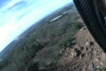
You'll warm up with a steep climb and descent on the Indian Head trails, then work your way toward the Water Tank Trail. You'll then head south along a lengthy escarpment while enjoying great views along the way. Eventually, you'll turn back north and make your way back to the starting point, perhaps thinking, "That was so easy that maybe I'll do another lap"

A few things to note:

1. The route is suitable for beginning riders and consists of trails rated green and blue. A few of the steeper sections may need to be walked if you're just starting out.

2. A bell should be considered mandatory. The trails are crowded and multiple-use. Please be cautious around blind corners. Even with a bell, many hikers have earbuds in place and may not hear you. Assume that someone will be standing in the trail when you turn a corner. Please watch your speed and be courteous.

3. All the trails are sanctioned and legal. Have fun!

Detailed Description
Easy Encinitas is a 10 mile moderately popular easy route located near Encinitas California. This mountain bike primary route can be used one direction and has a easy overall physical rating. This route includes 9 trails. This route climbs 1,108 ft with a max elevation of 406 ft then descends -915 ft.

Trail Issues on Route

  • Significant Issue / Amber: 1 trail (newest: Jan 21, 2026)
  • Minor Issue / Yellow: 3 trails (newest: Feb 2, 2023)

Stats

  • Distance
    10 miles
  • Avg time
    55 min 21 sec
  • Altitude min
    119 ft
  • Altitude start
    141 ft
  • Altitude end
    335 ft
  • Climb
    1,108 ft
  • Descent
    -915 ft
  • Grade
    0.4%
  • Grade max
    -67.1%
  • Grade min
    56.9%
  • Distance climb
    5 miles
  • Distance down
    4 miles
  • Distance flat
    1 mile

2 Reviews & Comments


We hope you've been enjoying Trailforks!

Create a FREE account to view route comments and much more.

Details

  • Riding area
  • Primary Activity
    Mountain Bike
  • Other Activities
    • Gravel Bike
  • Difficulty rating
    Green
  • Route Type
    Loop
  • Bike type
    AM, XC, Fat, CX, Gravel
  • Direction
    One Direction
  • Physical rating
    Easy

Directions

  1. Bike west on Indian Head Trail.
  2. Continue for 200 meters.
  3. Bike south on Indian Head Trail.
  4. Continue for 400 meters.
  5. Bike northeast on Indian Head Trail.
  6. Continue for 40 meters.
  7. Bear left onto Indian Head Trail Loop.
  8. Continue for 200 meters.
  9. Bike north on Indian Head Trail Loop.
  10. Continue for 200 meters.
  11. Bike southeast on Indian Head Trail Loop.
  12. Continue for 300 meters.
  13. Bike west on Indian Head Trail Loop.
  14. Continue for 40 meters.
  15. Bike west on Indian Head Trail.
  16. Continue for 600 meters.
  17. Make a sharp left onto Indian Head Connector.
  18. Continue for 70 meters.
  19. Turn right onto Water Tank Trail.
  20. Continue for 400 meters.
  21. Bike southeast on Water Tank Trail.
  22. Continue for 800 meters.
  23. Bike south on Water Tank Trail.
  24. Continue for 400 meters.
  25. Bike southwest on Leucadia Blvd Pathway.
  26. Continue for 400 meters.
  27. Bike south on Quail Gardens Pathway.
  28. Continue for 100 meters.
  29. Turn left onto Paseo de las Flores Pathway.
  30. Continue for 200 meters.
  31. Bike east on Paseo de las Flores Pathway.
  32. Continue for 300 meters.
  33. Bike east on Encinitas Ranch Trail.
  34. Continue for 200 meters.
  35. Bike east on Encinitas Ranch Trail.
  36. Continue for 100 meters.
  37. Bike south on Encinitas Ranch Trail.
  38. Continue for 1.5 kilometers.
  39. Bike west on Encinitas Ranch Trail.
  40. Continue for 1 kilometer.
  41. Bike north on Encinitas Ranch Trail.
  42. Continue for 500 meters.
  43. Bike north on Cantebria Garden Trail.
  44. Continue for 200 meters.
  45. Bike southeast on Cantebria Garden Trail.
  46. Continue for 500 meters.
  47. Bike north on Cantebria Garden Trail.
  48. Continue for 1 kilometer.
  49. Bike south on Cantebria Garden Trail.
  50. Continue for 1 kilometer.
  51. Bike northeast on Quail Gardens Pathway.
  52. Continue for 600 meters.
Avg: 3 (2 votes)
close
3D
Trail Conditions
  • Unknown
  • Snow Groomed
  • Snow Packed
  • Snow Covered
  • Snow Cover Partial
  • Freeze/thaw Cycle
  • Icy
  • Prevalent Mud
  • Wet
  • Variable
  • Ideal
  • Dry
  • Very Dry
Trail Flow (Ridden Direction)
Trailforks scans users ridelogs to determine the most popular direction each trail is ridden. A good flowing trail network will have most trails flowing in a single direction according to their intension.
The colour categories are based on what percentage of riders are riding a trail in its intended direction.
  • > 96%
  • > 90%
  • > 80%
  • > 70%
  • > 50%
  • < 50%
  • bi-directional trail
  • no data
Trail Last Ridden
Trailforks scans ridelogs to determine the last time a trail was ridden.
  • < 2 days
  • < 1 week
  • < 2 weeks
  • < 1 month
  • < 6 months
  • > 6 months
Trail Ridden Direction
The intended direction a trail should be ridden.
  • Downhill Only
  • Downhill Primary
  • Both Directions
  • Uphill Primary
  • Uphill Only
  • One Direction
Contribute Details
Colors indicate trail is missing specified detail.
  • Description
  • Photos
  • Description & Photos
  • Videos
Trail Popularity ?
Trailforks scans ridelogs to determine which trails are ridden the most in the last 9 months. Trails are compared with nearby trails in the same city region with a possible 25 colour shades. Think of this as a heatmap, more rides = more kinetic energy = warmer colors.
  • most popular
  • popular
  • less popular
  • not popular
ATV/ORV/OHV Filter
Max Vehicle Width
inches
US Cell Coverage
Legend
cell carrier legend

Radar Time
Activity Recordings
Trailforks uses anonymized public activity data. ?
Activity Recordings
Trailforks uses anonymized public activity data. ?
Personal Heatmap
Activity Types
all / none
Options
2
Date range month
Winter Trails
Warning A routing network for winter maps does not exist. Selecting trails using the winter trails layer has been disabled.
Missing Trails
Most Popular
Least Popular
Trails are colored based on popularity. The more popular a trail is, the more red. Less popular trails trend towards green.
Jump Magnitude Heatmap
Heatmap of where riders jump on trails. Zoom in to see individual jumps, click circles to view jump details.
BC Backroad Status

Service Road Atlas is a free to use, community-driven service for viewing and creating reports on the numerous back-country service roads around B.C. and Alberta.

map legend
Slope Aspect
Direction the slope faces
Flat N NE E SE S SW W NW
Trails Deemphasized
Trails are shown in grey.
disable
Only show trails with no bike usage.
Enable
Suggested Layers
Based on selected activity type

    Save the current map location and zoom level as your default home location whenever this page is loaded.

    Save
    Trail transparency
    • Unpaved
    22
    32 | 1 faves
    28
    44
    UNP UNCUT - Water Tank Trail - 360 - Adaptive MTB
    UNP UNCUT - Water Tank Trail - 360 - Adaptive MTB
    2:06 | 600 | comments: 0 | favs:
    Apr 8, 2019
    Water Tank Trail (La Costa Preserve)
    Water Tank Trail (La Costa Preserve)
    2:57 | 312 | comments: 0 | favs:
    Oct 29, 2010
    Camera head slipped... Oh well... Will have to reshoot this one later... (10.29.2010)

    Recent Trail Reports Along Route

    statustraildateconditiondescription
    Cantebria Garden Trail
    Jan 21, 2026 @ 6:50am (America/Los_Angeles)
    Jan 21, 2026
    TRAIL WORK IN PROGRESS. Heavy equipment. Exercise caution. Work will conclude EOD Jan21, but new dirt will cause conditions to be extremely loose until next rain.
    Indian Head Trail Loop
    Feb 2, 2023 @ 12:36am
    Feb 2, 2023
    Trail is seriously rutty due to water run off.
    Quail Gardens Pathway
    Feb 2, 2023 @ 12:36am
    Feb 2, 2023
    Trail is seriously rutty due to water run off.
    Indian Head Trail
    Feb 2, 2023 @ 12:36am
    Feb 2, 2023
    Trail is seriously rutty due to water run off.
    Encinitas Ranch Trail
    Sep 4, 2022 @ 8:12am
    Sep 4, 2022
    more reports »

    Hit the Trail

    Open in App

    Get this route on your phone instantly.

    Download Route

    Save to wishlist, Garmin & download.