16.1 miles
Distance
1,285 ft
Climb
-1,282 ft
Descent
865 ft
High Point
4 ft
Altitude change
378 ft
Altitude min
378 ft
Altitude start
381 ft
Altitude end
-25.8%
Grade max
22.8%
Grade min
7 miles
Distance climb
6 miles
Distance down
3 miles
Distance flat

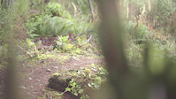
A good, rolling rip from Edgehill school usually ridden counter clockwise but works both ways and including some local classics such as Game, Mud, Bob's, Cream Soda, 51 Dodge, Myrtle.

Detailed Description
Edgehill Mud Rip is a 16 mile popular intermediate route located near Powell River British Columbia. This mountain bike only route can be used both directions and has a moderate overall physical rating. This route includes 33 trails. This route climbs 1,285 ft with a max elevation of 865 ft then descends -1,282 ft.

Trail Issues on Route

  • Significant Issue / Amber: 2 trails (newest: Jun 7, 2026)
  • Minor Issue / Yellow: 4 trails (newest: Jun 14, 2026)
Local Trail Association
Local trail association
Qathet Regional Cycling Association (qrca.ca)
Please consider joining or donating to the local riding association to support trail development & maintenance.
Donate to earn trail karma!

Stats

  • Distance
    16 miles
  • Avg time
    3 hr 43 min
  • Altitude min
    378 ft
  • Altitude start
    378 ft
  • Altitude end
    381 ft
  • Climb
    1,285 ft
  • Descent
    -1,282 ft
  • Grade max
    -25.8%
  • Grade min
    22.8%
  • Distance climb
    7 miles
  • Distance down
    6 miles
  • Distance flat
    3 miles

13 Reviews & Comments


We hope you've been enjoying Trailforks!

Create a FREE account to view route comments and much more.

Trails in Route

Edgehill Main2 miles
Bobcat2,867 ft
Blue5,056 ft
Blue Connector3,274 ft
Game On2,080 ft
IT Road571 ft
Game On348 ft
IT Road85 ft
Game On413 ft
IT Road367 ft
Game On105 ft
IT Road75 ft
Game On2,411 ft
Game1,988 ft
Duck Lake Road Branch 2144 ft
Mud Lake381 ft
Yew1 mile
3GB325 ft
Spur 73,383 ft
Mud Lake3 miles
Weir Trail1,355 ft
Weir Road335 ft
Duck Lake Road Branch 21,900 ft
Edgehill Main13 ft
Bob's Yer Uncle1 mile
Bob's Your Brother2,047 ft
Cream Soda3,045 ft
Duck Lake Road Branch 2177 ft
51 Dodge3,494 ft
Myrtle Springs3,625 ft
Bucket Upper2,428 ft
Bucket Lower1,926 ft
Edgehill Main2,844 ft

Details

  • Featured
  • Riding area
  • Primary Activity
    Mountain Bike
  • Difficulty rating
    Blue
  • Route Type
    Out & Back
  • Bike type
    XC
  • Direction
    Both Directions
  • Physical rating
    Moderate
  • Ridelogs
    1
Avg: 5 (1 votes)
close
3D
Trail Conditions
  • Unknown
  • Snow Groomed
  • Snow Packed
  • Snow Covered
  • Snow Cover Partial
  • Freeze/thaw Cycle
  • Icy
  • Prevalent Mud
  • Wet
  • Variable
  • Ideal
  • Dry
  • Very Dry
Trail Flow (Ridden Direction)
Trailforks scans users ridelogs to determine the most popular direction each trail is ridden. A good flowing trail network will have most trails flowing in a single direction according to their intension.
The colour categories are based on what percentage of riders are riding a trail in its intended direction.
  • > 96%
  • > 90%
  • > 80%
  • > 70%
  • > 50%
  • < 50%
  • bi-directional trail
  • no data
Trail Last Ridden
Trailforks scans ridelogs to determine the last time a trail was ridden.
  • < 2 days
  • < 1 week
  • < 2 weeks
  • < 1 month
  • < 6 months
  • > 6 months
Trail Ridden Direction
The intended direction a trail should be ridden.
  • Downhill Only
  • Downhill Primary
  • Both Directions
  • Uphill Primary
  • Uphill Only
  • One Direction
Contribute Details
Colors indicate trail is missing specified detail.
  • Description
  • Photos
  • Description & Photos
  • Videos
Trail Popularity ?
Trailforks scans ridelogs to determine which trails are ridden the most in the last 9 months. Trails are compared with nearby trails in the same city region with a possible 25 colour shades. Think of this as a heatmap, more rides = more kinetic energy = warmer colors.
  • most popular
  • popular
  • less popular
  • not popular
ATV/ORV/OHV Filter
Max Vehicle Width
inches
US Cell Coverage
Legend
cell carrier legend

Radar Time
Activity Recordings
Trailforks uses anonymized public activity data. ?
Activity Recordings
Trailforks uses anonymized public activity data. ?
Personal Heatmap
Activity Types
all / none
Options
2
Date range month
–
Winter Trails
Warning A routing network for winter maps does not exist. Selecting trails using the winter trails layer has been disabled.
Missing Trails
Most Popular
Least Popular
Trails are colored based on popularity. The more popular a trail is, the more red. Less popular trails trend towards green.
Jump Magnitude Heatmap
Heatmap of where riders jump on trails. Zoom in to see individual jumps, click circles to view jump details.
BC Backroad Status

Service Road Atlas is a free to use, community-driven service for viewing and creating reports on the numerous back-country service roads around B.C. and Alberta.

map legend
Slope Aspect
Direction the slope faces
Flat N NE E SE S SW W NW
Trails Deemphasized
Trails are shown in grey.
disable
Only show trails with no bike usage.
Enable
Suggested Layers
Based on selected activity type

    Save the current map location and zoom level as your default home location whenever this page is loaded.

    Save
    Trail transparency
    • Singletrack
    • Unpaved
    24
    25
    37
    27
    duck lake trails
    duck lake trails
    0:00 | 343 | comments: 0 | favs:
    Apr 25, 2018
    #enduro #sunshinecoast #powellriver #bc #ridegiant
    Brendon Edgar Manuel Down Yew St
    Brendon Edgar Manuel Down Yew St
    trail: Yew
    0:58 | 412 | comments: 3 | favs: 5
    Jul 25, 2012
    Brendon Edgar has taken his dirt jumper to the streets to see what kind of trouble he can find. Here is Yew St in Kitsilano BC.

    Recent Trail Reports Along Route

    statustraildateconditiondescription
    3GB
    Jun 14, 2026 @ 1:54pm (America/Vancouver)
    Jun 14, 2026
    Overgrown 3GB and 100m of Yew
    Blue Connector
    Jun 7, 2026 @ 5:53pm (America/Vancouver)
    Jun 7, 2026
    Tree across trail the trail on the west lake end by Hammil main. You can duck it but it’s a big one and will need saws.
    Spur 7
    Apr 26, 2026 @ 2:07pm (America/Vancouver)
    Apr 26, 2026
    Two trees down on trail that will need chainsaw to remove
    Blue
    Mar 21, 2026 @ 3:51pm (America/Vancouver)
    Mar 21, 2026
    All clear. Some decent sized puddles here and there but everything's rideable (there are ride-arounds for the big ones).
    Game On
    Jan 25, 2026 @ 2:14pm (America/Vancouver)
    Jan 25, 2026
    more reports »
    • By RubrewerTF Pro & contributors
    • #1056 - 3,123 views

    Hit the Trail

    Open in App

    Get this route on your phone instantly.

    Download Route

    Save to wishlist, Garmin & download.