15.9 miles
Distance
2,802 ft
Climb
-2,838 ft
Descent
3,062 ft
High Point
-35 ft
Altitude change
1,381 ft
Altitude min
1,536 ft
Altitude start
1,503 ft
Altitude end
-90%
Grade max
81.8%
Grade min
9 miles
Distance climb
4 miles
Distance down
3 miles
Distance flat

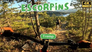
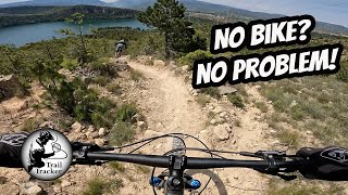
Ruta que ens porta al Trail dels Escorpins. Passant per la font de Talarn, Baixada pel ZZ Top fins anar a buscar la carretera que ens puja l'inici de Roques Pelades.
Farem Roques fins al mirador i despres al creuament amb Valkyries anirem a esquerra per agafar l'entrada d'Escorpins. Trail amb bones vistes i on l'única dificultat son varis salts que anirem trobant durant la baixada (Tots tenen variant fàcil).
Un cop abaix pugem per Guillot per anar a trobar Valkyries II. Anirem tornant a Tremp passant per la zona del Raig i les Insules. En dies de fang un cop acabat Valkyries millor tornar per carretera.

ESP: Ruta que nos lleva al trail dels Escorpins. Pasaremos por la fuente de Talarn, luego bajar por ZZtop hasta llegar a la carretera que nos sube al inicio de Roques Pelades.
Haremos Roques hasta el mirador i unos metros mas adelante justo en el cruce con Valkyries iremos a la izquierda para coger la entrada de Escorpins. Trail con buenas vistas donde la única dificultad son varios saltos que encontraremos durante la bajada (Todos con variante fácil).
Una vez abajo subiremos por Guillot para llegar a Valkyries II. Ya vamos regresando a Tremp pasando por la zona del Raig i les Insules. En dias con barro despues de Valkyries mejor volver por carretera.

Detailed Description
Els Escorpins is a 16 mile popular red route located near Tremp. This mountain bike primary route can be used one direction and has a hard overall physical rating. This route includes 14 trails. This route climbs 2,802 ft with a max elevation of 3,062 ft then descends -2,838 ft.
Local Trail Association
Local trail association
Associació Lo Podall (www.tremp.cat)
Please consider joining or donating to the local riding association to support trail development & maintenance.
Donate to earn trail karma!

Stats

  • Distance
    16 miles
  • Avg time
    2 hr 34 min
  • Altitude min
    1,381 ft
  • Altitude start
    1,536 ft
  • Altitude end
    1,503 ft
  • Climb
    2,802 ft
  • Descent
    -2,838 ft
  • Grade max
    -90%
  • Grade min
    81.8%
  • Distance climb
    9 miles
  • Distance down
    4 miles
  • Distance flat
    3 miles

35 Reviews & Comments


We hope you've been enjoying Trailforks!

Create a FREE account to view route comments and much more.

Details

  • Riding area
  • Primary Activity
    Mountain Bike
  • Other Activities
    • E-Bike
  • Difficulty rating
    Red
  • Route Type
    Loop
  • eBike Allowed
  • Bike type
    AM, XC
  • Direction
    One Direction
  • Physical rating
    Hard
  • Ridelogs
    1

Directions

  1. Bike west.
  2. Continue for 200 meters.
  3. Bike northeast.
  4. Continue for 200 meters.
  5. Bike northeast on Carrer d'Aragó.
  6. Continue for 70 meters.
  7. Turn left onto Passeig del Joncar.
  8. Continue for 90 meters.
  9. Bear left onto Pujada a St Adrià.
  10. Continue for 30 meters.
  11. Bike southeast on Pujada a St Adrià.
  12. Continue for 30 meters.
  13. Make a left U-turn onto Passeig del Joncar.
  14. Continue for 300 meters.
  15. Bike northwest on Passeig del Joncar.
  16. Continue for 20 meters.
  17. Turn right.
  18. Continue for 200 meters.
  19. Bike northeast.
  20. Continue for 70 meters.
  21. Bike northwest on Font de l'Aleixó.
  22. Continue for 300 meters.
  23. Bike northeast on Plaques Solars.
  24. Continue for 200 meters.
  25. Bike northwest on Tendrui.
  26. Continue for 400 meters.
  27. Bike northwest on Tendrui.
  28. Continue for 800 meters.
  29. Bike northeast on Sabarissos connection.
  30. Continue for 500 meters.
  31. Bike east on Talarn pels horts.
  32. Continue for 600 meters.
  33. Bike southeast on Cami de Sallent.
  34. Continue for 60 meters.
  35. Turn left onto Z.Z. 2.0.
  36. Continue for 300 meters.
  37. Bike northeast on Z.Z. 2.0.
  38. Continue for 300 meters.
  39. Bike west on carrer de la Font de Caps.
  40. Continue for 40 meters.
  41. Bear left onto Talarn pels horts.
  42. Continue for 900 meters.
  43. Turn left onto Fems i Sabarissos.
  44. Continue for 10 meters.
  45. Turn right onto Sabarissos connection.
  46. Continue for 1 kilometer.
  47. Turn left onto Pujada al Caragol.
  48. Continue for 100 meters.
  49. Turn left to stay on Pujada al Caragol.
  50. Continue for 400 meters.
  51. Turn right onto Cami dels Cavalls.
  52. Continue for 3 kilometers.
  53. Turn left onto Pujada a St Adrià.
  54. Continue for 1.5 kilometers.
  55. Turn left onto Carrer de Montllobar.
  56. Continue for 500 meters.
  57. Turn left onto Carrer del Montsec.
  58. Continue for 200 meters.
  59. Turn right onto Carrer del Paradís.
  60. Continue for 40 meters.
  61. Turn left onto Carrer de les Adoberies.
  62. Continue for 60 meters.
  63. Bear left onto carrer de Seix i Faya.
  64. Continue for 1 kilometer.
  65. Keep left to take C-13.
  66. Continue for 1.5 kilometers.
  67. Bear left onto Pujada a Sta Engracia.
  68. Continue for 200 meters.
  69. Bike south on Pujada a Sta Engracia.
  70. Continue for 200 meters.
  71. Bear right onto C-13.
  72. Continue for 1 kilometer.
  73. Keep left to stay on C-13.
  74. Continue for 1.5 kilometers.
  75. Bear right onto Carrer de les Adoberies.
  76. Continue for 100 meters.
  77. Turn right onto Carrer de Collegats.
  78. Continue for 30 meters.
  79. Turn left onto Carrer del Montsec.
  80. Continue for 100 meters.
  81. Turn right onto Carrer de Montllobar.
  82. Continue for 500 meters.
  83. Turn right onto Passeig del Joncar.
  84. Continue for 40 meters.
  85. Bear left onto Pujada a St Adrià.
  86. Continue for 1.5 kilometers.
  87. Turn right onto Cami dels Cavalls.
  88. Continue for 3 kilometers.
  89. Turn left onto Pujada al Caragol.
  90. Continue for 400 meters.
  91. Turn right to stay on Pujada al Caragol.
  92. Continue for 100 meters.
  93. Turn right onto Sabarissos connection.
  94. Continue for 1 kilometer.
  95. Make a sharp right onto Fems i Sabarissos.
  96. Continue for 500 meters.
  97. Turn left onto Sabarissos - Talarn.
  98. Continue for 1 kilometer.
  99. Turn left onto plaça Anna Maria Janer.
  100. Continue for 60 meters.
  101. Bear right onto carrer de la Mota.
  102. Continue for 100 meters.
  103. Turn left onto carrer de la Font de Caps.
  104. Continue for 300 meters.
  105. Turn right onto Font de Caps.
  106. Continue for 200 meters.
  107. Bear right onto Cami de Sallent.
  108. Continue for 70 meters.
  109. Bike north on Font de Caps.
  110. Continue for 40 meters.
  111. Bike east on Font de Caps.
  112. Continue for 30 meters.
  113. Bear right onto Cami de Sallent.
  114. Continue for 40 meters.
  115. Bike northwest on Z.Z. 2.0.
  116. Continue for 30 meters.
  117. Bike southeast on Z.Z. 2.0.
  118. Continue for 90 meters.
  119. Bike east on Z.Z. 2.0.
  120. Continue for 100 meters.
  121. Bike north on Z.Z. 2.0.
  122. Continue for 400 meters.
  123. Bike southeast on Sortida del Sílex.
  124. Continue for 80 meters.
  125. Bike northwest on Pujada a Sta Engracia.
  126. Continue for 300 meters.
  127. Bike east on Pujada a Sta Engracia.
  128. Continue for 1.5 kilometers.
  129. Turn right onto Drecera a Sta Engracia.
  130. Continue for 200 meters.
  131. Bike east on Drecera a Sta Engracia.
  132. Continue for 300 meters.
  133. Bike southeast on Pujada a Sta Engracia.
  134. Continue for 200 meters.
  135. Bike southeast on Pujada a Sta Engracia.
  136. Continue for 1.5 kilometers.
  137. Bike northwest on Pujada a Sta Engracia.
  138. Continue for 1.5 kilometers.
  139. Bike north on Pujada a Sta Engracia.
  140. Continue for 200 meters.
  141. Bike southeast on Roques Pelades.
  142. Continue for 600 meters.
  143. Bike east on Roques Pelades.
  144. Continue for 700 meters.
  145. Bike east on Roques Pelades.
  146. Continue for 20 meters.
  147. Turn right to stay on Roques Pelades.
  148. Continue for 600 meters.
  149. Bike south on Roques Pelades.
  150. Continue for 600 meters.
  151. Bike south on Roques Pelades.
  152. Continue for 100 meters.
  153. Walk northwest on Pista Pilones.
  154. Continue for 80 meters.
  155. Walk north on Pista Pilones.
  156. Continue for 70 meters.
  157. Walk north on Pista Pilones.
  158. Continue for 90 meters.
  159. Walk north on Pista Pilones.
  160. Continue for 100 meters.
  161. Walk northwest on Pista Pilones.
  162. Continue for 100 meters.
  163. Walk north on Pista Pilones.
  164. Continue for 50 meters.
  165. Walk west on Valkyries II.
  166. Continue for 80 meters.
  167. Walk south on Valkyries II.
  168. Continue for 100 meters.
  169. Walk south on Valkyries II.
  170. Continue for 200 meters.
  171. Walk south on Valkyries II.
  172. Continue for 60 meters.
  173. Walk west on Valkyries II.
  174. Continue for 100 meters.
  175. Walk southwest on Valkyries II.
  176. Continue for 20 meters.
  177. Walk northwest on Ponts de Pedra.
  178. Continue for 100 meters.
  179. Walk north on Ponts de Pedra.
  180. Continue for 200 meters.
  181. Walk southeast on Under C13.
  182. Continue for 200 meters.
  183. Walk southeast on Under C13.
  184. Continue for 20 meters.
  185. Bear right onto Cami del raig.
  186. Continue for 100 meters.
  187. Walk southeast on Cami del raig.
  188. Continue for 200 meters.
  189. Walk north on Cami del raig.
  190. Continue for 90 meters.
  191. Walk southeast on Comportes.
  192. Continue for 300 meters.
  193. Walk southeast on Comportes.
  194. Continue for 200 meters.
  195. Walk west on El Raig DH.
  196. Continue for 80 meters.
  197. Walk southeast on El Raig DH.
  198. Continue for 70 meters.
  199. Walk southeast on El Raig DH.
  200. Continue for 60 meters.
  201. Walk southwest on El Raig DH.
  202. Continue for 100 meters.
  203. Walk northwest on El Raig DH.
  204. Continue for 100 meters.
  205. Walk northwest on El Raig DH.
  206. Continue for 50 meters.
  207. Walk southwest on Ínsules trails.
  208. Continue for 100 meters.
  209. Walk northwest on Ínsules trails.
  210. Continue for 300 meters.
  211. Walk north on Ínsules trails.
  212. Continue for 300 meters.
  213. Walk southwest on Ínsules trails.
  214. Continue for 300 meters.
  215. Walk west on Ínsules trails.
  216. Continue for 200 meters.
  217. Walk west on Ínsules trails.
  218. Continue for 400 meters.
  219. Walk south on Ínsules trails.
  220. Continue for 300 meters.
  221. Walk south on Ínsules trails.
  222. Continue for 500 meters.
  223. Walk southeast on Ínsules trails.
  224. Continue for 300 meters.
  225. Walk southeast on Ínsules trails.
  226. Continue for 90 meters.
  227. Walk southwest on C-1412b.
  228. Continue for 500 meters.
Avg: 5 (2 votes)
close
3D
Trail Conditions
  • Unknown
  • Snow Groomed
  • Snow Packed
  • Snow Covered
  • Snow Cover Partial
  • Freeze/thaw Cycle
  • Icy
  • Prevalent Mud
  • Wet
  • Variable
  • Ideal
  • Dry
  • Very Dry
Trail Flow (Ridden Direction)
Trailforks scans users ridelogs to determine the most popular direction each trail is ridden. A good flowing trail network will have most trails flowing in a single direction according to their intension.
The colour categories are based on what percentage of riders are riding a trail in its intended direction.
  • > 96%
  • > 90%
  • > 80%
  • > 70%
  • > 50%
  • < 50%
  • bi-directional trail
  • no data
Trail Last Ridden
Trailforks scans ridelogs to determine the last time a trail was ridden.
  • < 2 days
  • < 1 week
  • < 2 weeks
  • < 1 month
  • < 6 months
  • > 6 months
Trail Ridden Direction
The intended direction a trail should be ridden.
  • Downhill Only
  • Downhill Primary
  • Both Directions
  • Uphill Primary
  • Uphill Only
  • One Direction
Contribute Details
Colors indicate trail is missing specified detail.
  • Description
  • Photos
  • Description & Photos
  • Videos
Trail Popularity ?
Trailforks scans ridelogs to determine which trails are ridden the most in the last 9 months. Trails are compared with nearby trails in the same city region with a possible 25 colour shades. Think of this as a heatmap, more rides = more kinetic energy = warmer colors.
  • most popular
  • popular
  • less popular
  • not popular
ATV/ORV/OHV Filter
Max Vehicle Width
inches
US Cell Coverage
Legend
cell carrier legend

Radar Time
Activity Recordings
Trailforks uses anonymized public activity data. ?
Activity Recordings
Trailforks uses anonymized public activity data. ?
Personal Heatmap
Activity Types
all / none
Options
2
Date range month
Winter Trails
Warning A routing network for winter maps does not exist. Selecting trails using the winter trails layer has been disabled.
Missing Trails
Most Popular
Least Popular
Trails are colored based on popularity. The more popular a trail is, the more red. Less popular trails trend towards green.
Jump Magnitude Heatmap
Heatmap of where riders jump on trails. Zoom in to see individual jumps, click circles to view jump details.
BC Backroad Status

Service Road Atlas is a free to use, community-driven service for viewing and creating reports on the numerous back-country service roads around B.C. and Alberta.

map legend
Slope Aspect
Direction the slope faces
Flat N NE E SE S SW W NW
Trails Deemphasized
Trails are shown in grey.
disable
Only show trails with no bike usage.
Enable
Suggested Layers
Based on selected activity type

    Save the current map location and zoom level as your default home location whenever this page is loaded.

    Save
    Trail transparency
    • Singletrack
    • Unpaved
    95
    149
    187
    497 | 1 faves
    Escorpins 4k
    Escorpins 4k
    trail: Escorpins
    6:01 | 185 | comments: 0 | favs:
    Dec 14, 2024
    youtuber So thankful for this loan bike - These trails...
    So thankful for this loan bike - These trails were phenomenal!
    trail: Escorpins
    14:52 | 107 | comments: 0 | favs:
    Nov 18, 2024

    Recent Trail Reports Along Route

    statustraildateconditiondescription
    Enllaç Ponts de Pedra
    May 18, 2026 @ 2:47pm (Europe/Madrid)
    May 18, 2026
    reporter
    Drecera a Sta Engracia
    May 18, 2026 @ 2:47pm (Europe/Madrid)
    May 18, 2026
    reporter
    Under C13
    May 18, 2026 @ 2:47pm (Europe/Madrid)
    May 18, 2026
    Una mica d'aigua just sota Carretera. reporter
    Font de Caps
    May 18, 2026 @ 2:47pm (Europe/Madrid)
    May 18, 2026
    Una mica d'herba en algun tram. reporter
    Valkyries II
    May 18, 2026 @ 2:47pm (Europe/Madrid)
    May 18, 2026
    reporter
    more reports »

    Hit the Trail

    Open in App

    Get this route on your phone instantly.

    Download Route

    Save to wishlist, Garmin & download.