

Open in App
Get this route on your phone instantly.
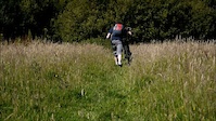
nice circular route included many trails, downhill sections etc. should be doable for average fit person with average mtb skills
We hope you've been enjoying Trailforks!
Create a FREE account to view route comments and much more.
| 1,148 ft | |||||
| 3,255 ft | |||||
| 1,512 ft | |||||
| 1,427 ft | |||||
| 259 ft | |||||
| 515 ft | |||||
| 535 ft | |||||
| 1,306 ft | |||||
| 164 ft | |||||
| 1,667 ft | |||||
| 2,349 ft | |||||
| 259 ft | |||||
| 1,263 ft | |||||
| 5,066 ft | |||||
| 1,690 ft | |||||
| 686 ft | |||||
| 515 ft | |||||
| 535 ft | |||||
| 1,306 ft | |||||
| 164 ft |

Service Road Atlas is a free to use, community-driven service for viewing and creating reports on the numerous back-country service roads around B.C. and Alberta.
Save the current map location and zoom level as your default home location whenever this page is loaded.
Save