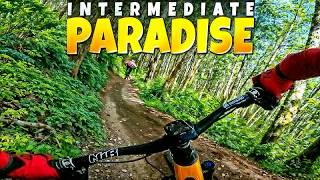
The full Raging River Lollipop climbing Upward Mobility and Raging Ridge, descending No Service, Climbing back out Return Policy, then descending Raging Ridge to Poppin Tops and Flow State. This is a big, fun ride that will take 3-5 hours depending on your fitness and pace. Take plenty of water and snacks. There is no cell phone service on the backside - ride with caution
Local Trail Association
Evergreen Mountain Bike Alliance | EMBA (evergreenmtb.org)Trail Products
Stats
-
Distance19 miles
-
Avg time2 hr 57 min
-
Altitude min1,066 ft
-
Altitude start1,076 ft
-
Altitude end1,066 ft
-
Climb3,821 ft
-
Descent-3,828 ft
-
Grade max-97.1%
-
Grade min56.9%
-
Distance climb10 miles
-
Distance down8 miles
-
Distance flat1,358 ft
83 Reviews & Comments
We hope you've been enjoying Trailforks!
Create a FREE account to view route comments and much more.
Trails in Route
| 335 ft | |||||
| 3 miles | |||||
| 6 miles | |||||
| 2 miles | |||||
| 1,345 ft | |||||
| 1,404 ft | |||||
| 2 miles | |||||
| 3 miles | |||||
| 292 ft | |||||
| 2,297 ft | |||||
| 2,326 ft | |||||
| 2,411 ft | |||||
| 2,956 ft | |||||
| 830 ft | |||||
| 335 ft |
Details
-
Riding area
-
Primary ActivityMountain Bike
-
Difficulty ratingBlack Diamond
-
Route TypeLoop
-
eBike Allowed
-
Bike typeAM
-
DirectionOne Direction
-
Physical ratingHard
-
Ridelogs
- Unknown
- Snow Groomed
- Snow Packed
- Snow Covered
- Snow Cover Partial
- Freeze/thaw Cycle
- Icy
- Prevalent Mud
- Wet
- Variable
- Ideal
- Dry
- Very Dry
The colour categories are based on what percentage of riders are riding a trail in its intended direction.
- > 96%
- > 90%
- > 80%
- > 70%
- > 50%
- < 50%
- bi-directional trail
- no data
- < 2 days
- < 1 week
- < 2 weeks
- < 1 month
- < 6 months
- > 6 months
- Downhill Only
- Downhill Primary
- Both Directions
- Uphill Primary
- Uphill Only
- One Direction
- Description
- Photos
- Description & Photos
- Videos
- most popular
- popular
- less popular
- not popular
Service Road Atlas is a free to use, community-driven service for viewing and creating reports on the numerous back-country service roads around B.C. and Alberta.
Save the current map location and zoom level as your default home location whenever this page is loaded.
Save- Singletrack
- Unpaved
Photos
Videos
Recent Trail Reports Along Route
- By evo & contributors
- #18188 - 16,585 views
