26.6 miles
Distance
4,901 ft
Climb
-4,997 ft
Descent
1,775 ft
High Point
-97 ft
Altitude change
357 ft
Altitude min
454 ft
Altitude start
358 ft
Altitude end
-0.1%
Grade
-52.2%
Grade max
149.6%
Grade min
13 miles
Distance climb
11 miles
Distance down
2 miles
Distance flat

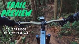
No description for Galbraith + route has been added yet! Submit one here.

Detailed Description
Galbraith + is a 27 mile popular intermediate route located near Bellingham Washington. This mountain bike only route. This route includes 87 trails. This route climbs 4,901 ft with a max elevation of 1,775 ft then descends -4,997 ft.

Trail Issues on Route

  • Minor Issue / Yellow: 13 trails (newest: Jun 13, 2026)
Local Trail Association
Local trail association
Whatcom Mountain Bike Coalition (wmbcmtb.org)
Please consider joining or donating to the local riding association to support trail development & maintenance.
Donate to earn trail karma!

Stats

  • Distance
    27 miles
  • Avg time
    2 hr 17 min
  • Altitude change
    -97 ft
  • Altitude min
    357 ft
  • Altitude start
    454 ft
  • Altitude end
    358 ft
  • Climb
    4,901 ft
  • Descent
    -4,997 ft
  • Grade
    -0.1%
  • Grade max
    -52.2%
  • Grade min
    149.6%
  • Distance climb
    13 miles
  • Distance down
    11 miles
  • Distance flat
    2 miles

166 Reviews & Comments


We hope you've been enjoying Trailforks!

Create a FREE account to view route comments and much more.

Trails in Route

The Ridge951 ft
Ante Up2,405 ft
The Ridge2,136 ft
Cedar Dust2,474 ft
Bandito2,592 ft
Pony Express902 ft
Brick4,055 ft
Tower Road3,097 ft
Whoopsie / Access820 ft
Cougar Ridge2 miles
Rufus Creek Trail2,218 ft
Backside Trail1,043 ft
Bottoms up2,306 ft
Bottoms Up Access Road561 ft
Road 4000 - East1 mile
Wonderland1,998 ft
Tower Road220 ft
Scorpion (Upper)1,083 ft
Scorpion1,795 ft
Tower Road453 ft
Irish Death2,297 ft
Road 2300246 ft
Lair of the Bear2,933 ft
Road 2100315 ft
Atomic Dog915 ft
Tower Road381 ft
Brick3,747 ft
Tower Road2,310 ft
Road 40001,486 ft
Spirit Bear482 ft
Road 2722230 ft
Oly Spur856 ft
Oly1,056 ft
Little Connector138 ft
Road 2000121 ft
1871,916 ft
Cabin2,208 ft
Cabin-SST Spur148 ft
SST - Upper1,073 ft
Orient Express3,517 ft
Road 1200 Connector299 ft
Road 1200889 ft
Candy217 ft
Wallace & Grommet108 ft
Intestine640 ft
Son of Sam505 ft
Arsenio2,139 ft
Rusty Can spur98 ft
Dragonfly666 ft
SST - Upper564 ft
Golden Spike - Lower1,864 ft
SST - Lower3,307 ft
Backdoor1,909 ft
The Ridge2,329 ft
Old Bob's2,165 ft
Bob's Trail2,205 ft
Karma1,490 ft

Details

Avg: 4 (1 votes)
close
3D
Trail Conditions
  • Unknown
  • Snow Groomed
  • Snow Packed
  • Snow Covered
  • Snow Cover Partial
  • Freeze/thaw Cycle
  • Icy
  • Prevalent Mud
  • Wet
  • Variable
  • Ideal
  • Dry
  • Very Dry
Trail Flow (Ridden Direction)
Trailforks scans users ridelogs to determine the most popular direction each trail is ridden. A good flowing trail network will have most trails flowing in a single direction according to their intension.
The colour categories are based on what percentage of riders are riding a trail in its intended direction.
  • > 96%
  • > 90%
  • > 80%
  • > 70%
  • > 50%
  • < 50%
  • bi-directional trail
  • no data
Trail Last Ridden
Trailforks scans ridelogs to determine the last time a trail was ridden.
  • < 2 days
  • < 1 week
  • < 2 weeks
  • < 1 month
  • < 6 months
  • > 6 months
Trail Ridden Direction
The intended direction a trail should be ridden.
  • Downhill Only
  • Downhill Primary
  • Both Directions
  • Uphill Primary
  • Uphill Only
  • One Direction
Contribute Details
Colors indicate trail is missing specified detail.
  • Description
  • Photos
  • Description & Photos
  • Videos
Trail Popularity ?
Trailforks scans ridelogs to determine which trails are ridden the most in the last 9 months. Trails are compared with nearby trails in the same city region with a possible 25 colour shades. Think of this as a heatmap, more rides = more kinetic energy = warmer colors.
  • most popular
  • popular
  • less popular
  • not popular
ATV/ORV/OHV Filter
Max Vehicle Width
inches
US Cell Coverage
Legend
cell carrier legend

Radar Time
Activity Recordings
Trailforks uses anonymized public activity data. ?
Activity Recordings
Trailforks uses anonymized public activity data. ?
Personal Heatmap
Activity Types
all / none
Options
2
Date range month
Winter Trails
Warning A routing network for winter maps does not exist. Selecting trails using the winter trails layer has been disabled.
Missing Trails
Most Popular
Least Popular
Trails are colored based on popularity. The more popular a trail is, the more red. Less popular trails trend towards green.
Jump Magnitude Heatmap
Heatmap of where riders jump on trails. Zoom in to see individual jumps, click circles to view jump details.
BC Backroad Status

Service Road Atlas is a free to use, community-driven service for viewing and creating reports on the numerous back-country service roads around B.C. and Alberta.

map legend
Slope Aspect
Direction the slope faces
Flat N NE E SE S SW W NW
Trails Deemphasized
Trails are shown in grey.
disable
Only show trails with no bike usage.
Enable
Suggested Layers
Based on selected activity type

    Save the current map location and zoom level as your default home location whenever this page is loaded.

    Save
    Trail transparency
    • Singletrack
    • Unpaved
    • Paved
    492
    1,045
    3,189 | 3 comments | 3 faves
    1,005 | 1 comments | 1 faves
    Mountain Bike Trail Preview: Cougar Ridge
    Mountain Bike Trail Preview: Cougar Ridge
    9:04 | 323 | comments: 0 | favs:
    Nov 10, 2019
    youtuber Conquering Cougar Ridge // Bellingham, Wa
    Conquering Cougar Ridge // Bellingham, Wa
    12:35 | 754 | comments: 0 | favs:
    May 30, 2023

    Recent Trail Reports Along Route

    statustraildateconditiondescription
    Irish Death
    Jun 18, 2026 @ 9:53am (America/Los_Angeles)
    14 hours
    Exit and lower portion were brushed prior to WWC 6-18-26 reporter
    Scorpion (Upper)
    Jun 18, 2026 @ 9:39am (America/Los_Angeles)
    14 hours
    Brushed prior to WWC.
    reporter
    SST - Lower
    Jun 15, 2026 @ 7:43am (America/Vancouver)
    Jun 15, 2026
    Atomic Dog
    Jun 13, 2026 @ 11:20pm (America/Los_Angeles)
    Jun 13, 2026
    Get it while the gettin’s great
    Cedar Dust
    Jun 13, 2026 @ 1:59pm (America/Vancouver)
    Jun 13, 2026
    Good (4)* - I didn't check the bridge mentioned previously but the trail is good otherwise.
    more reports »
    • By crystalleelambertTF Pro & contributors
    • #12492 - 7,126 views

    Hit the Trail

    Open in App

    Get this route on your phone instantly.

    Download Route

    Save to wishlist, Garmin & download.