2.1 miles
Distance
285 ft
Climb
-285 ft
Descent
969 ft
High Point
772 ft
Altitude min
772 ft
Altitude start
771 ft
Altitude end
-27.8%
Grade max
25.6%
Grade min
4,564 ft
Distance climb
4,626 ft
Distance down
1,624 ft
Distance flat

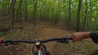
If you just came to get down, this is your route. Get to the top of Downriver and then repeat until you can’t pedal any more.

Detailed Description
Get Lappy is a 2 mile popular intermediate route located near Keene New York. This mountain bike primary route. This route includes 3 trails. This route climbs 285 ft with a max elevation of 969 ft then descends -285 ft.
Local Trail Association
Local trail association
Barkeater Trails Alliance (www.betatrails.org)
Please consider joining or donating to the local riding association to support trail development & maintenance.
Donate to earn trail karma!

Stats

  • Distance
    2 miles
  • Altitude min
    772 ft
  • Altitude start
    772 ft
  • Altitude end
    771 ft
  • Climb
    285 ft
  • Descent
    -285 ft
  • Grade max
    -27.8%
  • Grade min
    25.6%
  • Distance climb
    4,564 ft
  • Distance down
    4,626 ft
  • Distance flat
    1,624 ft

1 Review & Comments


We hope you've been enjoying Trailforks!

Create a FREE account to view route comments and much more.

Trails in Route

Leepoff Loop915 ft
Upstream Lower3,327 ft
Downriver2,589 ft

Details

no votes yet
close
3D
Trail Conditions
  • Unknown
  • Snow Groomed
  • Snow Packed
  • Snow Covered
  • Snow Cover Partial
  • Freeze/thaw Cycle
  • Icy
  • Prevalent Mud
  • Wet
  • Variable
  • Ideal
  • Dry
  • Very Dry
Trail Flow (Ridden Direction)
Trailforks scans users ridelogs to determine the most popular direction each trail is ridden. A good flowing trail network will have most trails flowing in a single direction according to their intension.
The colour categories are based on what percentage of riders are riding a trail in its intended direction.
  • > 96%
  • > 90%
  • > 80%
  • > 70%
  • > 50%
  • < 50%
  • bi-directional trail
  • no data
Trail Last Ridden
Trailforks scans ridelogs to determine the last time a trail was ridden.
  • < 2 days
  • < 1 week
  • < 2 weeks
  • < 1 month
  • < 6 months
  • > 6 months
Trail Ridden Direction
The intended direction a trail should be ridden.
  • Downhill Only
  • Downhill Primary
  • Both Directions
  • Uphill Primary
  • Uphill Only
  • One Direction
Contribute Details
Colors indicate trail is missing specified detail.
  • Description
  • Photos
  • Description & Photos
  • Videos
Trail Popularity ?
Trailforks scans ridelogs to determine which trails are ridden the most in the last 9 months. Trails are compared with nearby trails in the same city region with a possible 25 colour shades. Think of this as a heatmap, more rides = more kinetic energy = warmer colors.
  • most popular
  • popular
  • less popular
  • not popular
ATV/ORV/OHV Filter
Max Vehicle Width
inches
US Cell Coverage
Legend
cell carrier legend

Radar Time
Activity Recordings
Trailforks uses anonymized public activity data. ?
Activity Recordings
Trailforks uses anonymized public activity data. ?
Personal Heatmap
Activity Types
all / none
Options
2
Date range month
Winter Trails
Warning A routing network for winter maps does not exist. Selecting trails using the winter trails layer has been disabled.
Missing Trails
Most Popular
Least Popular
Trails are colored based on popularity. The more popular a trail is, the more red. Less popular trails trend towards green.
Jump Magnitude Heatmap
Heatmap of where riders jump on trails. Zoom in to see individual jumps, click circles to view jump details.
BC Backroad Status

Service Road Atlas is a free to use, community-driven service for viewing and creating reports on the numerous back-country service roads around B.C. and Alberta.

map legend
Slope Aspect
Direction the slope faces
Flat N NE E SE S SW W NW
Trails Deemphasized
Trails are shown in grey.
disable
Only show trails with no bike usage.
Enable
Suggested Layers
Based on selected activity type

    Save the current map location and zoom level as your default home location whenever this page is loaded.

    Save
    Trail transparency
    • Singletrack
    174
    151
    Flowy laps on Downriver
    Flowy laps on Downriver
    trail: Downriver
    0:50 | 259 | comments: 0 | favs:
    Nov 8, 2023
    Riding my Solace OM-1, perfect bike for the job

    Recent Trail Reports Along Route

    statustraildateconditiondescription
    Upstream Lower
    Oct 27, 2025 @ 5:18pm (America/New_York)
    Oct 27, 2025
    Leepoff Loop
    Oct 27, 2025 @ 5:18pm (America/New_York)
    Oct 27, 2025
    Downriver
    Sep 2, 2025 @ 5:57pm
    Sep 2, 2025
    more reports »
    • By dancashTF Pro & contributors
    • #57215 - 371 views

    Hit the Trail

    Open in App

    Get this route on your phone instantly.

    Download Route

    Save to wishlist, Garmin & download.