6.2 miles
Distance
393 ft
Climb
-402 ft
Descent
461 ft
High Point
-8 ft
Altitude change
353 ft
Altitude min
456 ft
Altitude start
446 ft
Altitude end
-19.3%
Grade max
17%
Grade min
2 miles
Distance climb
3 miles
Distance down
1 mile
Distance flat

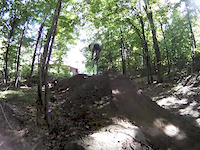
10k loop at Great Bear Recreation Area

Detailed Description
Great Bear 10k Loop is a 6 mile moderately popular easy route located near Fulton New York. This mountain bike primary route can be used both directions and has a easy overall physical rating. This route includes 15 trails. This route climbs 393 ft with a max elevation of 461 ft then descends -402 ft.
Local Trail Association
Please consider joining or donating to the local riding association to support trail development & maintenance.
Donate to earn trail karma!

Stats

  • Distance
    6 miles
  • Altitude min
    353 ft
  • Altitude start
    456 ft
  • Altitude end
    446 ft
  • Climb
    393 ft
  • Descent
    -402 ft
  • Grade max
    -19.3%
  • Grade min
    17%
  • Distance climb
    2 miles
  • Distance down
    3 miles
  • Distance flat
    1 mile

Comments


We hope you've been enjoying Trailforks!

Create a FREE account to view route comments and much more.

Trails in Route

Mixed Pines1,096 ft
Deer Run1,427 ft
440 Ridge1,985 ft
440 Ridge2,533 ft
Long Trail2,507 ft
Six South636 ft
Back630 ft
Stone Stairs896 ft
Mishemokwa Springs2,352 ft
Red Gem187 ft
Alec's Trail1,115 ft
Apple Trail2,037 ft
Apple Alt1,109 ft
Mixed Pines476 ft

Details

  • Riding area
  • Primary Activity
    Mountain Bike
  • Other Activities
    • Gravel Bike
  • Difficulty rating
    Green
  • Route Type
    Loop
  • Bike type
    AM, XC, Gravel
  • Direction
    Both Directions
  • Physical rating
    Easy
no votes yet
close
3D
Trail Conditions
  • Unknown
  • Snow Groomed
  • Snow Packed
  • Snow Covered
  • Snow Cover Partial
  • Freeze/thaw Cycle
  • Icy
  • Prevalent Mud
  • Wet
  • Variable
  • Ideal
  • Dry
  • Very Dry
Trail Flow (Ridden Direction)
Trailforks scans users ridelogs to determine the most popular direction each trail is ridden. A good flowing trail network will have most trails flowing in a single direction according to their intension.
The colour categories are based on what percentage of riders are riding a trail in its intended direction.
  • > 96%
  • > 90%
  • > 80%
  • > 70%
  • > 50%
  • < 50%
  • bi-directional trail
  • no data
Trail Last Ridden
Trailforks scans ridelogs to determine the last time a trail was ridden.
  • < 2 days
  • < 1 week
  • < 2 weeks
  • < 1 month
  • < 6 months
  • > 6 months
Trail Ridden Direction
The intended direction a trail should be ridden.
  • Downhill Only
  • Downhill Primary
  • Both Directions
  • Uphill Primary
  • Uphill Only
  • One Direction
Contribute Details
Colors indicate trail is missing specified detail.
  • Description
  • Photos
  • Description & Photos
  • Videos
Trail Popularity ?
Trailforks scans ridelogs to determine which trails are ridden the most in the last 9 months. Trails are compared with nearby trails in the same city region with a possible 25 colour shades. Think of this as a heatmap, more rides = more kinetic energy = warmer colors.
  • most popular
  • popular
  • less popular
  • not popular
ATV/ORV/OHV Filter
Max Vehicle Width
inches
US Cell Coverage
Legend
cell carrier legend

Radar Time
Activity Recordings
Trailforks uses anonymized public activity data. ?
Activity Recordings
Trailforks uses anonymized public activity data. ?
Personal Heatmap
Activity Types
all / none
Options
2
Date range month
Winter Trails
Warning A routing network for winter maps does not exist. Selecting trails using the winter trails layer has been disabled.
Missing Trails
Most Popular
Least Popular
Trails are colored based on popularity. The more popular a trail is, the more red. Less popular trails trend towards green.
Jump Magnitude Heatmap
Heatmap of where riders jump on trails. Zoom in to see individual jumps, click circles to view jump details.
BC Backroad Status

Service Road Atlas is a free to use, community-driven service for viewing and creating reports on the numerous back-country service roads around B.C. and Alberta.

map legend
Slope Aspect
Direction the slope faces
Flat N NE E SE S SW W NW
Trails Deemphasized
Trails are shown in grey.
disable
Only show trails with no bike usage.
Enable
Suggested Layers
Based on selected activity type

    Save the current map location and zoom level as your default home location whenever this page is loaded.

    Save
    Trail transparency
    • Singletrack
    88
    132 | 1 faves
    157
    153
    back yard jump
    back yard jump
    trail: Back
    0:07 | 164 | comments: 0 | favs:
    Jul 30, 2015
    2015 rebuild of the the back yard jump
    Little time on the back wheel:)
    Little time on the back wheel:)
    trail: Back
    0:58 | 220 | comments: 2 | favs:
    May 6, 2015
    Fun on the back wheel

    Recent Trail Reports Along Route

    statustraildateconditiondescription
    Long Trail
    Jun 15, 2026 @ 6:35pm (America/Toronto)
    3 days
    A few muddy places
    Back
    Jun 15, 2026 @ 6:35pm (America/Toronto)
    3 days
    Muddy in spots
    440 Ridge
    Jun 15, 2026 @ 6:35pm (America/Toronto)
    3 days
    Muddier than usual
    Mishemokwa Springs
    Jun 15, 2026 @ 6:35pm (America/Toronto)
    3 days
    A mud spot here or there
    Stone Stairs
    Jun 15, 2026 @ 6:35pm (America/Toronto)
    3 days
    Muddy in spots
    more reports »
    • By Unch & contributors
    • #57588 - 480 views

    Hit the Trail

    Open in App

    Get this route on your phone instantly.

    Download Route

    Save to wishlist, Garmin & download.