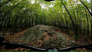
This is it, pretty much all of the jungle no waste just ride. Tarzan could do it, can you?
Ditch Witch, Warthog, Otter Slide, Rhino, Tanks, Cages, DOWN Goat, Debacle (Lion), hard left on road to Fenceline, Down to Safari 1, right and up Hippo, Up Fish, over to Boon, Junk Yard Dog, Dump Truck Hill, Boulderdash, Hippo, Lower Chute, Shute and home.
Trail Issues on Route
- Significant Issue / Amber: 2 trails (newest: Jul 8, 2023)
- Minor Issue / Yellow: 5 trails (newest: Mar 11, 2026)
Local Trail Association
Jersey Off Road Bicycle Association (www.jorba.org)Stats
-
Distance10 miles
-
Avg time2 hr 8 min
-
Altitude min640 ft
-
Altitude start867 ft
-
Altitude end866 ft
-
Climb993 ft
-
Descent-997 ft
-
Grade max-31.4%
-
Grade min20.7%
-
Distance climb4 miles
-
Distance down3 miles
-
Distance flat2 miles
12 Reviews & Comments
We hope you've been enjoying Trailforks!
Create a FREE account to view route comments and much more.
Trails in Route
| 3,858 ft | |||||
| 2,700 ft | |||||
| 2,398 ft | |||||
| 2,730 ft | |||||
| 3,228 ft | |||||
| 3,684 ft | |||||
| 2,060 ft | |||||
| 1,529 ft | |||||
| 2 miles | |||||
| 3,261 ft | |||||
| 2,822 ft | |||||
| 1,516 ft | |||||
| 948 ft | |||||
| 1,549 ft | |||||
| 2,415 ft | |||||
| 1,024 ft | |||||
| 2,680 ft | |||||
| 328 ft | |||||
| 538 ft | |||||
| 748 ft | |||||
| 325 ft | |||||
| 230 ft | |||||
| 837 ft | |||||
| 1,844 ft | |||||
| 702 ft | |||||
| 4,757 ft |
Details
-
Riding area
-
Primary ActivityMountain Bike
-
Difficulty ratingBlue
-
Route TypeLoop
-
DirectionOne Direction
-
Physical ratingHard
-
Ridelogs
- Unknown
- Snow Groomed
- Snow Packed
- Snow Covered
- Snow Cover Partial
- Freeze/thaw Cycle
- Icy
- Prevalent Mud
- Wet
- Variable
- Ideal
- Dry
- Very Dry
The colour categories are based on what percentage of riders are riding a trail in its intended direction.
- > 96%
- > 90%
- > 80%
- > 70%
- > 50%
- < 50%
- bi-directional trail
- no data
- < 2 days
- < 1 week
- < 2 weeks
- < 1 month
- < 6 months
- > 6 months
- Downhill Only
- Downhill Primary
- Both Directions
- Uphill Primary
- Uphill Only
- One Direction
- Description
- Photos
- Description & Photos
- Videos
- most popular
- popular
- less popular
- not popular
Service Road Atlas is a free to use, community-driven service for viewing and creating reports on the numerous back-country service roads around B.C. and Alberta.
Save the current map location and zoom level as your default home location whenever this page is loaded.
Save- Singletrack
- Unpaved
Photos
Recent Trail Reports Along Route
- By TomHennigan
PMTB JORBA LewMo JORBA Allaire & contributors - #2449 - 4,337 views


