11.0 miles
Distance
1,748 ft
Climb
-3,091 ft
Descent
2 miles
High Point
-1,344 ft
Altitude change
6,159 ft
Altitude min
7,503 ft
Altitude start
6,158 ft
Altitude end
-2.3%
Grade
-67.4%
Grade max
55.3%
Grade min
5 miles
Distance climb
6 miles
Distance down
2,802 ft
Distance flat

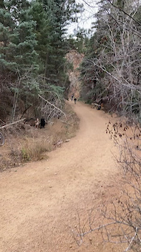
Starts at the top parking lot in North Cheyenne Canon Park and ends at the Red Rack parking lot next to Rudy's. You will spend most of your time climbing on this route to reach that SWEET SWEET downhill. Be careful on the 666 Connector and Bear Creek section, you can pick up a ton of speed fairly quick hit lots of loose gravel in the turns and straight away.

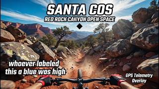
The reason I marked the route a Black Diamond is because of Section 16. A guy I met on the trail described it best "Section 16 is like a pick your own adventure". Big chunky gnar gnar!!

Detailed Description
Hold Fast is a 11 mile moderately popular expert route located near Colorado Springs Colorado. This mountain bike only route can be used one direction and has a hard overall physical rating. This route includes 22 trails. This route climbs 1,748 ft with a max elevation of 8,206 ft then descends -3,091 ft.

Trail Issues on Route

  • Minor Issue / Yellow: 1 trail (newest: Mar 16, 2025)
Local Trail Association
Local trail association
Medicine Wheel Trail Advocates (www.medwheel.org)
Please consider joining or donating to the local riding association to support trail development & maintenance.
Donate to earn trail karma!

Stats

  • Distance
    11 miles
  • Avg time
    3 hr 22 min
  • Altitude change
    -1,344 ft
  • Altitude min
    6,159 ft
  • Altitude start
    7,503 ft
  • Altitude end
    6,158 ft
  • Climb
    1,748 ft
  • Descent
    -3,091 ft
  • Grade
    -2.3%
  • Grade max
    -67.4%
  • Grade min
    55.3%
  • Distance climb
    5 miles
  • Distance down
    6 miles
  • Distance flat
    2,802 ft

20 Reviews & Comments


We hope you've been enjoying Trailforks!

Create a FREE account to view route comments and much more.

Trails in Route

Details

  • Riding area
  • Primary Activity
    Mountain Bike
  • Difficulty rating
    Black Diamond
  • Route Type
    Point to Point
  • Bike type
    DH, AM
  • Direction
    One Direction
  • Physical rating
    Hard
Avg: 2 (1 votes)
close
3D
Trail Conditions
  • Unknown
  • Snow Groomed
  • Snow Packed
  • Snow Covered
  • Snow Cover Partial
  • Freeze/thaw Cycle
  • Icy
  • Prevalent Mud
  • Wet
  • Variable
  • Ideal
  • Dry
  • Very Dry
Trail Flow (Ridden Direction)
Trailforks scans users ridelogs to determine the most popular direction each trail is ridden. A good flowing trail network will have most trails flowing in a single direction according to their intension.
The colour categories are based on what percentage of riders are riding a trail in its intended direction.
  • > 96%
  • > 90%
  • > 80%
  • > 70%
  • > 50%
  • < 50%
  • bi-directional trail
  • no data
Trail Last Ridden
Trailforks scans ridelogs to determine the last time a trail was ridden.
  • < 2 days
  • < 1 week
  • < 2 weeks
  • < 1 month
  • < 6 months
  • > 6 months
Trail Ridden Direction
The intended direction a trail should be ridden.
  • Downhill Only
  • Downhill Primary
  • Both Directions
  • Uphill Primary
  • Uphill Only
  • One Direction
Contribute Details
Colors indicate trail is missing specified detail.
  • Description
  • Photos
  • Description & Photos
  • Videos
Trail Popularity ?
Trailforks scans ridelogs to determine which trails are ridden the most in the last 9 months. Trails are compared with nearby trails in the same city region with a possible 25 colour shades. Think of this as a heatmap, more rides = more kinetic energy = warmer colors.
  • most popular
  • popular
  • less popular
  • not popular
ATV/ORV/OHV Filter
Max Vehicle Width
inches
US Cell Coverage
Legend
cell carrier legend

Radar Time
Activity Recordings
Trailforks uses anonymized public activity data. ?
Activity Recordings
Trailforks uses anonymized public activity data. ?
Personal Heatmap
Activity Types
all / none
Options
2
Date range month
Winter Trails
Warning A routing network for winter maps does not exist. Selecting trails using the winter trails layer has been disabled.
Missing Trails
Most Popular
Least Popular
Trails are colored based on popularity. The more popular a trail is, the more red. Less popular trails trend towards green.
Jump Magnitude Heatmap
Heatmap of where riders jump on trails. Zoom in to see individual jumps, click circles to view jump details.
BC Backroad Status

Service Road Atlas is a free to use, community-driven service for viewing and creating reports on the numerous back-country service roads around B.C. and Alberta.

map legend
Slope Aspect
Direction the slope faces
Flat N NE E SE S SW W NW
Trails Deemphasized
Trails are shown in grey.
disable
Only show trails with no bike usage.
Enable
Suggested Layers
Based on selected activity type

    Save the current map location and zoom level as your default home location whenever this page is loaded.

    Save
    Trail transparency
    • Singletrack
    • Unpaved
    4
    19
    172
    132
    Red Rock Canyon Open Space -Santa COS
    Red Rock Canyon Open Space -Santa COS
    trail: Santa COS
    4:49 | 14 | comments: 0 | favs:
    May 17, 2026
    719 Pixie Repack race 2022
    719 Pixie Repack race 2022
    trail: High Drive
    0:38 | 112 | comments: 0 | favs:
    Nov 14, 2022
    Colorado Springs pixie repack race 2022

    Recent Trail Reports Along Route

    statustraildateconditiondescription
    Garbage Chute
    Jun 20, 2026 @ 8:08am (America/Denver)
    Jun 20, 2026
    Lower Codell
    Jun 20, 2026 @ 8:08am (America/Denver)
    Jun 20, 2026
    Palmer Trail
    Jun 20, 2026 @ 8:08am (America/Denver)
    Jun 20, 2026
    Section 16
    Jun 20, 2026 @ 8:08am (America/Denver)
    Jun 20, 2026
    Hogback Valley
    Jun 20, 2026 @ 8:08am (America/Denver)
    Jun 20, 2026
    more reports »
    • By illYeti & contributors
    • #7638 - 1,224 views

    Hit the Trail

    Open in App

    Get this route on your phone instantly.

    Download Route

    Save to wishlist, Garmin & download.