

Open in App
Get this route on your phone instantly.
Start from Parking Lot area across from Iron Goat Restaurant in Canmore at Benchland Tr and Elk Run Blvd (SE corner of the traffic circle)
- Go south on the Elk Run Blvd bridge to access the Cougar Creek East access
- Go northeast on Cougar Creek East access until you get onto Horseshoe Upper
- From there, these are the trails:
- Horseshoe Upper to Horshoe Slabs, then back onto HS Upper
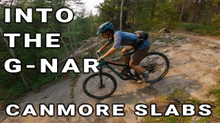
- HS Upper to G8 Access
- G8 Access to G8, then cut left onto G8 Bonus, which cut back onto G8
- Loop around on the G8 lower section to get back onto G8 Access
- Instead of going back onto HS Upper, go left and get onto HS Middle
- Continue on HS Middle back to HS Upper
- Continue finishing HS Upper back to Cougar Creek to the parking lot.
We hope you've been enjoying Trailforks!
Create a FREE account to view route comments and much more.
| 1,903 ft | |||||
| 597 ft | |||||
| 4,820 ft | |||||
| 3,540 ft | |||||
| 1,217 ft | |||||
| 3,645 ft | |||||
| 1 mile | |||||
| 1,217 ft | |||||
| 1 mile | |||||
| 597 ft | |||||
| 1,903 ft |


Service Road Atlas is a free to use, community-driven service for viewing and creating reports on the numerous back-country service roads around B.C. and Alberta.
Save the current map location and zoom level as your default home location whenever this page is loaded.
Save