9.0 miles
Distance
1,443 ft
Climb
-1,543 ft
Descent
1 mile
High Point
-100 ft
Altitude change
6,340 ft
Altitude min
6,439 ft
Altitude start
6,339 ft
Altitude end
-0.2%
Grade
-32.6%
Grade max
28.3%
Grade min
4 miles
Distance climb
4 miles
Distance down
3,038 ft
Distance flat

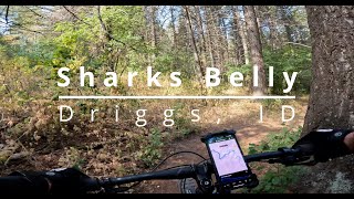
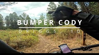
Great Loop. Some good cross country, downhill and climbs. Super beautiful views and peaceful trails through the woods. You can cut down on the length a bit or add more to it.

Detailed Description
Horseshoe Loop is a 9 mile popular intermediate route located near Driggs Idaho. This mountain bike only route and has a moderate overall physical rating. This route includes 8 trails. This route climbs 1,443 ft with a max elevation of 7,136 ft then descends -1,543 ft.
Local Trail Association
Local trail association
Mountain Bike the Tetons (www.mountainbiketetons.org)
Please consider joining or donating to the local riding association to support trail development & maintenance.
Donate to earn trail karma!

Stats

  • Distance
    9 miles
  • Avg time
    1 hr 36 min
  • Altitude min
    6,340 ft
  • Altitude start
    6,439 ft
  • Altitude end
    6,339 ft
  • Climb
    1,443 ft
  • Descent
    -1,543 ft
  • Grade
    -0.2%
  • Grade max
    -32.6%
  • Grade min
    28.3%
  • Distance climb
    4 miles
  • Distance down
    4 miles
  • Distance flat
    3,038 ft

18 Reviews & Comments


We hope you've been enjoying Trailforks!

Create a FREE account to view route comments and much more.

Trails in Route

Bovine Bliss1 mile
Shark's Belly2 miles
Probation4,193 ft
Burgh3,110 ft
Bumper - Cody's1 mile
Sodbuster2 miles
Channel Lock2 miles

Details

  • Riding area
  • Primary Activity
    Mountain Bike
  • Difficulty rating
    Blue
  • Route Type
    Loop
  • eBike Allowed
  • Bike type
    AM
  • Physical rating
    Moderate
  • Ridelogs
    26
Avg: 3 (2 votes)
close
3D
Trail Conditions
  • Unknown
  • Snow Groomed
  • Snow Packed
  • Snow Covered
  • Snow Cover Partial
  • Freeze/thaw Cycle
  • Icy
  • Prevalent Mud
  • Wet
  • Variable
  • Ideal
  • Dry
  • Very Dry
Trail Flow (Ridden Direction)
Trailforks scans users ridelogs to determine the most popular direction each trail is ridden. A good flowing trail network will have most trails flowing in a single direction according to their intension.
The colour categories are based on what percentage of riders are riding a trail in its intended direction.
  • > 96%
  • > 90%
  • > 80%
  • > 70%
  • > 50%
  • < 50%
  • bi-directional trail
  • no data
Trail Last Ridden
Trailforks scans ridelogs to determine the last time a trail was ridden.
  • < 2 days
  • < 1 week
  • < 2 weeks
  • < 1 month
  • < 6 months
  • > 6 months
Trail Ridden Direction
The intended direction a trail should be ridden.
  • Downhill Only
  • Downhill Primary
  • Both Directions
  • Uphill Primary
  • Uphill Only
  • One Direction
Contribute Details
Colors indicate trail is missing specified detail.
  • Description
  • Photos
  • Description & Photos
  • Videos
Trail Popularity ?
Trailforks scans ridelogs to determine which trails are ridden the most in the last 9 months. Trails are compared with nearby trails in the same city region with a possible 25 colour shades. Think of this as a heatmap, more rides = more kinetic energy = warmer colors.
  • most popular
  • popular
  • less popular
  • not popular
ATV/ORV/OHV Filter
Max Vehicle Width
inches
US Cell Coverage
Legend
cell carrier legend

Radar Time
Activity Recordings
Trailforks uses anonymized public activity data. ?
Activity Recordings
Trailforks uses anonymized public activity data. ?
Personal Heatmap
Activity Types
all / none
Options
2
Date range month
Winter Trails
Warning A routing network for winter maps does not exist. Selecting trails using the winter trails layer has been disabled.
Missing Trails
Most Popular
Least Popular
Trails are colored based on popularity. The more popular a trail is, the more red. Less popular trails trend towards green.
Jump Magnitude Heatmap
Heatmap of where riders jump on trails. Zoom in to see individual jumps, click circles to view jump details.
BC Backroad Status

Service Road Atlas is a free to use, community-driven service for viewing and creating reports on the numerous back-country service roads around B.C. and Alberta.

map legend
Slope Aspect
Direction the slope faces
Flat N NE E SE S SW W NW
Trails Deemphasized
Trails are shown in grey.
disable
Only show trails with no bike usage.
Enable
Suggested Layers
Based on selected activity type

    Save the current map location and zoom level as your default home location whenever this page is loaded.

    Save
    Trail transparency
    • Singletrack
    134
    119
    167
    224
    Shark’s Belly: Uphill Pain Served Fresh!
    Shark’s Belly: Uphill Pain Served Fresh!
    8:10 | 40 | comments: 0 | favs:
    Oct 5, 2025
    Bumper Cody Trail | Flow, Forest & a Bit...
    Bumper Cody Trail | Flow, Forest & a Bit of Burn in Driggs, ID
    5:33 | 81 | comments: 0 | favs:
    Oct 5, 2025

    Recent Trail Reports Along Route

    statustraildateconditiondescription
    Sodbuster
    May 13, 2026 @ 3:14pm (America/Boise)
    May 13, 2026
    Bumper - Cody's
    May 13, 2026 @ 3:13pm (America/Boise)
    May 13, 2026
    Bovine Bliss
    May 3, 2026 @ 4:06pm (America/Boise)
    May 3, 2026
    Shark's Belly
    May 3, 2026 @ 4:06pm (America/Boise)
    May 3, 2026
    Probation
    May 3, 2026 @ 4:05pm (America/Boise)
    May 3, 2026
    more reports »
    • By Boatmantp & contributors
    • #20438 - 3,009 views

    Hit the Trail

    Open in App

    Get this route on your phone instantly.

    Download Route

    Save to wishlist, Garmin & download.