35.5 miles
Distance
3,573 ft
Climb
-3,589 ft
Descent
3,365 ft
High Point
-16 ft
Altitude change
1,113 ft
Altitude min
1,149 ft
Altitude start
1,132 ft
Altitude end
-65.1%
Grade max
37.9%
Grade min
15 miles
Distance climb
17 miles
Distance down
3 miles
Distance flat

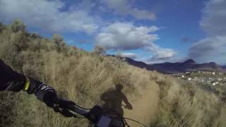
This loop takes you from North Shore Kamloops out and up through the Lac de Bois grasslands and further up to Isobel Lake and back. It's a 2 hour jaunt until the climb up to Isobel. The climb is not difficult for an intermediate rider. And the trip home is a reward, as it is mostly downhill. It's about 4h 15 mins for me and I am not at all fast.

Detailed Description
Isobel Lake Loop is a 36 mile moderately popular intermediate route located near Kamloops British Columbia. This mountain bike only route and has a moderate overall physical rating. This route includes 4 trails. This route climbs 3,573 ft with a max elevation of 3,365 ft then descends -3,589 ft.

Trail Issues on Route

  • Minor Issue / Yellow: 2 trails (newest: Jan 1, 2026)
Local Trail Association
Local trail association
Kamloops Bike Riders Association (bikekamloops.com)
Please consider joining or donating to the local riding association to support trail development & maintenance.
Donate to earn trail karma!

Trail Products

Stats

  • Distance
    36 miles
  • Avg time
    10 hr 0 min
  • Altitude min
    1,113 ft
  • Altitude start
    1,149 ft
  • Altitude end
    1,132 ft
  • Climb
    3,573 ft
  • Descent
    -3,589 ft
  • Grade max
    -65.1%
  • Grade min
    37.9%
  • Distance climb
    15 miles
  • Distance down
    17 miles
  • Distance flat
    3 miles

Comments


We hope you've been enjoying Trailforks!

Create a FREE account to view route comments and much more.

Details

  • Riding area
  • Primary Activity
    Mountain Bike
  • Difficulty rating
    Blue
  • Route Type
    Out & Back
  • Bike type
    XC
  • Physical rating
    Moderate
  • Ridelogs
    5
no votes yet
close
3D
Trail Conditions
  • Unknown
  • Snow Groomed
  • Snow Packed
  • Snow Covered
  • Snow Cover Partial
  • Freeze/thaw Cycle
  • Icy
  • Prevalent Mud
  • Wet
  • Variable
  • Ideal
  • Dry
  • Very Dry
Trail Flow (Ridden Direction)
Trailforks scans users ridelogs to determine the most popular direction each trail is ridden. A good flowing trail network will have most trails flowing in a single direction according to their intension.
The colour categories are based on what percentage of riders are riding a trail in its intended direction.
  • > 96%
  • > 90%
  • > 80%
  • > 70%
  • > 50%
  • < 50%
  • bi-directional trail
  • no data
Trail Last Ridden
Trailforks scans ridelogs to determine the last time a trail was ridden.
  • < 2 days
  • < 1 week
  • < 2 weeks
  • < 1 month
  • < 6 months
  • > 6 months
Trail Ridden Direction
The intended direction a trail should be ridden.
  • Downhill Only
  • Downhill Primary
  • Both Directions
  • Uphill Primary
  • Uphill Only
  • One Direction
Contribute Details
Colors indicate trail is missing specified detail.
  • Description
  • Photos
  • Description & Photos
  • Videos
Trail Popularity ?
Trailforks scans ridelogs to determine which trails are ridden the most in the last 9 months. Trails are compared with nearby trails in the same city region with a possible 25 colour shades. Think of this as a heatmap, more rides = more kinetic energy = warmer colors.
  • most popular
  • popular
  • less popular
  • not popular
ATV/ORV/OHV Filter
Max Vehicle Width
inches
US Cell Coverage
Legend
cell carrier legend

Radar Time
Activity Recordings
Trailforks uses anonymized public activity data. ?
Activity Recordings
Trailforks uses anonymized public activity data. ?
Personal Heatmap
Activity Types
all / none
Options
2
Date range month
Winter Trails
Warning A routing network for winter maps does not exist. Selecting trails using the winter trails layer has been disabled.
Missing Trails
Most Popular
Least Popular
Trails are colored based on popularity. The more popular a trail is, the more red. Less popular trails trend towards green.
Jump Magnitude Heatmap
Heatmap of where riders jump on trails. Zoom in to see individual jumps, click circles to view jump details.
BC Backroad Status

Service Road Atlas is a free to use, community-driven service for viewing and creating reports on the numerous back-country service roads around B.C. and Alberta.

map legend
Slope Aspect
Direction the slope faces
Flat N NE E SE S SW W NW
Trails Deemphasized
Trails are shown in grey.
disable
Only show trails with no bike usage.
Enable
Suggested Layers
Based on selected activity type

    Save the current map location and zoom level as your default home location whenever this page is loaded.

    Save
    Trail transparency
    • Singletrack
    • Unpaved
    717 | 6 faves

    Recent Trail Reports Along Route

    statustraildateconditiondescription
    Back in the Saddle
    Mar 26, 2026 @ 4:49pm (America/Vancouver)
    Mar 26, 2026
    Great spring conditions reporter
    McQueen Lake Road
    Jan 1, 2026 @ 7:50am (America/Vancouver)
    Jan 1, 2026
    plowed all the way to the rec site on December 31, 2025 but still typical winter conditions, snow/ice will be prevalent. reporter
    Isobel Lake Loop Trail
    Jan 16, 2022 @ 11:51am
    Jan 16, 2022
    Dairy Creek Forest Service Road
    Apr 9, 2020 @ 9:02am
    Apr 9, 2020
    reporter
    more reports »
    • By josepiiam & contributors
    • #3928 - 2,069 views

    Hit the Trail

    Open in App

    Get this route on your phone instantly.

    Download Route

    Save to wishlist, Garmin & download.