
Open in App
Get this route on your phone instantly.
Kittens Course
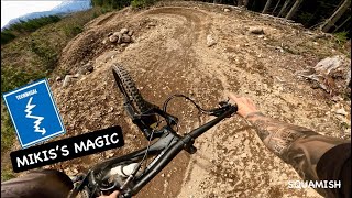
STAGE 1
Miki's Magic - we know this trail isn't your typical enduro style trail but it's a fast flowy perfect way to get the race jitters out and pay tribute to an incredible past HOYH racer, Micayla Martin
STAGE 2
Lower Lumbar / All About Yew - a new cruisy trail to the Squamish network
STAGE 3
Another Man's Gold - Fast and fun and always a favourite. We will wrap up the finish line just before it joins with Airplane Mode
STAGE 4
Hoods in the Woods - a staple of HOYH but it's had a bit of a facelift over the past few years. It's a bit tech, nothing too difficult. If you only have time to session 1 trail of the race course, this is it.
We hope you've been enjoying Trailforks!
Create a FREE account to view route comments and much more.
| 1 | STAGE 1 - Miki's Magic
|
| 2 | STAGE 2 - Lower Lumbar / All About Yew
|
| 3 | STAGE 3 - Another Man's Gold
|
| 4 | STAGE 4 - Hood's in the Woods
|
| 2,349 ft | |||||
| 2,792 ft | |||||
| 387 ft | |||||
| 1,627 ft | |||||
| 1 mile | |||||
| 2,096 ft | |||||
| 581 ft | |||||
| 3,793 ft | |||||
| 240 ft | |||||
| 2,129 ft | |||||
| 2,500 ft |

Service Road Atlas is a free to use, community-driven service for viewing and creating reports on the numerous back-country service roads around B.C. and Alberta.
Save the current map location and zoom level as your default home location whenever this page is loaded.
Save