96.4 miles
Distance
9,280 ft
Climb
-9,275 ft
Descent
2 miles
High Point
4 ft
Altitude change
7,214 ft
Altitude min
7,353 ft
Altitude start
7,356 ft
Altitude end
-62.4%
Grade max
40.1%
Grade min
45 miles
Distance climb
43 miles
Distance down
8 miles
Distance flat

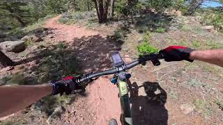
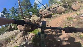
The Laradise Superloop is a 96 mile lollypop loop in southeast Wyoming that starts and ends in Laramie, WY and links up the awesome single-track trails of the School Yard, Happy Jack, Vedauwoo/Blair, and Curt Gowdy State Park, following legacy and current race course tracks (Laramie Range Enduro/Laramie Enduro/Laramie Range Epic/Gowdy Grinder/Stone Temple Cool . It has approximately 9K feet of elevation gain. This is primarily a weekend bikepacking route due to its length, with plenty of dispersed and designated campsite camping available in the Medicine Bow National Forest, as well as by reservation at Curt Gowdy State Park. The route has a large percentage of single-track, some forest service roads, and less than 10% paved road link ups. The single track varies from technical and rocky (especially at Gowdy) to fast and flowy (Happy Jack).

Detailed Description
Laradise Superloop is a 96 mile popular intermediate route located near Laramie Wyoming. This mountain bike only route can be used one direction and has a hard overall physical rating. This route includes 29 trails. This route climbs 9,280 ft with a max elevation of 8,929 ft then descends -9,275 ft.

Trail Issues on Route

  • Minor Issue / Yellow: 1 trail (newest: Jul 26, 2025)
Local Trail Association
Local trail association
Laramie BikeNet (www.laramiebikenet.org)
Please consider joining or donating to the local riding association to support trail development & maintenance.
Donate to earn trail karma!

Stats

  • Distance
    96 miles
  • Avg time
    19 hr 41 min
  • Altitude min
    7,214 ft
  • Altitude start
    7,353 ft
  • Altitude end
    7,356 ft
  • Climb
    2 miles
  • Descent
    -9,275 ft
  • Grade max
    -62.4%
  • Grade min
    40.1%
  • Distance climb
    45 miles
  • Distance down
    43 miles
  • Distance flat
    8 miles

22 Reviews & Comments


We hope you've been enjoying Trailforks!

Create a FREE account to view route comments and much more.

Trails in Route

Homeroom489 ft
Trail 123,219 ft
Blackjack2,037 ft
Aspen2 miles
Browns Landing3,579 ft
Death Crotch2 miles
Hooch Trail5,036 ft
Specterman Trail2,890 ft
707AD3,596 ft
707A2,159 ft
Kate's Trail568 ft
Kate's Trail358 ft
Aspen Alley3,278 ft
Rock N Roller5,046 ft
Stone Temple Circuit2 miles
Albert's Alley1 mile
Mo Rocka2 miles
Foxtail1,424 ft
700BB4,659 ft
Skeleton Trail2 miles
Blair Trail2,723 ft
Cow Creek Access1,604 ft
Crow Creek Connect715 ft
Meadow2,365 ft
Campground By-Pass1,614 ft
Pilot Hill Connector4 miles
Trail 123,097 ft
Old School4,016 ft

Details

  • Riding area
  • Primary Activity
    Mountain Bike
  • Difficulty rating
    Blue
  • Route Type
    Loop
  • Bikepacking
    Yes
  • eBike Allowed
  • Bike type
    XC
  • Direction
    One Direction
  • Physical rating
    Hard
no votes yet
close
3D
Trail Conditions
  • Unknown
  • Snow Groomed
  • Snow Packed
  • Snow Covered
  • Snow Cover Partial
  • Freeze/thaw Cycle
  • Icy
  • Prevalent Mud
  • Wet
  • Variable
  • Ideal
  • Dry
  • Very Dry
Trail Flow (Ridden Direction)
Trailforks scans users ridelogs to determine the most popular direction each trail is ridden. A good flowing trail network will have most trails flowing in a single direction according to their intension.
The colour categories are based on what percentage of riders are riding a trail in its intended direction.
  • > 96%
  • > 90%
  • > 80%
  • > 70%
  • > 50%
  • < 50%
  • bi-directional trail
  • no data
Trail Last Ridden
Trailforks scans ridelogs to determine the last time a trail was ridden.
  • < 2 days
  • < 1 week
  • < 2 weeks
  • < 1 month
  • < 6 months
  • > 6 months
Trail Ridden Direction
The intended direction a trail should be ridden.
  • Downhill Only
  • Downhill Primary
  • Both Directions
  • Uphill Primary
  • Uphill Only
  • One Direction
Contribute Details
Colors indicate trail is missing specified detail.
  • Description
  • Photos
  • Description & Photos
  • Videos
Trail Popularity ?
Trailforks scans ridelogs to determine which trails are ridden the most in the last 9 months. Trails are compared with nearby trails in the same city region with a possible 25 colour shades. Think of this as a heatmap, more rides = more kinetic energy = warmer colors.
  • most popular
  • popular
  • less popular
  • not popular
ATV/ORV/OHV Filter
Max Vehicle Width
inches
US Cell Coverage
Legend
cell carrier legend

Radar Time
Activity Recordings
Trailforks uses anonymized public activity data. ?
Activity Recordings
Trailforks uses anonymized public activity data. ?
Personal Heatmap
Activity Types
all / none
Options
2
Date range month
Winter Trails
Warning A routing network for winter maps does not exist. Selecting trails using the winter trails layer has been disabled.
Missing Trails
Most Popular
Least Popular
Trails are colored based on popularity. The more popular a trail is, the more red. Less popular trails trend towards green.
Jump Magnitude Heatmap
Heatmap of where riders jump on trails. Zoom in to see individual jumps, click circles to view jump details.
BC Backroad Status

Service Road Atlas is a free to use, community-driven service for viewing and creating reports on the numerous back-country service roads around B.C. and Alberta.

map legend
Slope Aspect
Direction the slope faces
Flat N NE E SE S SW W NW
Trails Deemphasized
Trails are shown in grey.
disable
Only show trails with no bike usage.
Enable
Suggested Layers
Based on selected activity type

    Save the current map location and zoom level as your default home location whenever this page is loaded.

    Save
    Trail transparency
    • Singletrack
    • Unpaved
    37
    343
    286
    736
    Mo Rocka
    Mo Rocka
    trail: Mo Rocka
    12:01 | 64 | comments: 0 | favs:
    Jul 16, 2025
    Aspen
    Aspen
    trail: Aspen
    11:53 | 105 | comments: 0 | favs:
    Jul 2, 2025

    Recent Trail Reports Along Route

    statustraildateconditiondescription
    Aspen
    Jun 11, 2026 @ 12:51pm (America/Denver)
    Jun 11, 2026
    Homeroom
    May 31, 2026 @ 2:45pm (America/Denver)
    May 31, 2026
    Rock N Roller
    May 20, 2026 @ 3:14pm (America/Denver)
    May 20, 2026
    Albert's Alley
    May 20, 2026 @ 3:14pm (America/Denver)
    May 20, 2026
    Kate's Trail
    May 20, 2026 @ 3:14pm (America/Denver)
    May 20, 2026
    more reports »
    • By trailforksTF Pro Trailforks & contributors
    • #44141 - 1,118 views

    Hit the Trail

    Open in App

    Get this route on your phone instantly.

    Download Route

    Save to wishlist, Garmin & download.