99.5 miles
Distance
13,842 ft
Climb
-13,851 ft
Descent
2 miles
High Point
-9 ft
Altitude change
9,205 ft
Altitude min
10,122 ft
Altitude start
10,112 ft
Altitude end
-91.1%
Grade max
97.5%
Grade min
45 miles
Distance climb
45 miles
Distance down
10 miles
Distance flat

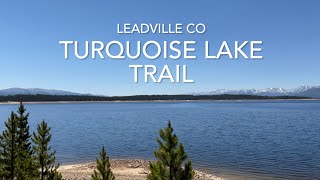
This is the Leadville Trail 100 Mile Run race course.

Detailed Description
Leadville 100 Run is a 99 mile intermediate race route located near Leadville Colorado. This trail running only route. This route includes 4 trails. This route climbs 13,842 ft with a max elevation of 12,506 ft then descends -13,851 ft.

Trail Issues on Route

  • Significant Issue / Amber: 2 trails (newest: Apr 21, 2026)
Local Trail Association
Please consider joining or donating to the local riding association to support trail development & maintenance.
Donate to earn trail karma!

Stats

  • Distance
    99 miles
  • Altitude min
    9,205 ft
  • Altitude start
    10,122 ft
  • Altitude end
    10,112 ft
  • Climb
    3 miles
  • Descent
    -13,851 ft
  • Grade max
    -91.1%
  • Grade min
    97.5%
  • Distance climb
    45 miles
  • Distance down
    45 miles
  • Distance flat
    10 miles

2 Reviews & Comments


We hope you've been enjoying Trailforks!

Create a FREE account to view route comments and much more.

Trails in Route

Route POI

InformationTurn left Information
InformationTurn rightInformation
InformationTurn slighInformation
InformationTurn rightInformation
InformationFINISHInformation
InformationMayqueenInformation
InformationHalf PipeInformation
InformationWinfieldInformation
InformationTwin LakesInformation
InformationMini Mt. EInformation
InformationPipeline -Information
InformationHopeInformation
InformationOutward BoInformation

Details

  • Race Course
  • Riding area
  • Primary Activity
    Trail Running
  • Difficulty rating
    Blue
  • Route Type
    Out & Back
no votes yet
close
3D
Trail Conditions
  • Unknown
  • Snow Groomed
  • Snow Packed
  • Snow Covered
  • Snow Cover Partial
  • Freeze/thaw Cycle
  • Icy
  • Prevalent Mud
  • Wet
  • Variable
  • Ideal
  • Dry
  • Very Dry
Trail Flow (Ridden Direction)
Trailforks scans users ridelogs to determine the most popular direction each trail is ridden. A good flowing trail network will have most trails flowing in a single direction according to their intension.
The colour categories are based on what percentage of riders are riding a trail in its intended direction.
  • > 96%
  • > 90%
  • > 80%
  • > 70%
  • > 50%
  • < 50%
  • bi-directional trail
  • no data
Trail Last Ridden
Trailforks scans ridelogs to determine the last time a trail was ridden.
  • < 2 days
  • < 1 week
  • < 2 weeks
  • < 1 month
  • < 6 months
  • > 6 months
Trail Ridden Direction
The intended direction a trail should be ridden.
  • Downhill Only
  • Downhill Primary
  • Both Directions
  • Uphill Primary
  • Uphill Only
  • One Direction
Contribute Details
Colors indicate trail is missing specified detail.
  • Description
  • Photos
  • Description & Photos
  • Videos
Trail Popularity ?
Trailforks scans ridelogs to determine which trails are ridden the most in the last 9 months. Trails are compared with nearby trails in the same city region with a possible 25 colour shades. Think of this as a heatmap, more rides = more kinetic energy = warmer colors.
  • most popular
  • popular
  • less popular
  • not popular
ATV/ORV/OHV Filter
Max Vehicle Width
inches
US Cell Coverage
Legend
cell carrier legend

Radar Time
Activity Recordings
Trailforks uses anonymized public activity data. ?
Activity Recordings
Trailforks uses anonymized public activity data. ?
Personal Heatmap
Activity Types
all / none
Options
2
Date range month
Winter Trails
Warning A routing network for winter maps does not exist. Selecting trails using the winter trails layer has been disabled.
Missing Trails
Most Popular
Least Popular
Trails are colored based on popularity. The more popular a trail is, the more red. Less popular trails trend towards green.
Jump Magnitude Heatmap
Heatmap of where riders jump on trails. Zoom in to see individual jumps, click circles to view jump details.
BC Backroad Status

Service Road Atlas is a free to use, community-driven service for viewing and creating reports on the numerous back-country service roads around B.C. and Alberta.

map legend
Slope Aspect
Direction the slope faces
Flat N NE E SE S SW W NW
Trails Deemphasized
Trails are shown in grey.
disable
Only show trails with no bike usage.
Enable
Suggested Layers
Based on selected activity type

    Save the current map location and zoom level as your default home location whenever this page is loaded.

    Save
    Trail transparency
    • Singletrack
    111
    110
    101
    97
    Leadville CO Turquoise Lake Trail
    Leadville CO Turquoise Lake Trail
    8:24 | 296 | comments: 0 | favs:
    May 22, 2024

    Recent Trail Reports Along Route

    statustraildateconditiondescription
    CT Lodgepole Connector
    May 31, 2026 @ 10:09am (America/Denver)
    May 31, 2026
    reporter
    Turquoise Lake
    Apr 21, 2026 @ 4:42pm (America/Denver)
    Apr 21, 2026
    Many large tree down across trail, blocking trail especially on West end.
    Turquoise Lake
    Jul 12, 2024 @ 4:06am
    Jul 12, 2024
    CDT - Sheep Gulch
    Nov 11, 2021 @ 9:10pm
    Nov 11, 2021
    reporter
    more reports »
    • By jeraldcookTF Pro & contributors
    • #51567 - 4,852 views

    Hit the Trail

    Open in App

    Get this route on your phone instantly.

    Download Route

    Save to wishlist, Garmin & download.