10.8 miles
Distance
2,134 ft
Climb
-2,484 ft
Descent
1 mile
High Point
-350 ft
Altitude change
5,450 ft
Altitude min
5,800 ft
Altitude start
5,449 ft
Altitude end
-0.6%
Grade
-58.4%
Grade max
52.7%
Grade min
5 miles
Distance climb
5 miles
Distance down
2,897 ft
Distance flat

Originally from Chris P.
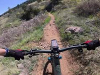
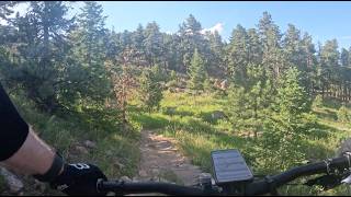
Shuttle riot starting from horsetooth parking lot ending in swan Johnson trail head parking lot

Detailed Description
Magic mountain is a 11 mile popular expert route located near Fort Collins Colorado. This mountain bike only route. This route includes 5 trails. This route climbs 2,134 ft with a max elevation of 6,927 ft then descends -2,484 ft.
Local Trail Association
Local trail association
Overland Mountain Bike Association (www.overlandmtb.org)
Please consider joining or donating to the local riding association to support trail development & maintenance.
Donate to earn trail karma!

Trail Products

Stats

  • Distance
    11 miles
  • Avg time
    1 hr 51 min
  • Altitude change
    -350 ft
  • Altitude min
    5,450 ft
  • Altitude start
    5,800 ft
  • Altitude end
    5,449 ft
  • Climb
    2,134 ft
  • Descent
    -2,484 ft
  • Grade
    -0.6%
  • Grade max
    -58.4%
  • Grade min
    52.7%
  • Distance climb
    5 miles
  • Distance down
    5 miles
  • Distance flat
    2,897 ft

11 Reviews & Comments


We hope you've been enjoying Trailforks!

Create a FREE account to view route comments and much more.

Trails in Route

Wathen1 mile
Herrington2,717 ft
Upper Mill Creek2 miles
Sawmill Ext1,168 ft
Swan Johnson2,142 ft

Details

  • Riding area
  • Primary Activity
    Mountain Bike
  • Difficulty rating
    Black Diamond
  • Ridelogs
    42
no votes yet
close
3D
Trail Conditions
  • Unknown
  • Snow Groomed
  • Snow Packed
  • Snow Covered
  • Snow Cover Partial
  • Freeze/thaw Cycle
  • Icy
  • Prevalent Mud
  • Wet
  • Variable
  • Ideal
  • Dry
  • Very Dry
Trail Flow (Ridden Direction)
Trailforks scans users ridelogs to determine the most popular direction each trail is ridden. A good flowing trail network will have most trails flowing in a single direction according to their intension.
The colour categories are based on what percentage of riders are riding a trail in its intended direction.
  • > 96%
  • > 90%
  • > 80%
  • > 70%
  • > 50%
  • < 50%
  • bi-directional trail
  • no data
Trail Last Ridden
Trailforks scans ridelogs to determine the last time a trail was ridden.
  • < 2 days
  • < 1 week
  • < 2 weeks
  • < 1 month
  • < 6 months
  • > 6 months
Trail Ridden Direction
The intended direction a trail should be ridden.
  • Downhill Only
  • Downhill Primary
  • Both Directions
  • Uphill Primary
  • Uphill Only
  • One Direction
Contribute Details
Colors indicate trail is missing specified detail.
  • Description
  • Photos
  • Description & Photos
  • Videos
Trail Popularity ?
Trailforks scans ridelogs to determine which trails are ridden the most in the last 9 months. Trails are compared with nearby trails in the same city region with a possible 25 colour shades. Think of this as a heatmap, more rides = more kinetic energy = warmer colors.
  • most popular
  • popular
  • less popular
  • not popular
ATV/ORV/OHV Filter
Max Vehicle Width
inches
US Cell Coverage
Legend
cell carrier legend

Radar Time
Activity Recordings
Trailforks uses anonymized public activity data. ?
Activity Recordings
Trailforks uses anonymized public activity data. ?
Personal Heatmap
Activity Types
all / none
Options
2
Date range month
Winter Trails
Warning A routing network for winter maps does not exist. Selecting trails using the winter trails layer has been disabled.
Missing Trails
Most Popular
Least Popular
Trails are colored based on popularity. The more popular a trail is, the more red. Less popular trails trend towards green.
Jump Magnitude Heatmap
Heatmap of where riders jump on trails. Zoom in to see individual jumps, click circles to view jump details.
BC Backroad Status

Service Road Atlas is a free to use, community-driven service for viewing and creating reports on the numerous back-country service roads around B.C. and Alberta.

map legend
Slope Aspect
Direction the slope faces
Flat N NE E SE S SW W NW
Trails Deemphasized
Trails are shown in grey.
disable
Only show trails with no bike usage.
Enable
Suggested Layers
Based on selected activity type

    Save the current map location and zoom level as your default home location whenever this page is loaded.

    Save
    Trail transparency
    • Singletrack
    • Unpaved
    51
    58
    54
    230
    Sawmill Ext
    Sawmill Ext
    43 | comments: 0 | favs:
    Jun 20, 2025
    Wathen - Horsetooth Mountain - Fort Collins -...
    Wathen - Horsetooth Mountain - Fort Collins - Colorado
    trail: Wathen
    9:32 | 234 | comments: 0 | favs:
    Jun 23, 2024

    Recent Trail Reports Along Route

    statustraildateconditiondescription
    Swan Johnson
    May 9, 2026 @ 10:58am (America/Denver)
    May 9, 2026
    Sawmill Ext
    May 9, 2026 @ 10:58am (America/Denver)
    May 9, 2026
    Wathen
    Oct 25, 2025 @ 10:42am (America/Denver)
    Oct 25, 2025
    Dry and loose.
    Herrington
    Jul 21, 2025 @ 5:29am
    Jul 21, 2025
    Typical dry summer conditions
    Upper Mill Creek
    May 12, 2025 @ 4:33am
    May 12, 2025
    more reports »
    • By Snowgoon37TF Pro & contributors
    • #32448 - 1,047 views

    Hit the Trail

    Open in App

    Get this route on your phone instantly.

    Download Route

    Save to wishlist, Garmin & download.