

Open in App
Get this route on your phone instantly.
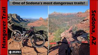
EXPERTS ONLY: This lap includes Hangover Trail, one of Sedona's most technically and physically demanding trails. You'll climb up Schnebly Hill Rd and hit single track on the Cowpies Trail. Head through loose rock gardens and up slick rock features to where it links into Hangover Trail and continue to climb sustained and highly technical terrain that requires big wheel lifts and throws some exposure at you. Reaching the Hangover Saddle, you will look out into Oak Creek Canyon and into West Sedona. The views do not disappoint. Begin the descent, which starts out with some big moves, then head into exposed, narrow, technical traversing around the southwest side of the formation. The trail barely lets up as you follow white dots down committal slick rock as you descend the southwestern side of the hill and traverse back towards Munds Wagon. End with a fun, flowy descent that let's you loosen up after the technical ride.
We hope you've been enjoying Trailforks!
Create a FREE account to view route comments and much more.
| 3 miles | |||||
| 2,740 ft | |||||
| 3 miles | |||||
| 1 mile | |||||
| 633 ft | |||||
| 1,755 ft |

Service Road Atlas is a free to use, community-driven service for viewing and creating reports on the numerous back-country service roads around B.C. and Alberta.
Save the current map location and zoom level as your default home location whenever this page is loaded.
Save