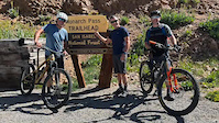
This ride is long, has multiple extended climbs, is at high elevation, and water sources are few. Bring plenty of food, lots of water, and ample layers. Weather can come in quickly in the high country, be prepared!
Put on your big kid pants, grab plenty of snacks, and earn your turns on five (more if you count parts of Rainbow Trail) amazing descents in a day on this grueling but amazing tour of the Monarch Crest areaβSouth Fooses Creek, Crest, Silver Creek, Starvation Creek and Greens Greek. Donβt be afraid to ride your big bike with grippy tires and a dropper post to maximize the fun
Trail Issues on Route
- Significant Issue / Amber: 2 trails (newest: Sep 6, 2025)
Local Trail Association
Salida Mountain Trails (salidamountaintrails.org)Stats
-
Distance80 miles
-
Altitude change-2,449 ft
-
Altitude min8,433 ft
-
Altitude start11,308 ft
-
Altitude end8,858 ft
-
Climb2 miles
-
Descent-13,047 ft
-
Grade-0.6%
-
Grade max-83.7%
-
Grade min69.5%
-
Distance climb38 miles
-
Distance down38 miles
-
Distance flat4 miles
45 Reviews & Comments
We hope you've been enjoying Trailforks!
Create a FREE account to view route comments and much more.
Trails in Route
| 7 miles | |||||
| 4 miles | |||||
| 187 ft | |||||
| 3 miles | |||||
| 4 miles | |||||
| 11 miles | |||||
| 187 ft | |||||
| 1,552 ft | |||||
| 5 miles | |||||
| 6 miles |
Details
-
Riding area
-
Primary ActivityMountain Bike
-
Difficulty ratingBlack Diamond
-
Route TypePoint to Point
-
Bike typeAM, XC
-
Physical ratingExtreme
- Unknown
- Snow Groomed
- Snow Packed
- Snow Covered
- Snow Cover Partial
- Freeze/thaw Cycle
- Icy
- Prevalent Mud
- Wet
- Variable
- Ideal
- Dry
- Very Dry
The colour categories are based on what percentage of riders are riding a trail in its intended direction.
- > 96%
- > 90%
- > 80%
- > 70%
- > 50%
- < 50%
- bi-directional trail
- no data
- < 2 days
- < 1 week
- < 2 weeks
- < 1 month
- < 6 months
- > 6 months
- Downhill Only
- Downhill Primary
- Both Directions
- Uphill Primary
- Uphill Only
- One Direction
- Description
- Photos
- Description & Photos
- Videos
- most popular
- popular
- less popular
- not popular
Service Road Atlas is a free to use, community-driven service for viewing and creating reports on the numerous back-country service roads around B.C. and Alberta.
Save the current map location and zoom level as your default home location whenever this page is loaded.
Save- Singletrack
- Unpaved
Photos
Videos
Recent Trail Reports Along Route
- By FullTrucker
& contributors - #58302 - 950 views


