6.5 miles
Distance
792 ft
Climb
-795 ft
Descent
896 ft
High Point
-4 ft
Altitude change
545 ft
Altitude min
642 ft
Altitude start
640 ft
Altitude end
-24.7%
Grade max
20.7%
Grade min
3 miles
Distance climb
3 miles
Distance down
2,969 ft
Distance flat

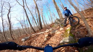
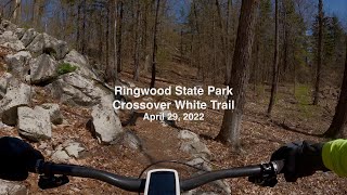
An intermediate loop out the singletrack race trail and then fire roads to Weebly Pond to pick up Crossover trail at Poison Ivy.

Detailed Description
NJMTBFest Crossover Intermediate is a 6 mile popular intermediate route located near Ringwood New Jersey. This mountain bike only route can be used one direction and has a moderate overall physical rating. This route includes 6 trails. This route climbs 792 ft with a max elevation of 896 ft then descends -795 ft.
Local Trail Association
Local trail association
Jersey Off Road Bicycle Association (www.jorba.org)
Please consider joining or donating to the local riding association to support trail development & maintenance.
Donate to earn trail karma!

Stats

  • Distance
    6 miles
  • Avg time
    1 hr 28 min
  • Altitude min
    545 ft
  • Altitude start
    642 ft
  • Altitude end
    640 ft
  • Climb
    792 ft
  • Descent
    -795 ft
  • Grade max
    -24.7%
  • Grade min
    20.7%
  • Distance climb
    3 miles
  • Distance down
    3 miles
  • Distance flat
    2,969 ft

5 Reviews & Comments


We hope you've been enjoying Trailforks!

Create a FREE account to view route comments and much more.

Trails in Route

Details

  • Riding area
  • Primary Activity
    Mountain Bike
  • Difficulty rating
    Blue
  • Route Type
    Loop
  • eBike Allowed
  • Bike type
    AM, XC
  • Direction
    One Direction
  • Physical rating
    Moderate
  • Ridelogs
    21
Avg: 4 (3 votes)
close
3D
Trail Conditions
  • Unknown
  • Snow Groomed
  • Snow Packed
  • Snow Covered
  • Snow Cover Partial
  • Freeze/thaw Cycle
  • Icy
  • Prevalent Mud
  • Wet
  • Variable
  • Ideal
  • Dry
  • Very Dry
Trail Flow (Ridden Direction)
Trailforks scans users ridelogs to determine the most popular direction each trail is ridden. A good flowing trail network will have most trails flowing in a single direction according to their intension.
The colour categories are based on what percentage of riders are riding a trail in its intended direction.
  • > 96%
  • > 90%
  • > 80%
  • > 70%
  • > 50%
  • < 50%
  • bi-directional trail
  • no data
Trail Last Ridden
Trailforks scans ridelogs to determine the last time a trail was ridden.
  • < 2 days
  • < 1 week
  • < 2 weeks
  • < 1 month
  • < 6 months
  • > 6 months
Trail Ridden Direction
The intended direction a trail should be ridden.
  • Downhill Only
  • Downhill Primary
  • Both Directions
  • Uphill Primary
  • Uphill Only
  • One Direction
Contribute Details
Colors indicate trail is missing specified detail.
  • Description
  • Photos
  • Description & Photos
  • Videos
Trail Popularity ?
Trailforks scans ridelogs to determine which trails are ridden the most in the last 9 months. Trails are compared with nearby trails in the same city region with a possible 25 colour shades. Think of this as a heatmap, more rides = more kinetic energy = warmer colors.
  • most popular
  • popular
  • less popular
  • not popular
ATV/ORV/OHV Filter
Max Vehicle Width
inches
US Cell Coverage
Legend
cell carrier legend

Radar Time
Activity Recordings
Trailforks uses anonymized public activity data. ?
Activity Recordings
Trailforks uses anonymized public activity data. ?
Personal Heatmap
Activity Types
all / none
Options
2
Date range month
Winter Trails
Warning A routing network for winter maps does not exist. Selecting trails using the winter trails layer has been disabled.
Missing Trails
Most Popular
Least Popular
Trails are colored based on popularity. The more popular a trail is, the more red. Less popular trails trend towards green.
Jump Magnitude Heatmap
Heatmap of where riders jump on trails. Zoom in to see individual jumps, click circles to view jump details.
BC Backroad Status

Service Road Atlas is a free to use, community-driven service for viewing and creating reports on the numerous back-country service roads around B.C. and Alberta.

map legend
Slope Aspect
Direction the slope faces
Flat N NE E SE S SW W NW
Trails Deemphasized
Trails are shown in grey.
disable
Only show trails with no bike usage.
Enable
Suggested Layers
Based on selected activity type

    Save the current map location and zoom level as your default home location whenever this page is loaded.

    Save
    Trail transparency
    • Singletrack
    • Unpaved
    297
    232
    269
    222
    White Crossover Trail Ringwood St Pk Jan 8, 2023
    White Crossover Trail Ringwood St Pk Jan 8, 2023
    trail: Crossover
    26:08 | 184 | comments: 0 | favs:
    Jan 10, 2023
    Ringwood State Park Crossover Trail Apr 29, 2022
    Ringwood State Park Crossover Trail Apr 29, 2022
    2:43 | 295 | comments: 0 | favs:
    May 1, 2022

    Recent Trail Reports Along Route

    statustraildateconditiondescription
    Crossover Lot A
    Jun 10, 2026 @ 9:23am (America/New_York)
    Jun 10, 2026
    Crossover - White Rollers
    Apr 20, 2026 @ 6:55am (America/New_York)
    Apr 20, 2026
    Crossover
    Apr 20, 2026 @ 6:55am (America/New_York)
    Apr 20, 2026
    Crossover 19
    Apr 4, 2026 @ 9:42am (America/New_York)
    Apr 4, 2026
    Crossover (White)
    Nov 30, 2025 @ 9:26am (America/New_York)
    Nov 30, 2025
    rain and snow -wet but not soaked
    more reports »

    Hit the Trail

    Open in App

    Get this route on your phone instantly.

    Download Route

    Save to wishlist, Garmin & download.