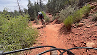
Starting from the Yavapai Vista parking lot you'll climb up towards Slim Shady. This downhill is one of Sedona's best. You'll find the flow - just stay loose and pump over the features Hit the Templeton intersection and take this to Easy Breezy. You'll hit a little bit of tech and some more flow as you continue back to where Easy Breezy meets Templeton. Climb back out via Hermit to the parking lot.
Trail Issues on Route
- Minor Issue / Yellow: 1 trail (newest: May 13, 2026)
Local Trail Association
Trail Products
Stats
-
Distance3 miles
-
Avg time56 min 55 sec
-
Altitude min4,201 ft
-
Altitude start4,372 ft
-
Altitude end4,337 ft
-
Climb260 ft
-
Descent-293 ft
-
Grade-0.2%
-
Grade max-21.2%
-
Grade min14.9%
-
Distance climb1 mile
-
Distance down1 mile
-
Distance flat2,635 ft
38 Reviews & Comments
We hope you've been enjoying Trailforks!
Create a FREE account to view route comments and much more.
Trails in Route
| 551 ft | |||||
| 5,246 ft | |||||
| 2,142 ft | |||||
| 594 ft | |||||
| 1,437 ft | |||||
| 1,591 ft |
- Unknown
- Snow Groomed
- Snow Packed
- Snow Covered
- Snow Cover Partial
- Freeze/thaw Cycle
- Icy
- Prevalent Mud
- Wet
- Variable
- Ideal
- Dry
- Very Dry
The colour categories are based on what percentage of riders are riding a trail in its intended direction.
- > 96%
- > 90%
- > 80%
- > 70%
- > 50%
- < 50%
- bi-directional trail
- no data
- < 2 days
- < 1 week
- < 2 weeks
- < 1 month
- < 6 months
- > 6 months
- Downhill Only
- Downhill Primary
- Both Directions
- Uphill Primary
- Uphill Only
- One Direction
- Description
- Photos
- Description & Photos
- Videos
- most popular
- popular
- less popular
- not popular
Service Road Atlas is a free to use, community-driven service for viewing and creating reports on the numerous back-country service roads around B.C. and Alberta.
Save the current map location and zoom level as your default home location whenever this page is loaded.
Save- Singletrack
Photos
Videos
Recent Trail Reports Along Route
- By MollyJoyce
& contributors - #17601 - 828 views
