52.7 miles
Distance
8,222 ft
Climb
-8,226 ft
Descent
1,502 ft
High Point
-4 ft
Altitude change
679 ft
Altitude min
817 ft
Altitude start
814 ft
Altitude end
-54.4%
Grade max
118.3%
Grade min
24 miles
Distance climb
20 miles
Distance down
9 miles
Distance flat

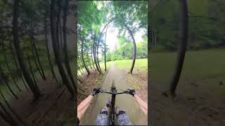
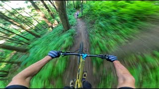
A tour of pretty much all the trails on Peg

Detailed Description
Peg Triple Crown is a 53 mile popular expert route located near Woodstock Vermont. This mountain bike only route can be used one direction and has a extreme overall physical rating. This route includes 74 trails. This route climbs 8,222 ft with a max elevation of 1,502 ft then descends -8,226 ft.

Trail Issues on Route

  • Closed: 8 trails (newest: Jun 13, 2026)
  • Minor Issue / Yellow: 1 trail (newest: May 16, 2026)
Local Trail Association
Local trail association
Woodstock Area Mountain Bike Association (www.mtbwoodstock.com)
Please consider joining or donating to the local riding association to support trail development & maintenance.
Donate to earn trail karma!

Stats

  • Distance
    53 miles
  • Avg time
    7 hr 49 min
  • Altitude min
    679 ft
  • Altitude start
    817 ft
  • Altitude end
    814 ft
  • Climb
    2 miles
  • Descent
    -8,226 ft
  • Grade max
    -54.4%
  • Grade min
    118.3%
  • Distance climb
    24 miles
  • Distance down
    20 miles
  • Distance flat
    9 miles

58 Reviews & Comments


We hope you've been enjoying Trailforks!

Create a FREE account to view route comments and much more.

Details

  • Riding area
  • Primary Activity
    Mountain Bike
  • Difficulty rating
    Black Diamond
  • Route Type
    Loop
  • eBike Allowed
  • Bike type
    AM
  • Direction
    One Direction
  • Physical rating
    Extreme
Avg: 4 (1 votes)
close
3D
Trail Conditions
  • Unknown
  • Snow Groomed
  • Snow Packed
  • Snow Covered
  • Snow Cover Partial
  • Freeze/thaw Cycle
  • Icy
  • Prevalent Mud
  • Wet
  • Variable
  • Ideal
  • Dry
  • Very Dry
Trail Flow (Ridden Direction)
Trailforks scans users ridelogs to determine the most popular direction each trail is ridden. A good flowing trail network will have most trails flowing in a single direction according to their intension.
The colour categories are based on what percentage of riders are riding a trail in its intended direction.
  • > 96%
  • > 90%
  • > 80%
  • > 70%
  • > 50%
  • < 50%
  • bi-directional trail
  • no data
Trail Last Ridden
Trailforks scans ridelogs to determine the last time a trail was ridden.
  • < 2 days
  • < 1 week
  • < 2 weeks
  • < 1 month
  • < 6 months
  • > 6 months
Trail Ridden Direction
The intended direction a trail should be ridden.
  • Downhill Only
  • Downhill Primary
  • Both Directions
  • Uphill Primary
  • Uphill Only
  • One Direction
Contribute Details
Colors indicate trail is missing specified detail.
  • Description
  • Photos
  • Description & Photos
  • Videos
Trail Popularity ?
Trailforks scans ridelogs to determine which trails are ridden the most in the last 9 months. Trails are compared with nearby trails in the same city region with a possible 25 colour shades. Think of this as a heatmap, more rides = more kinetic energy = warmer colors.
  • most popular
  • popular
  • less popular
  • not popular
ATV/ORV/OHV Filter
Max Vehicle Width
inches
US Cell Coverage
Legend
cell carrier legend

Radar Time
Activity Recordings
Trailforks uses anonymized public activity data. ?
Activity Recordings
Trailforks uses anonymized public activity data. ?
Personal Heatmap
Activity Types
all / none
Options
2
Date range month
Winter Trails
Warning A routing network for winter maps does not exist. Selecting trails using the winter trails layer has been disabled.
Missing Trails
Most Popular
Least Popular
Trails are colored based on popularity. The more popular a trail is, the more red. Less popular trails trend towards green.
Jump Magnitude Heatmap
Heatmap of where riders jump on trails. Zoom in to see individual jumps, click circles to view jump details.
BC Backroad Status

Service Road Atlas is a free to use, community-driven service for viewing and creating reports on the numerous back-country service roads around B.C. and Alberta.

map legend
Slope Aspect
Direction the slope faces
Flat N NE E SE S SW W NW
Trails Deemphasized
Trails are shown in grey.
disable
Only show trails with no bike usage.
Enable
Suggested Layers
Based on selected activity type

    Save the current map location and zoom level as your default home location whenever this page is loaded.

    Save
    Trail transparency
    • Singletrack
    • Unpaved
    48
    46
    48
    45
    Fast & Flowy A.F.! S6 Avery
    Fast & Flowy A.F.! S6 Avery
    2:42 | 91 | comments: 0 | favs:
    Jul 7, 2025

    Recent Trail Reports Along Route

    statustraildateconditiondescription
    Knox Turn
    Jun 17, 2026 @ 10:41am (America/New_York)
    7 hours
    Ravine
    Jun 17, 2026 @ 10:41am (America/New_York)
    7 hours
    Pegway
    Jun 17, 2026 @ 10:41am (America/New_York)
    7 hours
    Sir Bermsalot
    Jun 17, 2026 @ 10:41am (America/New_York)
    7 hours
    OMG -Fast!
    Cloud Drop
    Jun 17, 2026 @ 10:41am (America/New_York)
    7 hours
    more reports »
    • By Carltongc & contributors
    • #43973 - 1,259 views

    Hit the Trail

    Open in App

    Get this route on your phone instantly.

    Download Route

    Save to wishlist, Garmin & download.