
Open in App
Get this route on your phone instantly.
QMT 50 RACE GPX FILE UPLOAD
Discover this epic race course. QMT 50 is the biggest ultra trail in Canada with over 500 participants. Start from Mont-Sainte-Anne Cross Country Ski Center towards the splendid but brutal Mestachibo trail. Complete two ascents and two descents of Mont-Sainte-Anne, finish with a loop in the northern trails of MSA.anada.com/en/ultra-trail-races/qmt-50/
We hope you've been enjoying Trailforks!
Create a FREE account to view route comments and much more.
| 2,441 ft | |||||
| 1 mile | |||||
| 4,045 ft | |||||
| 2,628 ft | |||||
| 2,100 ft | |||||
| 1,155 ft |
 | Auberge du Fondeur | Information |
| Départ / Start | Information |
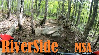
| Mestachibo | Information |
| MSA aid station | Information |
| Saint-Hilaire | Information |
| Sommet 1 & 2 | Information |

Service Road Atlas is a free to use, community-driven service for viewing and creating reports on the numerous back-country service roads around B.C. and Alberta.
Save the current map location and zoom level as your default home location whenever this page is loaded.
Save