6.7 miles
Distance
1,007 ft
Climb
-976 ft
Descent
1,370 ft
High Point
29 ft
Altitude change
763 ft
Altitude min
769 ft
Altitude start
797 ft
Altitude end
0.1%
Grade
-34.4%
Grade max
44.1%
Grade min
3 miles
Distance climb
3 miles
Distance down
2 miles
Distance flat

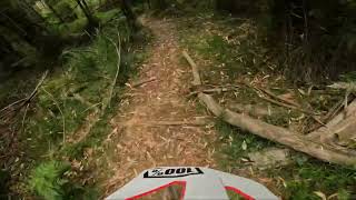
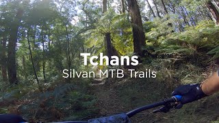
Easy 10Km loop with some fun downhill and climbs that are not going to kill you with some cross country thrown in.

Detailed Description
Quick Silvan Shred is a 7 mile moderately popular intermediate route located near Mount Dandenong. This mountain bike primary route can be used one direction and has a moderate overall physical rating. This route includes 6 trails. This route climbs 1,007 ft with a max elevation of 1,370 ft then descends -976 ft.

Trail Issues on Route

  • Closed: 1 trail (newest: May 1, 2026)
Local Trail Association
Local trail association
Yarra Ranges Mountain Bikers (yrmtb.com.au)
Please consider joining or donating to the local riding association to support trail development & maintenance.
Donate to earn trail karma!

Stats

  • Distance
    7 miles
  • Altitude min
    763 ft
  • Altitude start
    769 ft
  • Altitude end
    797 ft
  • Climb
    1,007 ft
  • Descent
    -976 ft
  • Grade
    0.1%
  • Grade max
    -34.4%
  • Grade min
    44.1%
  • Distance climb
    3 miles
  • Distance down
    3 miles
  • Distance flat
    2 miles

8 Reviews & Comments


We hope you've been enjoying Trailforks!

Create a FREE account to view route comments and much more.

Trails in Route

Dam Good View3,661 ft
Broken Hoe1,657 ft
Burnt Out Climb3,648 ft
Tchans1 mile
Link203 ft
Delta 44,790 ft

Details

  • Riding area
  • Primary Activity
    Mountain Bike
  • Other Activities
    • E-Bike
  • Difficulty rating
    Blue
  • Route Type
    Loop
  • eBike Allowed
  • Bike type
    AM, XC
  • Direction
    One Direction
  • Physical rating
    Moderate
no votes yet
close
3D
Trail Conditions
  • Unknown
  • Snow Groomed
  • Snow Packed
  • Snow Covered
  • Snow Cover Partial
  • Freeze/thaw Cycle
  • Icy
  • Prevalent Mud
  • Wet
  • Variable
  • Ideal
  • Dry
  • Very Dry
Trail Flow (Ridden Direction)
Trailforks scans users ridelogs to determine the most popular direction each trail is ridden. A good flowing trail network will have most trails flowing in a single direction according to their intension.
The colour categories are based on what percentage of riders are riding a trail in its intended direction.
  • > 96%
  • > 90%
  • > 80%
  • > 70%
  • > 50%
  • < 50%
  • bi-directional trail
  • no data
Trail Last Ridden
Trailforks scans ridelogs to determine the last time a trail was ridden.
  • < 2 days
  • < 1 week
  • < 2 weeks
  • < 1 month
  • < 6 months
  • > 6 months
Trail Ridden Direction
The intended direction a trail should be ridden.
  • Downhill Only
  • Downhill Primary
  • Both Directions
  • Uphill Primary
  • Uphill Only
  • One Direction
Contribute Details
Colors indicate trail is missing specified detail.
  • Description
  • Photos
  • Description & Photos
  • Videos
Trail Popularity ?
Trailforks scans ridelogs to determine which trails are ridden the most in the last 9 months. Trails are compared with nearby trails in the same city region with a possible 25 colour shades. Think of this as a heatmap, more rides = more kinetic energy = warmer colors.
  • most popular
  • popular
  • less popular
  • not popular
ATV/ORV/OHV Filter
Max Vehicle Width
inches
US Cell Coverage
Legend
cell carrier legend

Radar Time
Activity Recordings
Trailforks uses anonymized public activity data. ?
Activity Recordings
Trailforks uses anonymized public activity data. ?
Personal Heatmap
Activity Types
all / none
Options
2
Date range month
Winter Trails
Warning A routing network for winter maps does not exist. Selecting trails using the winter trails layer has been disabled.
Missing Trails
Most Popular
Least Popular
Trails are colored based on popularity. The more popular a trail is, the more red. Less popular trails trend towards green.
Jump Magnitude Heatmap
Heatmap of where riders jump on trails. Zoom in to see individual jumps, click circles to view jump details.
BC Backroad Status

Service Road Atlas is a free to use, community-driven service for viewing and creating reports on the numerous back-country service roads around B.C. and Alberta.

map legend
Slope Aspect
Direction the slope faces
Flat N NE E SE S SW W NW
Trails Deemphasized
Trails are shown in grey.
disable
Only show trails with no bike usage.
Enable
Suggested Layers
Based on selected activity type

    Save the current map location and zoom level as your default home location whenever this page is loaded.

    Save
    Trail transparency
    • Singletrack
    62
    47
    33
    107
    youtuber Delta 4 Silvan
    Delta 4 Silvan
    trail: Delta 4
    5:42 | 42 | comments: 0 | favs:
    Jan 28, 2023
    youtuber Silvan MTB Trails – Tchans
    Silvan MTB Trails – Tchans
    trail: Tchans
    8:11 | 1098 | comments: 0 | favs:
    May 22, 2021

    Recent Trail Reports Along Route

    statustraildateconditiondescription
    Broken Hoe
    May 1, 2026 @ 9:23pm (Australia/Melbourne)
    May 1, 2026
    Trail is in the burn zone. Condition largely unknown and trail will need to be checked and cleared.
    Dam Good View
    May 1, 2026 @ 9:22pm (Australia/Melbourne)
    May 1, 2026
    Trail has reopened.
    Delta 4
    May 1, 2026 @ 9:22pm (Australia/Melbourne)
    May 1, 2026
    Trail has reopened.
    Burnt Out Climb
    Jan 26, 2026 @ 6:55pm (Australia/Melbourne)
    Jan 25, 2026
    Tchans
    Jan 26, 2026 @ 6:54pm (Australia/Melbourne)
    Jan 25, 2026
    more reports »
    • By GrubieTF Pro & contributors
    • #50880 - 800 views

    Hit the Trail

    Open in App

    Get this route on your phone instantly.

    Download Route

    Save to wishlist, Garmin & download.