7.9 miles
Distance
1,138 ft
Climb
-1,135 ft
Descent
1 mile
High Point
5 ft
Altitude change
5,683 ft
Altitude min
5,868 ft
Altitude start
5,873 ft
Altitude end
-38%
Grade max
29.6%
Grade min
4 miles
Distance climb
3 miles
Distance down
2,323 ft
Distance flat

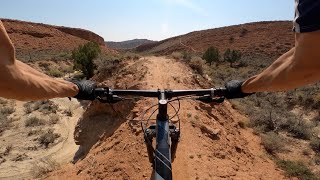
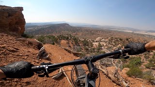
Favorite loop in the area. Starts off pretty easy and flowy with some ups and downs and fast flow sections on narrow hard pack. Continue up J-Boy climb that winds through fields of cryptobiotic soil. You then rip down red dirt and rocky drops and paths to the Dinosaur Tracks parking area. Fun and interesting climb up and then descend down hugging a rock face with some really fun engineered rocky paths.

Detailed Description
Red Fleet Ultimate is a 8 mile popular intermediate route located near Vernal Utah. This mountain bike only route can be used one direction and has a hard overall physical rating. This route includes 7 trails. This route climbs 1,138 ft with a max elevation of 6,089 ft then descends -1,135 ft.
Local Trail Association
Local trail association
Northeastern Utah Mountain Bikers (www.bikenumb.org)
Please consider joining or donating to the local riding association to support trail development & maintenance.
Donate to earn trail karma!

Stats

  • Distance
    8 miles
  • Avg time
    1 hr 29 min
  • Altitude min
    5,683 ft
  • Altitude start
    5,868 ft
  • Altitude end
    5,873 ft
  • Climb
    1,138 ft
  • Descent
    -1,135 ft
  • Grade max
    -38%
  • Grade min
    29.6%
  • Distance climb
    4 miles
  • Distance down
    3 miles
  • Distance flat
    2,323 ft

22 Reviews & Comments


We hope you've been enjoying Trailforks!

Create a FREE account to view route comments and much more.

Details

  • Featured
  • Riding area
  • Primary Activity
    Mountain Bike
  • Difficulty rating
    Blue
  • Route Type
    Loop
  • Direction
    One Direction
  • Physical rating
    Hard
  • Ridelogs
    78
Avg: 5 (2 votes)
close
3D
Trail Conditions
  • Unknown
  • Snow Groomed
  • Snow Packed
  • Snow Covered
  • Snow Cover Partial
  • Freeze/thaw Cycle
  • Icy
  • Prevalent Mud
  • Wet
  • Variable
  • Ideal
  • Dry
  • Very Dry
Trail Flow (Ridden Direction)
Trailforks scans users ridelogs to determine the most popular direction each trail is ridden. A good flowing trail network will have most trails flowing in a single direction according to their intension.
The colour categories are based on what percentage of riders are riding a trail in its intended direction.
  • > 96%
  • > 90%
  • > 80%
  • > 70%
  • > 50%
  • < 50%
  • bi-directional trail
  • no data
Trail Last Ridden
Trailforks scans ridelogs to determine the last time a trail was ridden.
  • < 2 days
  • < 1 week
  • < 2 weeks
  • < 1 month
  • < 6 months
  • > 6 months
Trail Ridden Direction
The intended direction a trail should be ridden.
  • Downhill Only
  • Downhill Primary
  • Both Directions
  • Uphill Primary
  • Uphill Only
  • One Direction
Contribute Details
Colors indicate trail is missing specified detail.
  • Description
  • Photos
  • Description & Photos
  • Videos
Trail Popularity ?
Trailforks scans ridelogs to determine which trails are ridden the most in the last 9 months. Trails are compared with nearby trails in the same city region with a possible 25 colour shades. Think of this as a heatmap, more rides = more kinetic energy = warmer colors.
  • most popular
  • popular
  • less popular
  • not popular
ATV/ORV/OHV Filter
Max Vehicle Width
inches
US Cell Coverage
Legend
cell carrier legend

Radar Time
Activity Recordings
Trailforks uses anonymized public activity data. ?
Activity Recordings
Trailforks uses anonymized public activity data. ?
Personal Heatmap
Activity Types
all / none
Options
2
Date range month
Winter Trails
Warning A routing network for winter maps does not exist. Selecting trails using the winter trails layer has been disabled.
Missing Trails
Most Popular
Least Popular
Trails are colored based on popularity. The more popular a trail is, the more red. Less popular trails trend towards green.
Jump Magnitude Heatmap
Heatmap of where riders jump on trails. Zoom in to see individual jumps, click circles to view jump details.
BC Backroad Status

Service Road Atlas is a free to use, community-driven service for viewing and creating reports on the numerous back-country service roads around B.C. and Alberta.

map legend
Slope Aspect
Direction the slope faces
Flat N NE E SE S SW W NW
Trails Deemphasized
Trails are shown in grey.
disable
Only show trails with no bike usage.
Enable
Suggested Layers
Based on selected activity type

    Save the current map location and zoom level as your default home location whenever this page is loaded.

    Save
    Trail transparency
    • Singletrack
    192
    166
    214
    208

    Recent Trail Reports Along Route

    statustraildateconditiondescription
    Handsome Cabin Boy
    Mar 10, 2026 @ 7:24am (America/Denver)
    Mar 10, 2026
    Red Fleet trails are mostly dry for the 2026 season. Please do not ride if the trails are wet-otherwise enjoy! reporter
    Jazz Access Road
    Mar 10, 2026 @ 7:24am (America/Denver)
    Mar 10, 2026
    Red Fleet trails are mostly dry for the 2026 season. Please do not ride if the trails are wet-otherwise enjoy! reporter
    Jazz Chrome Molly, North
    Mar 10, 2026 @ 7:24am (America/Denver)
    Mar 10, 2026
    Red Fleet trails are mostly dry for the 2026 season. Please do not ride if the trails are wet-otherwise enjoy! reporter
    Jazz Chrome Molly (West)
    Mar 10, 2026 @ 7:24am (America/Denver)
    Mar 10, 2026
    Red Fleet trails are mostly dry for the 2026 season. Please do not ride if the trails are wet-otherwise enjoy! reporter
    J-Boy (North)
    Mar 10, 2026 @ 7:24am (America/Denver)
    Mar 10, 2026
    Red Fleet trails are mostly dry for the 2026 season. Please do not ride if the trails are wet-otherwise enjoy! reporter
    more reports »
    • By toddTF Pro Trailforks & contributors
    • #2663 - 3,182 views

    Hit the Trail

    Open in App

    Get this route on your phone instantly.

    Download Route

    Save to wishlist, Garmin & download.