4.6 miles
Distance
874 ft
Climb
-872 ft
Descent
1,947 ft
High Point
2 ft
Altitude change
1,077 ft
Altitude min
1,077 ft
Altitude start
1,079 ft
Altitude end
-32.8%
Grade max
27.6%
Grade min
2 miles
Distance climb
2 miles
Distance down
745 ft
Distance flat

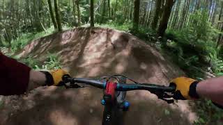
LOC MTB Medium route for August 10th, 2019 Team ride. Up Homestead to Flow Motion, Down Flow Motion, across Homestead to Lower Hide and Seek, Down Lower Hide and Seek to Homestead, across Homestead to Lower Hide and Seek to bottom.

Detailed Description
Sandy Flow LowHide is a 5 mile popular intermediate route located near Sandy Oregon. This mountain bike only route. This route includes 13 trails. This route climbs 874 ft with a max elevation of 1,947 ft then descends -872 ft.
Local Trail Association
Local trail association
Northwest Trail Alliance (nw-trail.org)
Please consider joining or donating to the local riding association to support trail development & maintenance.
Donate to earn trail karma!

Stats

  • Distance
    5 miles
  • Avg time
    58 min 2 sec
  • Altitude change
    2 ft
  • Altitude min
    1,077 ft
  • Altitude start
    1,077 ft
  • Altitude end
    1,079 ft
  • Climb
    874 ft
  • Descent
    -872 ft
  • Grade max
    -32.8%
  • Grade min
    27.6%
  • Distance climb
    2 miles
  • Distance down
    2 miles
  • Distance flat
    745 ft

23 Reviews & Comments


We hope you've been enjoying Trailforks!

Create a FREE account to view route comments and much more.

Trails in Route

Details

  • Riding area
  • Primary Activity
    Mountain Bike
  • Difficulty rating
    Blue
  • Bike type
    AM, XC
  • Ridelogs
    388
Avg: 5 (2 votes)
close
3D
Trail Conditions
  • Unknown
  • Snow Groomed
  • Snow Packed
  • Snow Covered
  • Snow Cover Partial
  • Freeze/thaw Cycle
  • Icy
  • Prevalent Mud
  • Wet
  • Variable
  • Ideal
  • Dry
  • Very Dry
Trail Flow (Ridden Direction)
Trailforks scans users ridelogs to determine the most popular direction each trail is ridden. A good flowing trail network will have most trails flowing in a single direction according to their intension.
The colour categories are based on what percentage of riders are riding a trail in its intended direction.
  • > 96%
  • > 90%
  • > 80%
  • > 70%
  • > 50%
  • < 50%
  • bi-directional trail
  • no data
Trail Last Ridden
Trailforks scans ridelogs to determine the last time a trail was ridden.
  • < 2 days
  • < 1 week
  • < 2 weeks
  • < 1 month
  • < 6 months
  • > 6 months
Trail Ridden Direction
The intended direction a trail should be ridden.
  • Downhill Only
  • Downhill Primary
  • Both Directions
  • Uphill Primary
  • Uphill Only
  • One Direction
Contribute Details
Colors indicate trail is missing specified detail.
  • Description
  • Photos
  • Description & Photos
  • Videos
Trail Popularity ?
Trailforks scans ridelogs to determine which trails are ridden the most in the last 9 months. Trails are compared with nearby trails in the same city region with a possible 25 colour shades. Think of this as a heatmap, more rides = more kinetic energy = warmer colors.
  • most popular
  • popular
  • less popular
  • not popular
ATV/ORV/OHV Filter
Max Vehicle Width
inches
US Cell Coverage
Legend
cell carrier legend

Radar Time
Activity Recordings
Trailforks uses anonymized public activity data. ?
Activity Recordings
Trailforks uses anonymized public activity data. ?
Personal Heatmap
Activity Types
all / none
Options
2
Date range month
Winter Trails
Warning A routing network for winter maps does not exist. Selecting trails using the winter trails layer has been disabled.
Missing Trails
Most Popular
Least Popular
Trails are colored based on popularity. The more popular a trail is, the more red. Less popular trails trend towards green.
Jump Magnitude Heatmap
Heatmap of where riders jump on trails. Zoom in to see individual jumps, click circles to view jump details.
BC Backroad Status

Service Road Atlas is a free to use, community-driven service for viewing and creating reports on the numerous back-country service roads around B.C. and Alberta.

map legend
Slope Aspect
Direction the slope faces
Flat N NE E SE S SW W NW
Trails Deemphasized
Trails are shown in grey.
disable
Only show trails with no bike usage.
Enable
Suggested Layers
Based on selected activity type

    Save the current map location and zoom level as your default home location whenever this page is loaded.

    Save
    Trail transparency
    • Singletrack
    • Unpaved
    51
    581
    413
    375
    Sandy Ridge MTB- Lower Hide and Seek
    Sandy Ridge MTB- Lower Hide and Seek
    5:35 | 21 | comments: 0 | favs:
    Jun 12, 2026
    MTB Sandy Ridge, Oregon - Lower Hide and Seek...
    MTB Sandy Ridge, Oregon - Lower Hide and Seek ( Sept 2025)
    6:29 | 155 | comments: 0 | favs:
    Sep 9, 2025

    Recent Trail Reports Along Route

    statustraildateconditiondescription
    Homestead Road
    Jun 13, 2026 @ 9:24am (America/Los_Angeles)
    Jun 13, 2026
    Flow Motion
    Jun 13, 2026 @ 9:24am (America/Los_Angeles)
    Jun 13, 2026
    Lower Hide and Seek
    Jun 13, 2026 @ 9:24am (America/Los_Angeles)
    Jun 13, 2026
    more reports »
    • By yerocnitramTF Pro & contributors
    • #15033 - 1,794 views

    Hit the Trail

    Open in App

    Get this route on your phone instantly.

    Download Route

    Save to wishlist, Garmin & download.