24.1 miles
Distance
4,753 ft
Climb
-4,674 ft
Descent
4,218 ft
High Point
79 ft
Altitude change
1,806 ft
Altitude min
1,806 ft
Altitude start
1,886 ft
Altitude end
0.1%
Grade
-75.4%
Grade max
31.5%
Grade min
15 miles
Distance climb
9 miles
Distance down
2,828 ft
Distance flat

Annual Shuswap Cycling Club Xc race. September 27th 2025. start time 9am.

Join us on September 27th at the South Canoe Trails for this grassroots XC race

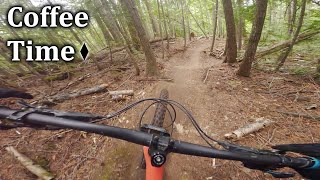
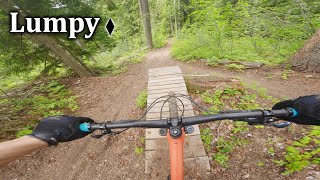
This is a low key and fun race but will test your fitness and riding! The course will take you up the new Ida View Trail, down Rubberhead, back up and through the lush Larch Hills, and back down the fast and flowy South Canoe system.

1. Self-Supportive Event: The event is self-supportive, meaning that participants are responsible for their own navigation, well-being, and equipment throughout the race. There will be some limited route markings, mostly through the Larch Hills Nordic Trails. You are responsible to be familiar with the route. The Route can be found on Trailforks.
2. Course Marshals: There are no Course Marshals. If you come across a rider in need please STOP to assist. 911 in case of an injury.
3. Aid Station: The only Aid Station on route will be at the Rubberhead Parking lot. This will have a limited supply of snacks and water. You are responsible to pack the food you need for this route.
4. Course: Participants are expected to understand the route themselves. This implies that there may not be course marshals or route markers, so cyclists need to be able to navigate the course independently.
o The long course will run from South Canoe to Rubbered using the Ida View Section if the Larch Hills Traverse. From the Top of Rubberhead to the Rubberhead Parking Lot, then Climb back up DD and assorted trails to the top of Hemlock Glide and through the Larch Hills Nordic Trails to South Canoe. See Trailforks Route
o The Short Course will skip the decent to the Rubberhead Parking Lot, Once at the top of the Ida View Trail/top of Hemlock Glide, riders will make their way back to South Canoe through the Larch Hills Nordic Trails.
5. Categories: Men's and Women's of the long and short courses, that’s it.
6. Timing: Old school, we all leave at the same time and try to keep track of when you get back to South Canoe
7. Ebikes: Sure, fill your boots, but you are not eligible for any category.
8. Prizes: A crisp high 5 and bragging rights
9. After Party: There will be Chili and Bannock for all participants.
10. Assessment of Ability: Participants are encouraged to assess their own ability to complete the event.
11. Safety Responsibility: Safety is the responsibility of each participant. This includes having the necessary equipment such as maps, GPS devices, food and repair kits to ensure their well-being during the race. Your are required to stop and assist any riders in need along the course.

Detailed Description
SCC XC is a 24 mile intermediate race route located near Salmon Arm British Columbia. This mountain bike primary route can be used one direction and has a hard overall physical rating. This route includes 29 trails. This route climbs 4,753 ft with a max elevation of 4,218 ft then descends -4,674 ft.

Trail Issues on Route

  • Significant Issue / Amber: 2 trails (newest: Nov 11, 2025)
  • Minor Issue / Yellow: 5 trails (newest: Jun 22, 2026)
Local Trail Association
Local trail association
Shuswap Trail Alliance (www.shuswaptrailalliance.com)
Please consider joining or donating to the local riding association to support trail development & maintenance.
Donate to earn trail karma!
Past Events

Stats

  • Distance
    24 miles
  • Altitude min
    1,806 ft
  • Altitude start
    1,806 ft
  • Altitude end
    1,886 ft
  • Climb
    4,753 ft
  • Descent
    -4,674 ft
  • Grade
    0.1%
  • Grade max
    -75.4%
  • Grade min
    31.5%
  • Distance climb
    15 miles
  • Distance down
    9 miles
  • Distance flat
    2,828 ft

36 Reviews & Comments


We hope you've been enjoying Trailforks!

Create a FREE account to view route comments and much more.

Details

  • Race Course
  • Race Date
    Sunday October 1, 2023 at 09:00am
  • Riding area
  • Primary Activity
    Mountain Bike
  • Other Activities
    • E-Bike
  • Difficulty rating
    Blue
  • Route Type
    Loop
  • eBike Allowed
  • Direction
    One Direction
  • Physical rating
    Hard
Avg: 2.5 (2 votes)
close
3D
Trail Conditions
  • Unknown
  • Snow Groomed
  • Snow Packed
  • Snow Covered
  • Snow Cover Partial
  • Freeze/thaw Cycle
  • Icy
  • Prevalent Mud
  • Wet
  • Variable
  • Ideal
  • Dry
  • Very Dry
Trail Flow (Ridden Direction)
Trailforks scans users ridelogs to determine the most popular direction each trail is ridden. A good flowing trail network will have most trails flowing in a single direction according to their intension.
The colour categories are based on what percentage of riders are riding a trail in its intended direction.
  • > 96%
  • > 90%
  • > 80%
  • > 70%
  • > 50%
  • < 50%
  • bi-directional trail
  • no data
Trail Last Ridden
Trailforks scans ridelogs to determine the last time a trail was ridden.
  • < 2 days
  • < 1 week
  • < 2 weeks
  • < 1 month
  • < 6 months
  • > 6 months
Trail Ridden Direction
The intended direction a trail should be ridden.
  • Downhill Only
  • Downhill Primary
  • Both Directions
  • Uphill Primary
  • Uphill Only
  • One Direction
Contribute Details
Colors indicate trail is missing specified detail.
  • Description
  • Photos
  • Description & Photos
  • Videos
Trail Popularity ?
Trailforks scans ridelogs to determine which trails are ridden the most in the last 9 months. Trails are compared with nearby trails in the same city region with a possible 25 colour shades. Think of this as a heatmap, more rides = more kinetic energy = warmer colors.
  • most popular
  • popular
  • less popular
  • not popular
ATV/ORV/OHV Filter
Max Vehicle Width
inches
US Cell Coverage
Legend
cell carrier legend

Radar Time
Activity Recordings
Trailforks uses anonymized public activity data. ?
Activity Recordings
Trailforks uses anonymized public activity data. ?
Personal Heatmap
Activity Types
all / none
Options
2
Date range month
Winter Trails
Warning A routing network for winter maps does not exist. Selecting trails using the winter trails layer has been disabled.
Missing Trails
Most Popular
Least Popular
Trails are colored based on popularity. The more popular a trail is, the more red. Less popular trails trend towards green.
Jump Magnitude Heatmap
Heatmap of where riders jump on trails. Zoom in to see individual jumps, click circles to view jump details.
BC Backroad Status

Service Road Atlas is a free to use, community-driven service for viewing and creating reports on the numerous back-country service roads around B.C. and Alberta.

map legend
Slope Aspect
Direction the slope faces
Flat N NE E SE S SW W NW
Trails Deemphasized
Trails are shown in grey.
disable
Only show trails with no bike usage.
Enable
Suggested Layers
Based on selected activity type

    Save the current map location and zoom level as your default home location whenever this page is loaded.

    Save
    Trail transparency
    • Singletrack
    • Unpaved
    47
    67
    78
    136
    Coffee Time - South Canoe
    Coffee Time - South Canoe
    0:55 | 220 | comments: 0 | favs:
    Oct 5, 2024
    Lumpy - South Canoe
    Lumpy - South Canoe
    trail: Lumpy
    3:30 | 272 | comments: 0 | favs:
    Oct 5, 2024

    Recent Trail Reports Along Route

    statustraildateconditiondescription
    Double D (upper)
    Jun 22, 2026 @ 6:42pm (America/Vancouver)
    2 days
    Tree down just past the old DD exit
    The Flying Nun (upper)
    Jun 22, 2026 @ 4:13pm (America/Creston)
    2 days
    Double D
    Jun 18, 2026 @ 5:35pm (America/Vancouver)
    Jun 18, 2026
    Tree down
    LHT (Ida View)
    May 21, 2026 @ 5:58pm (America/Vancouver)
    May 21, 2026
    Big and two small trees
    Ravine (9km)
    May 21, 2026 @ 10:09am (America/Vancouver)
    May 21, 2026
    trees cleared
    more reports »
    • By JoeDickTF Pro STAB SCC & contributors
    • #53072 - 2,120 views

    Hit the Trail

    Open in App

    Get this route on your phone instantly.

    Download Route

    Save to wishlist, Garmin & download.