7.5 miles
Distance
1,027 ft
Climb
-1,005 ft
Descent
5,064 ft
High Point
22 ft
Altitude change
4,436 ft
Altitude min
4,510 ft
Altitude start
4,531 ft
Altitude end
0.1%
Grade
-59.5%
Grade max
32.8%
Grade min
4 miles
Distance climb
3 miles
Distance down
1,906 ft
Distance flat

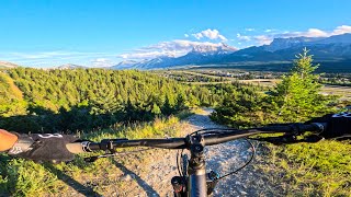
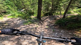
A good loop that starts and ends at Cougar Creek. It includes the great, flowy descents of upper Meander and Johnny's trail. The descent off of Douglas Fir Ridge is best walked.

Detailed Description
Short Montane Loop is a 7 mile popular intermediate route located near Canmore Alberta. This mountain bike primary route. This route includes 14 trails. This route climbs 1,027 ft with a max elevation of 5,064 ft then descends -1,005 ft.

Trail Issues on Route

  • Minor Issue / Yellow: 2 trails (newest: Jun 21, 2026)

Stats

  • Distance
    7 miles
  • Avg time
    1 hr 42 min
  • Altitude change
    22 ft
  • Altitude min
    4,436 ft
  • Altitude start
    4,510 ft
  • Altitude end
    4,531 ft
  • Climb
    1,027 ft
  • Descent
    -1,005 ft
  • Grade
    0.1%
  • Grade max
    -59.5%
  • Grade min
    32.8%
  • Distance climb
    4 miles
  • Distance down
    3 miles
  • Distance flat
    1,906 ft

14 Reviews & Comments


We hope you've been enjoying Trailforks!

Create a FREE account to view route comments and much more.

Details

  • Riding area
  • Primary Activity
    Mountain Bike
  • Other Activities
    • Hike
    • Trail Running
  • Difficulty rating
    Blue
  • Bike type
    AM, XC
  • Ridelogs
    42
Avg: 4 (1 votes)
close
3D
Trail Conditions
  • Unknown
  • Snow Groomed
  • Snow Packed
  • Snow Covered
  • Snow Cover Partial
  • Freeze/thaw Cycle
  • Icy
  • Prevalent Mud
  • Wet
  • Variable
  • Ideal
  • Dry
  • Very Dry
Trail Flow (Ridden Direction)
Trailforks scans users ridelogs to determine the most popular direction each trail is ridden. A good flowing trail network will have most trails flowing in a single direction according to their intension.
The colour categories are based on what percentage of riders are riding a trail in its intended direction.
  • > 96%
  • > 90%
  • > 80%
  • > 70%
  • > 50%
  • < 50%
  • bi-directional trail
  • no data
Trail Last Ridden
Trailforks scans ridelogs to determine the last time a trail was ridden.
  • < 2 days
  • < 1 week
  • < 2 weeks
  • < 1 month
  • < 6 months
  • > 6 months
Trail Ridden Direction
The intended direction a trail should be ridden.
  • Downhill Only
  • Downhill Primary
  • Both Directions
  • Uphill Primary
  • Uphill Only
  • One Direction
Contribute Details
Colors indicate trail is missing specified detail.
  • Description
  • Photos
  • Description & Photos
  • Videos
Trail Popularity ?
Trailforks scans ridelogs to determine which trails are ridden the most in the last 9 months. Trails are compared with nearby trails in the same city region with a possible 25 colour shades. Think of this as a heatmap, more rides = more kinetic energy = warmer colors.
  • most popular
  • popular
  • less popular
  • not popular
ATV/ORV/OHV Filter
Max Vehicle Width
inches
US Cell Coverage
Legend
cell carrier legend

Radar Time
Activity Recordings
Trailforks uses anonymized public activity data. ?
Activity Recordings
Trailforks uses anonymized public activity data. ?
Personal Heatmap
Activity Types
all / none
Options
2
Date range month
Winter Trails
Warning A routing network for winter maps does not exist. Selecting trails using the winter trails layer has been disabled.
Missing Trails
Most Popular
Least Popular
Trails are colored based on popularity. The more popular a trail is, the more red. Less popular trails trend towards green.
Jump Magnitude Heatmap
Heatmap of where riders jump on trails. Zoom in to see individual jumps, click circles to view jump details.
BC Backroad Status

Service Road Atlas is a free to use, community-driven service for viewing and creating reports on the numerous back-country service roads around B.C. and Alberta.

map legend
Slope Aspect
Direction the slope faces
Flat N NE E SE S SW W NW
Trails Deemphasized
Trails are shown in grey.
disable
Only show trails with no bike usage.
Enable
Suggested Layers
Based on selected activity type

    Save the current map location and zoom level as your default home location whenever this page is loaded.

    Save
    Trail transparency
    • Singletrack
    • Unpaved
    • Paved
    82
    40
    40
    37

    Recent Trail Reports Along Route

    statustraildateconditiondescription
    Montane Glades
    Jun 21, 2026 @ 11:06am (America/Edmonton)
    11 hours
    Tree down across trail
    Town Path
    Jun 13, 2026 @ 12:43pm (America/Edmonton)
    Jun 13, 2026
    Montane Traverse
    Jun 11, 2026 @ 6:34pm (America/Edmonton)
    Jun 11, 2026
    Meander
    May 23, 2026 @ 3:15pm (America/Edmonton)
    May 23, 2026
    10-12" Tree down, spanned,/ under tension needs a chainsaw and some care. Thank you.
    Cougar Creek West
    Sep 19, 2025 @ 8:13am (America/Creston)
    Sep 19, 2025
    Good intro back into trail riding. Not done since Sep ‘20
    more reports »
    • By rockwallTF Pro & contributors
    • #22964 - 1,079 views

    Hit the Trail

    Open in App

    Get this route on your phone instantly.

    Download Route

    Save to wishlist, Garmin & download.