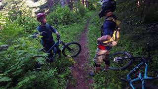
This is an very, very scenic route that connects northern ascent of Silver Star mountain, which 100% ridable, with Bluff mountain trail and Summit Springs descent using available two track roads. You follow an exposed ridge for 60% of the ride so the views are truly stunning. Doable on hard tail, but terrain is very rocky, so full susp recommended.
Local Trail Association
Trail Products
Stats
-
Distance23 miles
-
Altitude min1,030 ft
-
Altitude start1,030 ft
-
Altitude end1,040 ft
-
Climb4,800 ft
-
Descent-4,789 ft
-
Grade max-125%
-
Grade min64.5%
-
Distance climb11 miles
-
Distance down11 miles
-
Distance flat3,911 ft
7 Reviews & Comments
We hope you've been enjoying Trailforks!
Create a FREE account to view route comments and much more.
Trails in Route
| 1,870 ft | |||||
| 2 miles |
Details
-
Riding area
-
Primary ActivityMountain Bike
-
Difficulty ratingBlack Diamond
-
Route TypeLoop
-
eBike Allowed
-
Bike typeAM, XC
-
DirectionOne Direction
-
Physical ratingHard
- Unknown
- Snow Groomed
- Snow Packed
- Snow Covered
- Snow Cover Partial
- Freeze/thaw Cycle
- Icy
- Prevalent Mud
- Wet
- Variable
- Ideal
- Dry
- Very Dry
The colour categories are based on what percentage of riders are riding a trail in its intended direction.
- > 96%
- > 90%
- > 80%
- > 70%
- > 50%
- < 50%
- bi-directional trail
- no data
- < 2 days
- < 1 week
- < 2 weeks
- < 1 month
- < 6 months
- > 6 months
- Downhill Only
- Downhill Primary
- Both Directions
- Uphill Primary
- Uphill Only
- One Direction
- Description
- Photos
- Description & Photos
- Videos
- most popular
- popular
- less popular
- not popular
Service Road Atlas is a free to use, community-driven service for viewing and creating reports on the numerous back-country service roads around B.C. and Alberta.
Save the current map location and zoom level as your default home location whenever this page is loaded.
Save- Singletrack
- Unpaved
Photos
Videos
Recent Trail Reports Along Route
- By Wacek77
& contributors - #10263 - 1,597 views
