101.7 miles
Distance
11,155 ft
Climb
-11,107 ft
Descent
4,291 ft
High Point
49 ft
Altitude change
1,474 ft
Altitude min
1,527 ft
Altitude start
1,575 ft
Altitude end
-118.3%
Grade max
73.4%
Grade min
52 miles
Distance climb
47 miles
Distance down
3 miles
Distance flat
This route is archived
Event Date
Route Date: Sunday August 31, 2025

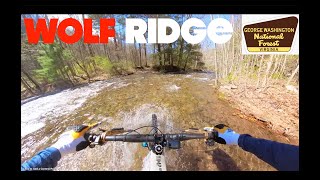
The OG Shenandoah Mountain 100 Mile Course is BACK IN ACTION!

We are SUPER PUMPED!!!

Sunday Aug 31st, 2025 from the Stokesville Campground - LETS DO THIS!!!

Detailed Description
Shenandoah Mountain100 Mile - 2025 is a 102 mile expert race route located near Staunton Virginia. This mountain bike only route. This route includes 44 trails. This route climbs 11,155 ft with a max elevation of 4,291 ft then descends -11,107 ft.

Trail Issues on Route

  • Closed: 1 trail (newest: May 12, 2018)
  • Significant Issue / Amber: 1 trail (newest: Jun 14, 2023)
  • Minor Issue / Yellow: 4 trails (newest: May 31, 2026)
Local Trail Association
Local trail association
Shenandoah Valley Bicycle Coalition (svbcoalition.org)
Please consider joining or donating to the local riding association to support trail development & maintenance.
Donate to earn trail karma!

Stats

  • Distance
    102 miles
  • Avg time
    18 hr 46 min
  • Altitude change
    49 ft
  • Altitude min
    1,474 ft
  • Altitude start
    1,527 ft
  • Altitude end
    1,575 ft
  • Climb
    2 miles
  • Descent
    -11,107 ft
  • Grade max
    -118.3%
  • Grade min
    73.4%
  • Distance climb
    52 miles
  • Distance down
    47 miles
  • Distance flat
    3 miles

47 Reviews & Comments


We hope you've been enjoying Trailforks!

Create a FREE account to view route comments and much more.

Details

no votes yet
close
3D
Trail Conditions
  • Unknown
  • Snow Groomed
  • Snow Packed
  • Snow Covered
  • Snow Cover Partial
  • Freeze/thaw Cycle
  • Icy
  • Prevalent Mud
  • Wet
  • Variable
  • Ideal
  • Dry
  • Very Dry
Trail Flow (Ridden Direction)
Trailforks scans users ridelogs to determine the most popular direction each trail is ridden. A good flowing trail network will have most trails flowing in a single direction according to their intension.
The colour categories are based on what percentage of riders are riding a trail in its intended direction.
  • > 96%
  • > 90%
  • > 80%
  • > 70%
  • > 50%
  • < 50%
  • bi-directional trail
  • no data
Trail Last Ridden
Trailforks scans ridelogs to determine the last time a trail was ridden.
  • < 2 days
  • < 1 week
  • < 2 weeks
  • < 1 month
  • < 6 months
  • > 6 months
Trail Ridden Direction
The intended direction a trail should be ridden.
  • Downhill Only
  • Downhill Primary
  • Both Directions
  • Uphill Primary
  • Uphill Only
  • One Direction
Contribute Details
Colors indicate trail is missing specified detail.
  • Description
  • Photos
  • Description & Photos
  • Videos
Trail Popularity ?
Trailforks scans ridelogs to determine which trails are ridden the most in the last 9 months. Trails are compared with nearby trails in the same city region with a possible 25 colour shades. Think of this as a heatmap, more rides = more kinetic energy = warmer colors.
  • most popular
  • popular
  • less popular
  • not popular
ATV/ORV/OHV Filter
Max Vehicle Width
inches
US Cell Coverage
Legend
cell carrier legend

Radar Time
Activity Recordings
Trailforks uses anonymized public activity data. ?
Activity Recordings
Trailforks uses anonymized public activity data. ?
Personal Heatmap
Activity Types
all / none
Options
2
Date range month
Winter Trails
Warning A routing network for winter maps does not exist. Selecting trails using the winter trails layer has been disabled.
Missing Trails
Most Popular
Least Popular
Trails are colored based on popularity. The more popular a trail is, the more red. Less popular trails trend towards green.
Jump Magnitude Heatmap
Heatmap of where riders jump on trails. Zoom in to see individual jumps, click circles to view jump details.
BC Backroad Status

Service Road Atlas is a free to use, community-driven service for viewing and creating reports on the numerous back-country service roads around B.C. and Alberta.

map legend
Slope Aspect
Direction the slope faces
Flat N NE E SE S SW W NW
Trails Deemphasized
Trails are shown in grey.
disable
Only show trails with no bike usage.
Enable
Suggested Layers
Based on selected activity type

    Save the current map location and zoom level as your default home location whenever this page is loaded.

    Save
    Trail transparency
    • Singletrack
    • Unpaved
    75
    90
    816
    670
    When Life Hands You Lemons, Go Ride Wolfs...
    When Life Hands You Lemons, Go Ride Wolfs Ridge! GWNF MTB
    32:24 | 273 | comments: 0 | favs:
    Apr 16, 2024
    Tillman's West Trail, George Washington...
    Tillman's West Trail, George Washington National Forest, Raw Edit
    7:53 | 286 | comments: 0 | favs:
    Dec 12, 2023

    Recent Trail Reports Along Route

    statustraildateconditiondescription
    Tower Trail
    May 31, 2026 @ 2:36pm (America/New_York)
    May 31, 2026
    Two downed trees close to each other. Both are about 18 inches and the bottom of each trunk is just above the trail corridor.
    Tillman West
    May 31, 2026 @ 2:33pm (America/New_York)
    May 31, 2026
    Tree down after first hard right hander descending. About 12 inches wide
    Wolf Ridge Trail
    May 8, 2026 @ 12:18pm (America/Indiana/Vevay)
    May 8, 2026
    Lynn Trail
    Apr 19, 2026 @ 7:11am (America/New_York)
    Apr 19, 2026
    Thursday April 16, 2026, 3 of us “earned” the elevation here, huge climb, thus was after we did 2100 ft going up Briery road , legs thrashed . Pure mental test.
    Big Game
    Dec 17, 2025 @ 9:55am (America/New_York)
    Dec 17, 2025
    more reports »
    • By psyclnTF Pro & contributors
    • #21733 - 4,695 views

    Hit the Trail

    Open in App

    Get this route on your phone instantly.

    Download Route

    Save to wishlist, Garmin & download.