21.4 miles
Distance
3,517 ft
Climb
-3,523 ft
Descent
2 miles
High Point
-9 ft
Altitude change
8,338 ft
Altitude min
8,368 ft
Altitude start
8,360 ft
Altitude end
-43.5%
Grade max
91.4%
Grade min
10 miles
Distance climb
9 miles
Distance down
3 miles
Distance flat

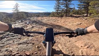
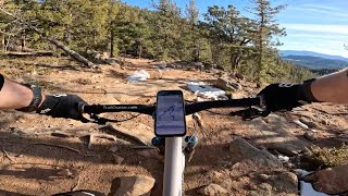
A fun loop that includes the newly built Rusty Buckle trail. Note that eBikes are not allowed on Rusty Buckle or North Elk as they are on NSF land.

Detailed Description
Staunton Big Loop is a 21 mile moderately popular intermediate route located near Conifer Colorado. This mountain bike only route. This route includes 13 trails. This route climbs 3,517 ft with a max elevation of 9,558 ft then descends -3,523 ft.
Local Trail Association
Please consider joining or donating to the local riding association to support trail development & maintenance.
Donate to earn trail karma!

Stats

  • Distance
    21 miles
  • Avg time
    4 hr 44 min
  • Altitude min
    8,338 ft
  • Altitude start
    8,368 ft
  • Altitude end
    8,360 ft
  • Climb
    3,517 ft
  • Descent
    -3,523 ft
  • Grade max
    -43.5%
  • Grade min
    91.4%
  • Distance climb
    10 miles
  • Distance down
    9 miles
  • Distance flat
    3 miles

16 Reviews & Comments


We hope you've been enjoying Trailforks!

Create a FREE account to view route comments and much more.

Details

  • Riding area
  • Primary Activity
    Mountain Bike
  • Difficulty rating
    Blue
  • Route Type
    Loop
  • eBike Allowed
  • Bike type
    AM, XC
  • Ridelogs
    3
no votes yet
close
3D
Trail Conditions
  • Unknown
  • Snow Groomed
  • Snow Packed
  • Snow Covered
  • Snow Cover Partial
  • Freeze/thaw Cycle
  • Icy
  • Prevalent Mud
  • Wet
  • Variable
  • Ideal
  • Dry
  • Very Dry
Trail Flow (Ridden Direction)
Trailforks scans users ridelogs to determine the most popular direction each trail is ridden. A good flowing trail network will have most trails flowing in a single direction according to their intension.
The colour categories are based on what percentage of riders are riding a trail in its intended direction.
  • > 96%
  • > 90%
  • > 80%
  • > 70%
  • > 50%
  • < 50%
  • bi-directional trail
  • no data
Trail Last Ridden
Trailforks scans ridelogs to determine the last time a trail was ridden.
  • < 2 days
  • < 1 week
  • < 2 weeks
  • < 1 month
  • < 6 months
  • > 6 months
Trail Ridden Direction
The intended direction a trail should be ridden.
  • Downhill Only
  • Downhill Primary
  • Both Directions
  • Uphill Primary
  • Uphill Only
  • One Direction
Contribute Details
Colors indicate trail is missing specified detail.
  • Description
  • Photos
  • Description & Photos
  • Videos
Trail Popularity ?
Trailforks scans ridelogs to determine which trails are ridden the most in the last 9 months. Trails are compared with nearby trails in the same city region with a possible 25 colour shades. Think of this as a heatmap, more rides = more kinetic energy = warmer colors.
  • most popular
  • popular
  • less popular
  • not popular
ATV/ORV/OHV Filter
Max Vehicle Width
inches
US Cell Coverage
Legend
cell carrier legend

Radar Time
Activity Recordings
Trailforks uses anonymized public activity data. ?
Activity Recordings
Trailforks uses anonymized public activity data. ?
Personal Heatmap
Activity Types
all / none
Options
2
Date range month
Winter Trails
Warning A routing network for winter maps does not exist. Selecting trails using the winter trails layer has been disabled.
Missing Trails
Most Popular
Least Popular
Trails are colored based on popularity. The more popular a trail is, the more red. Less popular trails trend towards green.
Jump Magnitude Heatmap
Heatmap of where riders jump on trails. Zoom in to see individual jumps, click circles to view jump details.
BC Backroad Status

Service Road Atlas is a free to use, community-driven service for viewing and creating reports on the numerous back-country service roads around B.C. and Alberta.

map legend
Slope Aspect
Direction the slope faces
Flat N NE E SE S SW W NW
Trails Deemphasized
Trails are shown in grey.
disable
Only show trails with no bike usage.
Enable
Suggested Layers
Based on selected activity type

    Save the current map location and zoom level as your default home location whenever this page is loaded.

    Save
    Trail transparency
    • Singletrack
    • Unpaved
    24
    30
    87
    61

    Recent Trail Reports Along Route

    statustraildateconditiondescription
    Rusty Buckle
    Jun 16, 2026 @ 9:29pm (America/Denver)
    Jun 16, 2026
    All trees cleared as of 6/16
    Border Line Trail
    Jun 16, 2026 @ 3:57pm (America/Denver)
    Jun 16, 2026
    Staunton Ranch Trail North
    Jun 16, 2026 @ 3:57pm (America/Denver)
    Jun 16, 2026
    Mason Creek (Upper)
    Jun 16, 2026 @ 3:57pm (America/Denver)
    Jun 16, 2026
    Mason Creek Cutoff
    Jun 16, 2026 @ 3:57pm (America/Denver)
    Jun 16, 2026
    more reports »
    • By dMontyTF Pro & contributors
    • #41835 - 1,101 views

    Hit the Trail

    Open in App

    Get this route on your phone instantly.

    Download Route

    Save to wishlist, Garmin & download.