

Open in App
Get this route on your phone instantly.
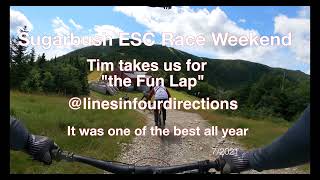
One of several top to bottom enduro rides that combine some of the best Sugarbush lift-served/ pedal-access trails and the Mad River Riders bigger vertical routes.
We hope you've been enjoying Trailforks!
Create a FREE account to view route comments and much more.
| 3,609 ft | |||||
| 778 ft | |||||
| 1,709 ft | |||||
| 2,067 ft | |||||
| 1,194 ft | |||||
| 2,264 ft | |||||
| 951 ft | |||||
| 4,888 ft | |||||
| 1,283 ft | |||||
| 2,313 ft | |||||
| 974 ft | |||||
| 4,659 ft |

Service Road Atlas is a free to use, community-driven service for viewing and creating reports on the numerous back-country service roads around B.C. and Alberta.
Save the current map location and zoom level as your default home location whenever this page is loaded.
Save