3,835 ft
Distance
-384 ft
Descent
1,502 ft
High Point
-384 ft
Altitude change
1,118 ft
Altitude min
1,502 ft
Altitude start
1,119 ft
Altitude end
-10%
Grade
-60.6%
Grade max
2.2%
Grade min
59 ft
Distance climb
3,009 ft
Distance down
768 ft
Distance flat

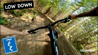
Sorca Super Cinco 2024 Intro Course
* Full Recycle
*Lowdown Part 1 & Lowdown Part 2
(Finish on Northside Connector)

Detailed Description
Super Cinco Intro is a 3,835 ft intermediate race route located near Squamish British Columbia. This mountain bike only route. This route includes 3 trails. This route with a max elevation of 1,502 ft then descends -384 ft.

Trail Issues on Route

  • Minor Issue / Yellow: 1 trail (newest: Jun 16, 2026)
Route Supporters
Local Trail Association
Local trail association
Squamish Off-Road Cycling Association (www.sorca.ca)
Please consider joining or donating to the local riding association to support trail development & maintenance.
Donate to earn trail karma!

Stats

  • Distance
    3,835 ft
  • Altitude change
    -384 ft
  • Altitude min
    1,118 ft
  • Altitude start
    1,502 ft
  • Altitude end
    1,119 ft
  • Descent
    -384 ft
  • Grade
    -10%
  • Grade max
    -60.6%
  • Grade min
    2.2%
  • Distance climb
    59 ft
  • Distance down
    3,009 ft
  • Distance flat
    768 ft

13 Reviews & Comments


We hope you've been enjoying Trailforks!

Create a FREE account to view route comments and much more.

Route Sections

1 Section 1
  • 4,446 ft distance
  • 69 ft climb
  • -388 ft descent
2 Transition
  • 974 ft distance
  • 0 ft climb
  • -16 ft descent
3 Section 2
  • 3,835 ft distance
  • 0 ft climb
  • -383 ft descent

Trails in Route

Details

  • Race Course
  • Race Date
    Saturday April 13, 2024 at 09:00am
  • Riding area
  • Primary Activity
    Mountain Bike
  • Difficulty rating
    Blue
  • eBike Allowed
  • Bike type
    AM

Directions

  1. Walk south on Ring Creek Access Road.
  2. Continue for 200 meters.
  3. Walk south on Ring Creek Access Road.
  4. Continue for 40 meters.
  5. Walk southeast on Ring Creek Access Road.
  6. Continue for 50 meters.
  7. Walk southeast on Ring Creek Access Road.
  8. Continue for 60 meters.
  9. Walk north on Ring Creek Access Road.
  10. Continue for 10 meters.
  11. Turn left onto Low Down Part 1.
  12. Continue for 90 meters.
  13. Walk northeast on Low Down Part 1.
  14. Continue for 90 meters.
  15. Turn right onto Ring Creek Access Road.
  16. Continue for 80 meters.
  17. Bear right onto East Infection.
  18. Continue for 100 meters.
  19. Walk south on Low Down Part 1.
  20. Continue for 60 meters.
  21. Walk southwest on Low Down Part 1.
  22. Continue for 40 meters.
  23. Walk southeast on Access4.
  24. Continue for 10 meters.
  25. Turn right onto Low Down Part 2.
  26. Continue for 200 meters.
  27. Walk south on Low Down Part 2.
  28. Continue for 100 meters.
  29. Walk northwest on Low Down Part 2.
  30. Continue for 90 meters.
no votes yet
close
3D
Trail Conditions
  • Unknown
  • Snow Groomed
  • Snow Packed
  • Snow Covered
  • Snow Cover Partial
  • Freeze/thaw Cycle
  • Icy
  • Prevalent Mud
  • Wet
  • Variable
  • Ideal
  • Dry
  • Very Dry
Trail Flow (Ridden Direction)
Trailforks scans users ridelogs to determine the most popular direction each trail is ridden. A good flowing trail network will have most trails flowing in a single direction according to their intension.
The colour categories are based on what percentage of riders are riding a trail in its intended direction.
  • > 96%
  • > 90%
  • > 80%
  • > 70%
  • > 50%
  • < 50%
  • bi-directional trail
  • no data
Trail Last Ridden
Trailforks scans ridelogs to determine the last time a trail was ridden.
  • < 2 days
  • < 1 week
  • < 2 weeks
  • < 1 month
  • < 6 months
  • > 6 months
Trail Ridden Direction
The intended direction a trail should be ridden.
  • Downhill Only
  • Downhill Primary
  • Both Directions
  • Uphill Primary
  • Uphill Only
  • One Direction
Contribute Details
Colors indicate trail is missing specified detail.
  • Description
  • Photos
  • Description & Photos
  • Videos
Trail Popularity ?
Trailforks scans ridelogs to determine which trails are ridden the most in the last 9 months. Trails are compared with nearby trails in the same city region with a possible 25 colour shades. Think of this as a heatmap, more rides = more kinetic energy = warmer colors.
  • most popular
  • popular
  • less popular
  • not popular
ATV/ORV/OHV Filter
Max Vehicle Width
inches
US Cell Coverage
Legend
cell carrier legend

Radar Time
Activity Recordings
Trailforks uses anonymized public activity data. ?
Activity Recordings
Trailforks uses anonymized public activity data. ?
Personal Heatmap
Activity Types
all / none
Options
2
Date range month
Winter Trails
Warning A routing network for winter maps does not exist. Selecting trails using the winter trails layer has been disabled.
Missing Trails
Most Popular
Least Popular
Trails are colored based on popularity. The more popular a trail is, the more red. Less popular trails trend towards green.
Jump Magnitude Heatmap
Heatmap of where riders jump on trails. Zoom in to see individual jumps, click circles to view jump details.
BC Backroad Status

Service Road Atlas is a free to use, community-driven service for viewing and creating reports on the numerous back-country service roads around B.C. and Alberta.

map legend
Slope Aspect
Direction the slope faces
Flat N NE E SE S SW W NW
Trails Deemphasized
Trails are shown in grey.
disable
Only show trails with no bike usage.
Enable
Suggested Layers
Based on selected activity type

    Save the current map location and zoom level as your default home location whenever this page is loaded.

    Save
    Trail transparency
    • Singletrack
    226
    295
    1,161 | 5 faves
    919
    youtuber Low Down | Fast Flowy Fun in Squamish
    Low Down | Fast Flowy Fun in Squamish
    trail: Nightshift
    2:54 | 328 | comments: 0 | favs:
    Jan 5, 2024

    Recent Trail Reports Along Route

    statustraildateconditiondescription
    Recycle
    Jun 16, 2026 @ 1:18pm (America/Vancouver)
    Jun 16, 2026
    Tree is near the end of the trail
    Low Down Part 2
    Jun 10, 2026 @ 2:23pm (America/Vancouver)
    Jun 10, 2026
    Nightshift
    Jun 10, 2026 @ 2:23pm (America/Vancouver)
    Jun 10, 2026
    more reports »
    • By SORCATF Pro SORCA & contributors
    • #55607 - 1,340 views

    Hit the Trail

    Open in App

    Get this route on your phone instantly.

    Download Route

    Save to wishlist, Garmin & download.