12.6 miles
Distance
1,333 ft
Climb
-1,349 ft
Descent
810 ft
High Point
-13 ft
Altitude change
93 ft
Altitude min
155 ft
Altitude start
141 ft
Altitude end
-60.5%
Grade max
53.2%
Grade min
6 miles
Distance climb
6 miles
Distance down
1 mile
Distance flat

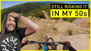
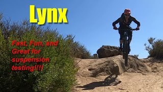
cholla to lynx, coyote run, then mathis to car wreck


I kinda messed up making the map, so it shows taking wood canyon to mathis, but I meant to show it to take coyote run.

Detailed Description
Techy Time is a 13 mile moderately popular expert route located near Laguna Niguel California. This mountain bike primary route can be used one direction and has a hard overall physical rating. This route includes 7 trails. This route climbs 1,333 ft with a max elevation of 810 ft then descends -1,349 ft.

Trail Issues on Route

  • Minor Issue / Yellow: 1 trail (newest: Mar 10, 2024)
Local Trail Association
Local trail association
Laguna Canyon Riders
Please consider joining or donating to the local riding association to support trail development & maintenance.
Donate to earn trail karma!

Stats

  • Distance
    13 miles
  • Avg time
    3 hr 31 min
  • Altitude change
    -13 ft
  • Altitude min
    93 ft
  • Altitude start
    155 ft
  • Altitude end
    141 ft
  • Climb
    1,333 ft
  • Descent
    -1,349 ft
  • Grade max
    -60.5%
  • Grade min
    53.2%
  • Distance climb
    6 miles
  • Distance down
    6 miles
  • Distance flat
    1 mile

26 Reviews & Comments


We hope you've been enjoying Trailforks!

Create a FREE account to view route comments and much more.

Trails in Route

Details

  • Riding area
  • Primary Activity
    Mountain Bike
  • Other Activities
    • Hike
    • Trail Running
  • Difficulty rating
    Black Diamond
  • Bike type
    AM
  • Direction
    One Direction
  • Physical rating
    Hard
  • Ridelogs
    3
no votes yet
close
3D
Trail Conditions
  • Unknown
  • Snow Groomed
  • Snow Packed
  • Snow Covered
  • Snow Cover Partial
  • Freeze/thaw Cycle
  • Icy
  • Prevalent Mud
  • Wet
  • Variable
  • Ideal
  • Dry
  • Very Dry
Trail Flow (Ridden Direction)
Trailforks scans users ridelogs to determine the most popular direction each trail is ridden. A good flowing trail network will have most trails flowing in a single direction according to their intension.
The colour categories are based on what percentage of riders are riding a trail in its intended direction.
  • > 96%
  • > 90%
  • > 80%
  • > 70%
  • > 50%
  • < 50%
  • bi-directional trail
  • no data
Trail Last Ridden
Trailforks scans ridelogs to determine the last time a trail was ridden.
  • < 2 days
  • < 1 week
  • < 2 weeks
  • < 1 month
  • < 6 months
  • > 6 months
Trail Ridden Direction
The intended direction a trail should be ridden.
  • Downhill Only
  • Downhill Primary
  • Both Directions
  • Uphill Primary
  • Uphill Only
  • One Direction
Contribute Details
Colors indicate trail is missing specified detail.
  • Description
  • Photos
  • Description & Photos
  • Videos
Trail Popularity ?
Trailforks scans ridelogs to determine which trails are ridden the most in the last 9 months. Trails are compared with nearby trails in the same city region with a possible 25 colour shades. Think of this as a heatmap, more rides = more kinetic energy = warmer colors.
  • most popular
  • popular
  • less popular
  • not popular
ATV/ORV/OHV Filter
Max Vehicle Width
inches
US Cell Coverage
Legend
cell carrier legend

Radar Time
Activity Recordings
Trailforks uses anonymized public activity data. ?
Activity Recordings
Trailforks uses anonymized public activity data. ?
Personal Heatmap
Activity Types
all / none
Options
2
Date range month
Winter Trails
Warning A routing network for winter maps does not exist. Selecting trails using the winter trails layer has been disabled.
Missing Trails
Most Popular
Least Popular
Trails are colored based on popularity. The more popular a trail is, the more red. Less popular trails trend towards green.
Jump Magnitude Heatmap
Heatmap of where riders jump on trails. Zoom in to see individual jumps, click circles to view jump details.
BC Backroad Status

Service Road Atlas is a free to use, community-driven service for viewing and creating reports on the numerous back-country service roads around B.C. and Alberta.

map legend
Slope Aspect
Direction the slope faces
Flat N NE E SE S SW W NW
Trails Deemphasized
Trails are shown in grey.
disable
Only show trails with no bike usage.
Enable
Suggested Layers
Based on selected activity type

    Save the current map location and zoom level as your default home location whenever this page is loaded.

    Save
    Trail transparency
    • Singletrack
    • Unpaved
    6
    6
    280
    231
    youtuber In my 50s and still taking risks.
    In my 50s and still taking risks.
    trail: Car Wreck
    13:24 | 105 | comments: 0 | favs:
    Apr 7, 2025
    youtuber Aliso Woods Mountain Biking Lynx 2025
    Aliso Woods Mountain Biking Lynx 2025
    trail: Lynx
    4:41 | 85 | comments: 0 | favs:
    Nov 10, 2025

    Recent Trail Reports Along Route

    statustraildateconditiondescription
    Car Wreck
    Jun 10, 2026 @ 11:06pm (America/Los_Angeles)
    Jun 10, 2026
    rides fine, the last rock garden is experiencing some serious erosion
    Mathis Canyon Trail
    Jun 8, 2026 @ 12:36pm (America/Los_Angeles)
    Jun 8, 2026
    Cholla
    Jan 19, 2026 @ 11:47am (America/Los_Angeles)
    Jan 19, 2026
    In great condition
    Lynx
    Jan 19, 2026 @ 11:47am (America/Los_Angeles)
    Jan 19, 2026
    No issues typical good condition
    Oak Grove
    Dec 3, 2025 @ 9:10am (America/Los_Angeles)
    Dec 3, 2025
    more reports »
    • By DPTR & contributors
    • #35260 - 398 views

    Hit the Trail

    Open in App

    Get this route on your phone instantly.

    Download Route

    Save to wishlist, Garmin & download.