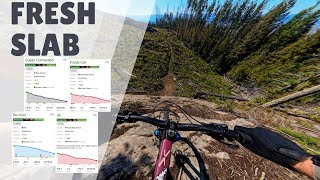
This is an epic ride, Ed Callenders "EdMondo" route completed in 2019 has been updated to include the Ranchlands.
It is now know as the Big Six.
Top to bottom of all the major riding areas in Vernon in one ride, no shuttles.
This is no easy task. The EdMondo has been complete by 2 people so far back in 2019. This Route is a step up on that.
INSPIRED BY THE MONDO RIDE
Trail Issues on Route
- Significant Issue / Amber: 1 trail (newest: May 8, 2026)
- Minor Issue / Yellow: 6 trails (newest: Jun 12, 2026)
Local Trail Association
Mountain Bikers of the Central Okanagan (mtbco.ca)Stats
-
Distance82 miles
-
Avg time20 hr 31 min
-
Altitude change-4,192 ft
-
Altitude min1,272 ft
-
Altitude start5,464 ft
-
Altitude end1,273 ft
-
Climb2 miles
-
Descent-15,909 ft
-
Grade-1%
-
Grade max-103%
-
Grade min76.2%
-
Distance climb37 miles
-
Distance down40 miles
-
Distance flat5 miles
88 Reviews & Comments
We hope you've been enjoying Trailforks!
Create a FREE account to view route comments and much more.
Trails in Route
| 171 ft | |||||
| 827 ft | |||||
| 2,979 ft | |||||
| 2 miles | |||||
| 3,468 ft | |||||
| 1,037 ft | |||||
| 2,011 ft | |||||
| 184 ft | |||||
| 2 miles | |||||
| 4,974 ft | |||||
| 1 mile | |||||
| 8 miles | |||||
| 4,301 ft | |||||
| 4,058 ft | |||||
| 3,048 ft | |||||
| 604 ft | |||||
| 1,690 ft | |||||
| 1 mile | |||||
| 2 miles | |||||
| 3 miles | |||||
| 2,605 ft | |||||
| 1 mile | |||||
| 1,444 ft | |||||
| 2,618 ft | |||||
| 1,263 ft | |||||
| 1,309 ft | |||||
| 2,182 ft | |||||
| 1,519 ft | |||||
| 1,496 ft | |||||
| 1,109 ft | |||||
| 2,293 ft | |||||
| 732 ft |
Details
- Featured
-
Riding area
-
Primary ActivityMountain Bike
-
Difficulty ratingDouble Black Diamond
-
Route TypePoint to Point
-
Bike typeAM, XC
-
DirectionOne Direction
-
Physical ratingExtreme
- Unknown
- Snow Groomed
- Snow Packed
- Snow Covered
- Snow Cover Partial
- Freeze/thaw Cycle
- Icy
- Prevalent Mud
- Wet
- Variable
- Ideal
- Dry
- Very Dry
The colour categories are based on what percentage of riders are riding a trail in its intended direction.
- > 96%
- > 90%
- > 80%
- > 70%
- > 50%
- < 50%
- bi-directional trail
- no data
- < 2 days
- < 1 week
- < 2 weeks
- < 1 month
- < 6 months
- > 6 months
- Downhill Only
- Downhill Primary
- Both Directions
- Uphill Primary
- Uphill Only
- One Direction
- Description
- Photos
- Description & Photos
- Videos
- most popular
- popular
- less popular
- not popular
Service Road Atlas is a free to use, community-driven service for viewing and creating reports on the numerous back-country service roads around B.C. and Alberta.
Save the current map location and zoom level as your default home location whenever this page is loaded.
Save- Singletrack
- Unpaved
Photos
Videos
Recent Trail Reports Along Route
- By daneargan
& contributors - #22423 - 3,279 views

