7.5 miles
Distance
141 ft
Climb
-4,001 ft
Descent
1 mile
High Point
-3,860 ft
Altitude change
1,446 ft
Altitude min
5,306 ft
Altitude start
1,447 ft
Altitude end
-9.7%
Grade
-68.8%
Grade max
25.6%
Grade min
2,602 ft
Distance climb
7 miles
Distance down
984 ft
Distance flat

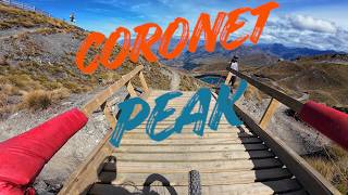
Introducing The Dirty Four

Combine Dirt Serpent, Rude Rock, Morning Glory and Hot Rod for one EPIC 1200m descent from the top of Coronet peak down to the valley floor!

Detailed Description
The Dirty Four is a 8 mile popular advanced route located near Queenstown. This mountain bike primary route can be used one direction and has a moderate overall physical rating. This route includes 4 trails. This route climbs 141 ft with a max elevation of 5,306 ft then descends -4,001 ft.

Trail Issues on Route

  • Closed: 4 trails (newest: May 30, 2026)

Stats

  • Distance
    8 miles
  • Altitude change
    -3,860 ft
  • Altitude min
    1,446 ft
  • Altitude start
    5,306 ft
  • Altitude end
    1,447 ft
  • Climb
    141 ft
  • Descent
    -4,001 ft
  • Grade
    -9.7%
  • Grade max
    -68.8%
  • Grade min
    25.6%
  • Distance climb
    2,602 ft
  • Distance down
    7 miles
  • Distance flat
    984 ft

10 Reviews & Comments


We hope you've been enjoying Trailforks!

Create a FREE account to view route comments and much more.

Trails in Route

Dirt Serpent2 miles
Rude Rock2 miles
Morning Glory4,777 ft
Hot Rod2 miles

Details

  • Riding area
  • Primary Activity
    Mountain Bike
  • Other Activities
    • E-Bike
  • Difficulty rating
    Advanced
  • Route Type
    Point to Point
  • eBike Allowed
  • Bike type
    DH, AM
  • Direction
    One Direction
  • Physical rating
    Moderate

Directions

  1. Walk west on Coronet DH.
  2. Continue for 100 meters.
  3. Walk west on Coronet DH.
  4. Continue for 100 meters.
  5. Walk northwest on Coronet DH.
  6. Continue for 30 meters.
  7. Keep right to take Upper Rude Rock.
  8. Continue for 100 meters.
  9. Walk west on Upper Rude Rock.
  10. Continue for 2.5 kilometers.
  11. Turn right to stay on Upper Rude Rock.
  12. Continue for 400 meters.
  13. Walk southwest on Rude Rock.
  14. Continue for 2.5 kilometers.
  15. Walk south on Rude Rock.
  16. Continue for 900 meters.
  17. Walk east on Coronet Peak Road.
  18. Continue for 40 meters.
  19. Walk east on Upper Hot Rod.
  20. Continue for 1.5 kilometers.
  21. Walk northeast on Coronet Face Water Race.
  22. Continue for 100 meters.
  23. Walk south on Hot Rod.
  24. Continue for 3 kilometers.
  25. Walk east on Dan O Connell Climb.
  26. Continue for 1 kilometer.
Avg: 4.5 (2 votes)
close
3D
Trail Conditions
  • Unknown
  • Snow Groomed
  • Snow Packed
  • Snow Covered
  • Snow Cover Partial
  • Freeze/thaw Cycle
  • Icy
  • Prevalent Mud
  • Wet
  • Variable
  • Ideal
  • Dry
  • Very Dry
Trail Flow (Ridden Direction)
Trailforks scans users ridelogs to determine the most popular direction each trail is ridden. A good flowing trail network will have most trails flowing in a single direction according to their intension.
The colour categories are based on what percentage of riders are riding a trail in its intended direction.
  • > 96%
  • > 90%
  • > 80%
  • > 70%
  • > 50%
  • < 50%
  • bi-directional trail
  • no data
Trail Last Ridden
Trailforks scans ridelogs to determine the last time a trail was ridden.
  • < 2 days
  • < 1 week
  • < 2 weeks
  • < 1 month
  • < 6 months
  • > 6 months
Trail Ridden Direction
The intended direction a trail should be ridden.
  • Downhill Only
  • Downhill Primary
  • Both Directions
  • Uphill Primary
  • Uphill Only
  • One Direction
Contribute Details
Colors indicate trail is missing specified detail.
  • Description
  • Photos
  • Description & Photos
  • Videos
Trail Popularity ?
Trailforks scans ridelogs to determine which trails are ridden the most in the last 9 months. Trails are compared with nearby trails in the same city region with a possible 25 colour shades. Think of this as a heatmap, more rides = more kinetic energy = warmer colors.
  • most popular
  • popular
  • less popular
  • not popular
ATV/ORV/OHV Filter
Max Vehicle Width
inches
US Cell Coverage
Legend
cell carrier legend

Radar Time
Activity Recordings
Trailforks uses anonymized public activity data. ?
Activity Recordings
Trailforks uses anonymized public activity data. ?
Personal Heatmap
Activity Types
all / none
Options
2
Date range month
Winter Trails
Warning A routing network for winter maps does not exist. Selecting trails using the winter trails layer has been disabled.
Missing Trails
Most Popular
Least Popular
Trails are colored based on popularity. The more popular a trail is, the more red. Less popular trails trend towards green.
Jump Magnitude Heatmap
Heatmap of where riders jump on trails. Zoom in to see individual jumps, click circles to view jump details.
BC Backroad Status

Service Road Atlas is a free to use, community-driven service for viewing and creating reports on the numerous back-country service roads around B.C. and Alberta.

map legend
Slope Aspect
Direction the slope faces
Flat N NE E SE S SW W NW
Trails Deemphasized
Trails are shown in grey.
disable
Only show trails with no bike usage.
Enable
Suggested Layers
Based on selected activity type

    Save the current map location and zoom level as your default home location whenever this page is loaded.

    Save
    Trail transparency
    • Singletrack
    15
    10
    408
    184

    Recent Trail Reports Along Route

    statustraildateconditiondescription
    Rude Rock
    May 31, 2026 @ 5:30pm (Pacific/Auckland)
    May 30, 2026
    Closed for Winter! Please keep off the trail to prevent damage. Will let you know when it's back open in Spring!
    Hot Rod
    May 31, 2026 @ 5:30pm (Pacific/Auckland)
    May 30, 2026
    Closed for Winter! Please keep off the trail to prevent damage. Will let you know when it's back open in Spring!
    Morning Glory
    May 31, 2026 @ 5:30pm (Pacific/Auckland)
    May 30, 2026
    Closed for Winter! Please keep off the trail to prevent damage. Will let you know when it's back open in Spring!
    Dirt Serpent
    May 31, 2026 @ 5:24pm (Pacific/Auckland)
    May 30, 2026
    Closed for Winter! Please keep off the trail to prevent damage. Will let you know when it's back open in Spring!
    more reports »
    • By QMTBCTF Pro & contributors
    • #50290 - 1,705 views

    Hit the Trail

    Open in App

    Get this route on your phone instantly.

    Download Route

    Save to wishlist, Garmin & download.