1,654 ft
Distance
-100 ft
Descent
712 ft
High Point
-100 ft
Altitude change
612 ft
Altitude min
712 ft
Altitude start
614 ft
Altitude end
-6.1%
Grade
-16.7%
Grade max
-2.4%
Grade min
1,654 ft
Distance down

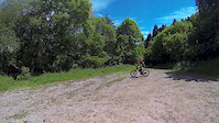
Fast xc trail with some technical elements towards the end

This route is Unsanctioned, Ride at your own Risk!

Detailed Description
Three Eight Zero is a 1,654 ft less popular intermediate unsanctioned route located near Kenn. This mountain bike primary route can be used one direction. This route includes 3 trails. This route with a max elevation of 712 ft then descends -100 ft.

Trail Issues on Route

  • Minor Issue / Yellow: 2 trails (newest: Feb 11, 2025)

Stats

  • Distance
    1,654 ft
  • Avg time
    3 min 52 sec
  • Altitude change
    -100 ft
  • Altitude min
    612 ft
  • Altitude start
    712 ft
  • Altitude end
    614 ft
  • Descent
    -100 ft
  • Grade
    -6.1%
  • Grade max
    -16.7%
  • Grade min
    -2.4%
  • Distance down
    1,654 ft

1 Review & Comments


We hope you've been enjoying Trailforks!

Create a FREE account to view route comments and much more.

Trails in Route

Details

  • Riding area
  • Primary Activity
    Mountain Bike
  • Other Activities
    • Hike
    • Trail Running
  • Difficulty rating
    Blue
  • Route Type
    Point to Point
  • Bike type
    AM, XC
  • Direction
    One Direction
no votes yet
close
3D
Trail Conditions
  • Unknown
  • Snow Groomed
  • Snow Packed
  • Snow Covered
  • Snow Cover Partial
  • Freeze/thaw Cycle
  • Icy
  • Prevalent Mud
  • Wet
  • Variable
  • Ideal
  • Dry
  • Very Dry
Trail Flow (Ridden Direction)
Trailforks scans users ridelogs to determine the most popular direction each trail is ridden. A good flowing trail network will have most trails flowing in a single direction according to their intension.
The colour categories are based on what percentage of riders are riding a trail in its intended direction.
  • > 96%
  • > 90%
  • > 80%
  • > 70%
  • > 50%
  • < 50%
  • bi-directional trail
  • no data
Trail Last Ridden
Trailforks scans ridelogs to determine the last time a trail was ridden.
  • < 2 days
  • < 1 week
  • < 2 weeks
  • < 1 month
  • < 6 months
  • > 6 months
Trail Ridden Direction
The intended direction a trail should be ridden.
  • Downhill Only
  • Downhill Primary
  • Both Directions
  • Uphill Primary
  • Uphill Only
  • One Direction
Contribute Details
Colors indicate trail is missing specified detail.
  • Description
  • Photos
  • Description & Photos
  • Videos
Trail Popularity ?
Trailforks scans ridelogs to determine which trails are ridden the most in the last 9 months. Trails are compared with nearby trails in the same city region with a possible 25 colour shades. Think of this as a heatmap, more rides = more kinetic energy = warmer colors.
  • most popular
  • popular
  • less popular
  • not popular
ATV/ORV/OHV Filter
Max Vehicle Width
inches
US Cell Coverage
Legend
cell carrier legend

Radar Time
Activity Recordings
Trailforks uses anonymized public activity data. ?
Activity Recordings
Trailforks uses anonymized public activity data. ?
Personal Heatmap
Activity Types
all / none
Options
2
Date range month
Winter Trails
Warning A routing network for winter maps does not exist. Selecting trails using the winter trails layer has been disabled.
Missing Trails
Most Popular
Least Popular
Trails are colored based on popularity. The more popular a trail is, the more red. Less popular trails trend towards green.
Jump Magnitude Heatmap
Heatmap of where riders jump on trails. Zoom in to see individual jumps, click circles to view jump details.
BC Backroad Status

Service Road Atlas is a free to use, community-driven service for viewing and creating reports on the numerous back-country service roads around B.C. and Alberta.

map legend
Slope Aspect
Direction the slope faces
Flat N NE E SE S SW W NW
Trails Deemphasized
Trails are shown in grey.
disable
Only show trails with no bike usage.
Enable
Suggested Layers
Based on selected activity type

    Save the current map location and zoom level as your default home location whenever this page is loaded.

    Save
    Trail transparency
    • Singletrack
    Uni Boy's Line Cafeside
    Uni Boy's Line Cafeside
    0:43 | 134 | comments: 0 | favs:
    May 27, 2017
    Me following Alec White down the Uni Boy's line up cafe side. Tried to inside a turn down the bottom, lost a bit of speed there! Good fun now it's...

    Recent Trail Reports Along Route

    statustraildateconditiondescription
    Happy Happy Joy Joy
    Feb 11, 2025 @ 5:46pm
    Feb 11, 2025
    Difficult to follow, needs a rake
    Richard the 3rd
    May 27, 2024 @ 7:19am
    May 27, 2024
    The Happy Pangolin
    Apr 23, 2024 @ 10:24am
    Apr 23, 2024
    monor wet and trail damage in lower section
    more reports »
    • By davemassive & contributors
    • #16067 - 600 views

    Hit the Trail

    Open in App

    Get this route on your phone instantly.

    Download Route

    Save to wishlist, Garmin & download.