68.7 miles
Distance
5,342 ft
Climb
-5,395 ft
Descent
1,373 ft
High Point
-52 ft
Altitude change
602 ft
Altitude min
656 ft
Altitude start
604 ft
Altitude end
-63.2%
Grade max
56.3%
Grade min
27 miles
Distance climb
30 miles
Distance down
11 miles
Distance flat

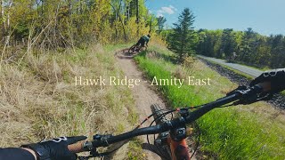
Epic Duluth ride......................

Detailed Description
Tour Duluth is a 69 mile moderately popular easy route located near Minnesota Minnesota. This mountain bike only route. This route includes 106 trails. This route climbs 5,342 ft with a max elevation of 1,373 ft then descends -5,395 ft.

Trail Issues on Route

  • Significant Issue / Amber: 2 trails (newest: Jun 12, 2026)
  • Minor Issue / Yellow: 2 trails (newest: Jul 6, 2024)

Stats

  • Distance
    69 miles
  • Avg time
    11 hr 53 min
  • Altitude change
    -52 ft
  • Altitude min
    602 ft
  • Altitude start
    656 ft
  • Altitude end
    604 ft
  • Climb
    1 mile
  • Descent
    -5,395 ft
  • Grade max
    -63.2%
  • Grade min
    56.3%
  • Distance climb
    27 miles
  • Distance down
    30 miles
  • Distance flat
    11 miles

39 Reviews & Comments


We hope you've been enjoying Trailforks!

Create a FREE account to view route comments and much more.

Details

  • Riding area
  • Primary Activity
    Mountain Bike
  • Difficulty rating
    Green
no votes yet
close
3D
Trail Conditions
  • Unknown
  • Snow Groomed
  • Snow Packed
  • Snow Covered
  • Snow Cover Partial
  • Freeze/thaw Cycle
  • Icy
  • Prevalent Mud
  • Wet
  • Variable
  • Ideal
  • Dry
  • Very Dry
Trail Flow (Ridden Direction)
Trailforks scans users ridelogs to determine the most popular direction each trail is ridden. A good flowing trail network will have most trails flowing in a single direction according to their intension.
The colour categories are based on what percentage of riders are riding a trail in its intended direction.
  • > 96%
  • > 90%
  • > 80%
  • > 70%
  • > 50%
  • < 50%
  • bi-directional trail
  • no data
Trail Last Ridden
Trailforks scans ridelogs to determine the last time a trail was ridden.
  • < 2 days
  • < 1 week
  • < 2 weeks
  • < 1 month
  • < 6 months
  • > 6 months
Trail Ridden Direction
The intended direction a trail should be ridden.
  • Downhill Only
  • Downhill Primary
  • Both Directions
  • Uphill Primary
  • Uphill Only
  • One Direction
Contribute Details
Colors indicate trail is missing specified detail.
  • Description
  • Photos
  • Description & Photos
  • Videos
Trail Popularity ?
Trailforks scans ridelogs to determine which trails are ridden the most in the last 9 months. Trails are compared with nearby trails in the same city region with a possible 25 colour shades. Think of this as a heatmap, more rides = more kinetic energy = warmer colors.
  • most popular
  • popular
  • less popular
  • not popular
ATV/ORV/OHV Filter
Max Vehicle Width
inches
US Cell Coverage
Legend
cell carrier legend

Radar Time
Activity Recordings
Trailforks uses anonymized public activity data. ?
Activity Recordings
Trailforks uses anonymized public activity data. ?
Personal Heatmap
Activity Types
all / none
Options
2
Date range month
Winter Trails
Warning A routing network for winter maps does not exist. Selecting trails using the winter trails layer has been disabled.
Missing Trails
Most Popular
Least Popular
Trails are colored based on popularity. The more popular a trail is, the more red. Less popular trails trend towards green.
Jump Magnitude Heatmap
Heatmap of where riders jump on trails. Zoom in to see individual jumps, click circles to view jump details.
BC Backroad Status

Service Road Atlas is a free to use, community-driven service for viewing and creating reports on the numerous back-country service roads around B.C. and Alberta.

map legend
Slope Aspect
Direction the slope faces
Flat N NE E SE S SW W NW
Trails Deemphasized
Trails are shown in grey.
disable
Only show trails with no bike usage.
Enable
Suggested Layers
Based on selected activity type

    Save the current map location and zoom level as your default home location whenever this page is loaded.

    Save
    Trail transparency
    • Singletrack
    • Unpaved
    • Paved
    212
    922
    1,219
    1,398 | 1 faves
    youtuber A true classic Duluth trail! || Hawks Ridge |...
    A true classic Duluth trail! || Hawks Ridge | Amity East
    12:34 | 117 | comments: 0 | favs:
    Jun 4, 2025
    Mountain Biking Mission Creek Outer Loop -...
    Mountain Biking Mission Creek Outer Loop - Duluth, MN
    12:14 | 65 | comments: 0 | favs:
    Aug 11, 2025

    Recent Trail Reports Along Route

    statustraildateconditiondescription
    Lower Burner of Stovetop
    Jun 15, 2026 @ 4:44pm (America/Atikokan)
    2 days
    Lincoln
    Jun 15, 2026 @ 4:44pm (America/Atikokan)
    2 days
    Miller Creek
    Jun 15, 2026 @ 4:44pm (America/Atikokan)
    2 days
    Skyline
    Jun 15, 2026 @ 4:44pm (America/Atikokan)
    2 days
    Enger Trail
    Jun 15, 2026 @ 4:44pm (America/Atikokan)
    2 days
    more reports »
    • By hpcamp & contributors
    • #20979 - 1,499 views

    Hit the Trail

    Open in App

    Get this route on your phone instantly.

    Download Route

    Save to wishlist, Garmin & download.