8.8 miles
Distance
2,179 ft
Climb
-2,179 ft
Descent
1,184 ft
High Point
663 ft
Altitude min
1,066 ft
Altitude start
1,066 ft
Altitude end
-59.4%
Grade max
41.3%
Grade min
5 miles
Distance climb
3 miles
Distance down
1 mile
Distance flat

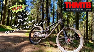
You could do a day on these trails and ride entirely different ones to these, there are so many variations to each track. Go for an explore. They can be ridden in all weather conditions although watch out for off camber roots in the wet. The trails progressively get stepper as you lose height. This route will show you all the main climb options - all rideable on a X country/all mountain bike. Happy exploring!!

Detailed Description
Triscombe DH is a 9 mile popular intermediate route located near Taunton. This mountain bike only route. This route includes 10 trails. This route climbs 2,179 ft with a max elevation of 1,184 ft then descends -2,179 ft.

Trail Issues on Route

  • Significant Issue / Amber: 1 trail (newest: Dec 2, 2018)
Local Trail Association
Please consider joining or donating to the local riding association to support trail development & maintenance.
Donate to earn trail karma!

Stats

  • Distance
    9 miles
  • Avg time
    3 hr 1 min
  • Altitude min
    663 ft
  • Altitude start
    1,066 ft
  • Altitude end
    1,066 ft
  • Climb
    2,179 ft
  • Descent
    -2,179 ft
  • Grade max
    -59.4%
  • Grade min
    41.3%
  • Distance climb
    5 miles
  • Distance down
    3 miles
  • Distance flat
    1 mile

1 Review & Comments


We hope you've been enjoying Trailforks!

Create a FREE account to view route comments and much more.

Details

  • Riding area
  • Primary Activity
    Mountain Bike
  • Difficulty rating
    Blue
  • Ridelogs
    4
no votes yet
close
3D
Trail Conditions
  • Unknown
  • Snow Groomed
  • Snow Packed
  • Snow Covered
  • Snow Cover Partial
  • Freeze/thaw Cycle
  • Icy
  • Prevalent Mud
  • Wet
  • Variable
  • Ideal
  • Dry
  • Very Dry
Trail Flow (Ridden Direction)
Trailforks scans users ridelogs to determine the most popular direction each trail is ridden. A good flowing trail network will have most trails flowing in a single direction according to their intension.
The colour categories are based on what percentage of riders are riding a trail in its intended direction.
  • > 96%
  • > 90%
  • > 80%
  • > 70%
  • > 50%
  • < 50%
  • bi-directional trail
  • no data
Trail Last Ridden
Trailforks scans ridelogs to determine the last time a trail was ridden.
  • < 2 days
  • < 1 week
  • < 2 weeks
  • < 1 month
  • < 6 months
  • > 6 months
Trail Ridden Direction
The intended direction a trail should be ridden.
  • Downhill Only
  • Downhill Primary
  • Both Directions
  • Uphill Primary
  • Uphill Only
  • One Direction
Contribute Details
Colors indicate trail is missing specified detail.
  • Description
  • Photos
  • Description & Photos
  • Videos
Trail Popularity ?
Trailforks scans ridelogs to determine which trails are ridden the most in the last 9 months. Trails are compared with nearby trails in the same city region with a possible 25 colour shades. Think of this as a heatmap, more rides = more kinetic energy = warmer colors.
  • most popular
  • popular
  • less popular
  • not popular
ATV/ORV/OHV Filter
Max Vehicle Width
inches
US Cell Coverage
Legend
cell carrier legend

Radar Time
Activity Recordings
Trailforks uses anonymized public activity data. ?
Activity Recordings
Trailforks uses anonymized public activity data. ?
Personal Heatmap
Activity Types
all / none
Options
2
Date range month
Winter Trails
Warning A routing network for winter maps does not exist. Selecting trails using the winter trails layer has been disabled.
Missing Trails
Most Popular
Least Popular
Trails are colored based on popularity. The more popular a trail is, the more red. Less popular trails trend towards green.
Jump Magnitude Heatmap
Heatmap of where riders jump on trails. Zoom in to see individual jumps, click circles to view jump details.
BC Backroad Status

Service Road Atlas is a free to use, community-driven service for viewing and creating reports on the numerous back-country service roads around B.C. and Alberta.

map legend
Slope Aspect
Direction the slope faces
Flat N NE E SE S SW W NW
Trails Deemphasized
Trails are shown in grey.
disable
Only show trails with no bike usage.
Enable
Suggested Layers
Based on selected activity type

    Save the current map location and zoom level as your default home location whenever this page is loaded.

    Save
    Trail transparency
    • Singletrack
    • Unpaved
    152
    128
    428
    336
    OLD GRUMPY
    OLD GRUMPY
    2:03 | 152 | comments: 0 | favs:
    Oct 7, 2021
    @RichWilts #downhill #blackrun #triscombe

    Recent Trail Reports Along Route

    statustraildateconditiondescription
    Old Farm Track DH
    May 23, 2026 @ 10:28am (Europe/London)
    May 23, 2026
    Bracken and Berms DH
    Aug 4, 2025 @ 6:57am
    Aug 4, 2025
    Little rutted but super fun jumps line
    New Track DH
    Feb 16, 2025 @ 6:36am
    Feb 16, 2025
    Old Grumpy DH
    May 24, 2023 @ 8:22am
    May 24, 2023
    Mr Pump DH
    May 24, 2023 @ 8:21am
    May 24, 2023
    more reports »
    • By Zerograv80 & contributors
    • #981 - 29,242 views

    Hit the Trail

    Open in App

    Get this route on your phone instantly.

    Download Route

    Save to wishlist, Garmin & download.