2,949 ft
Distance
110 ft
Climb
-112 ft
Descent
1 mile
High Point
-2 ft
Altitude change
5,796 ft
Altitude min
5,907 ft
Altitude start
5,906 ft
Altitude end
-0.1%
Grade
-29.9%
Grade max
23.7%
Grade min
1,427 ft
Distance climb
1,348 ft
Distance down
174 ft
Distance flat

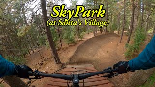
Quick lap on Upper Arrow if you don't want to go all the way to the bottom.

Adaptive Riders:
All bridges have been widened to 48" and Everything has a ride around. There is one wall ride with a tight radius you will probably need to slow down for and the trail tightens slightly at the end.

Detailed Description
Upper Arrow Hot Lap is a 2,949 ft moderately popular intermediate route located near Skyforest California. This mountain bike primary route can be used one direction and has a moderate overall physical rating. This route includes 5 trails. This route climbs 110 ft with a max elevation of 5,907 ft then descends -112 ft.
Local Trail Association
Please consider joining or donating to the local riding association to support trail development & maintenance.
Donate to earn trail karma!

Stats

  • Distance
    2,949 ft
  • Avg time
    17 min 25 sec
  • Altitude min
    5,796 ft
  • Altitude start
    5,907 ft
  • Altitude end
    5,906 ft
  • Climb
    110 ft
  • Descent
    -112 ft
  • Grade
    -0.1%
  • Grade max
    -29.9%
  • Grade min
    23.7%
  • Distance climb
    1,427 ft
  • Distance down
    1,348 ft
  • Distance flat
    174 ft

4 Reviews & Comments


We hope you've been enjoying Trailforks!

Create a FREE account to view route comments and much more.

Trails in Route

Details

  • Riding area
  • Primary Activity
    Mountain Bike
  • Other Activities
    • E-Bike
    • Adaptive Bike
  • Difficulty rating
    Blue
  • Route Type
    Loop
  • eBike Allowed
  • Bike type
    DH, AM, Adaptive MTB
  • Direction
    One Direction
  • Physical rating
    Moderate
  • Ridelogs
    3
no votes yet
close
3D
Trail Conditions
  • Unknown
  • Snow Groomed
  • Snow Packed
  • Snow Covered
  • Snow Cover Partial
  • Freeze/thaw Cycle
  • Icy
  • Prevalent Mud
  • Wet
  • Variable
  • Ideal
  • Dry
  • Very Dry
Trail Flow (Ridden Direction)
Trailforks scans users ridelogs to determine the most popular direction each trail is ridden. A good flowing trail network will have most trails flowing in a single direction according to their intension.
The colour categories are based on what percentage of riders are riding a trail in its intended direction.
  • > 96%
  • > 90%
  • > 80%
  • > 70%
  • > 50%
  • < 50%
  • bi-directional trail
  • no data
Trail Last Ridden
Trailforks scans ridelogs to determine the last time a trail was ridden.
  • < 2 days
  • < 1 week
  • < 2 weeks
  • < 1 month
  • < 6 months
  • > 6 months
Trail Ridden Direction
The intended direction a trail should be ridden.
  • Downhill Only
  • Downhill Primary
  • Both Directions
  • Uphill Primary
  • Uphill Only
  • One Direction
Contribute Details
Colors indicate trail is missing specified detail.
  • Description
  • Photos
  • Description & Photos
  • Videos
Trail Popularity ?
Trailforks scans ridelogs to determine which trails are ridden the most in the last 9 months. Trails are compared with nearby trails in the same city region with a possible 25 colour shades. Think of this as a heatmap, more rides = more kinetic energy = warmer colors.
  • most popular
  • popular
  • less popular
  • not popular
ATV/ORV/OHV Filter
Max Vehicle Width
inches
US Cell Coverage
Legend
cell carrier legend

Radar Time
Activity Recordings
Trailforks uses anonymized public activity data. ?
Activity Recordings
Trailforks uses anonymized public activity data. ?
Personal Heatmap
Activity Types
all / none
Options
2
Date range month
Winter Trails
Warning A routing network for winter maps does not exist. Selecting trails using the winter trails layer has been disabled.
Missing Trails
Most Popular
Least Popular
Trails are colored based on popularity. The more popular a trail is, the more red. Less popular trails trend towards green.
Jump Magnitude Heatmap
Heatmap of where riders jump on trails. Zoom in to see individual jumps, click circles to view jump details.
BC Backroad Status

Service Road Atlas is a free to use, community-driven service for viewing and creating reports on the numerous back-country service roads around B.C. and Alberta.

map legend
Slope Aspect
Direction the slope faces
Flat N NE E SE S SW W NW
Trails Deemphasized
Trails are shown in grey.
disable
Only show trails with no bike usage.
Enable
Suggested Layers
Based on selected activity type

    Save the current map location and zoom level as your default home location whenever this page is loaded.

    Save
    Trail transparency
    • Singletrack
    • Unpaved
    113
    125
    110
    102
    youtuber SkyPark at Santa's Village
    SkyPark at Santa's Village
    trail: Arrow
    16:31 | 88 | comments: 0 | favs:
    May 16, 2025
    youtuber Every Skypark Trail - Newest Updates and Full...
    Every Skypark Trail - Newest Updates and Full Trails
    trail: Arrow
    22:07 | 83 | comments: 0 | favs:
    Nov 13, 2024

    Recent Trail Reports Along Route

    statustraildateconditiondescription
    Arrow
    Jun 9, 2025 @ 11:27am
    Jun 9, 2025
    Rim Of The World Upline
    May 18, 2025 @ 12:50pm
    May 18, 2025
    trails were in excellent condition
    more reports »
    • By jpmcgheeTF Pro Trailforks & contributors
    • #24806 - 627 views

    Hit the Trail

    Open in App

    Get this route on your phone instantly.

    Download Route

    Save to wishlist, Garmin & download.