2.9 miles
Distance
505 ft
Climb
-511 ft
Descent
1,118 ft
High Point
-7 ft
Altitude change
721 ft
Altitude min
728 ft
Altitude start
722 ft
Altitude end
-36.4%
Grade max
29.3%
Grade min
1 mile
Distance climb
5,207 ft
Distance down
2,710 ft
Distance flat

Use at own risk.

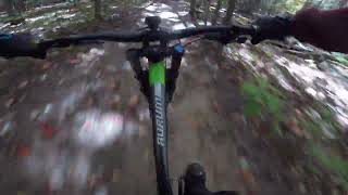
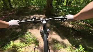
Quick visitor loop Enjoy the easier way up, some good singletrack across the top and a stellar down through Rodeo Ride and into Hillside down to Ski Club Road. Note: Rodeo ride is steep at the top, descend with caution.

Detailed Description
Visitor Loop is a 3 mile moderately popular easy route located near North Bay Ontario. This mountain bike only route. This route includes 16 trails. This route climbs 505 ft with a max elevation of 1,118 ft then descends -511 ft.

Trail Issues on Route

  • Significant Issue / Amber: 1 trail (newest: Jul 14, 2025)
  • Minor Issue / Yellow: 4 trails (newest: Apr 23, 2026)
Local Trail Association
North Bay Mountain Bike Association (www.nbmba.ca)
Please consider joining or donating to the local riding association to support trail development & maintenance.
Donate to earn trail karma!

Stats

  • Distance
    3 miles
  • Avg time
    54 min 26 sec
  • Altitude change
    -7 ft
  • Altitude min
    721 ft
  • Altitude start
    728 ft
  • Altitude end
    722 ft
  • Climb
    505 ft
  • Descent
    -511 ft
  • Grade max
    -36.4%
  • Grade min
    29.3%
  • Distance climb
    1 mile
  • Distance down
    5,207 ft
  • Distance flat
    2,710 ft

3 Reviews & Comments


We hope you've been enjoying Trailforks!

Create a FREE account to view route comments and much more.

Trails in Route

Doubletrack1,253 ft
Pipe Line1,148 ft
Sidewinder56 ft
Ladder1,818 ft
Doe Trail1,650 ft
Child's Play1,457 ft
Butter Ball1,512 ft
Discovery190 ft
Rodeo Ride407 ft
Dragon's Tail758 ft
Rodeo Ride735 ft
Doubletrack994 ft
Sidewinder604 ft
Hill Part 21,398 ft
Sidewinder997 ft

Details

no votes yet
close
3D
Trail Conditions
  • Unknown
  • Snow Groomed
  • Snow Packed
  • Snow Covered
  • Snow Cover Partial
  • Freeze/thaw Cycle
  • Icy
  • Prevalent Mud
  • Wet
  • Variable
  • Ideal
  • Dry
  • Very Dry
Trail Flow (Ridden Direction)
Trailforks scans users ridelogs to determine the most popular direction each trail is ridden. A good flowing trail network will have most trails flowing in a single direction according to their intension.
The colour categories are based on what percentage of riders are riding a trail in its intended direction.
  • > 96%
  • > 90%
  • > 80%
  • > 70%
  • > 50%
  • < 50%
  • bi-directional trail
  • no data
Trail Last Ridden
Trailforks scans ridelogs to determine the last time a trail was ridden.
  • < 2 days
  • < 1 week
  • < 2 weeks
  • < 1 month
  • < 6 months
  • > 6 months
Trail Ridden Direction
The intended direction a trail should be ridden.
  • Downhill Only
  • Downhill Primary
  • Both Directions
  • Uphill Primary
  • Uphill Only
  • One Direction
Contribute Details
Colors indicate trail is missing specified detail.
  • Description
  • Photos
  • Description & Photos
  • Videos
Trail Popularity ?
Trailforks scans ridelogs to determine which trails are ridden the most in the last 9 months. Trails are compared with nearby trails in the same city region with a possible 25 colour shades. Think of this as a heatmap, more rides = more kinetic energy = warmer colors.
  • most popular
  • popular
  • less popular
  • not popular
ATV/ORV/OHV Filter
Max Vehicle Width
inches
US Cell Coverage
Legend
cell carrier legend

Radar Time
Activity Recordings
Trailforks uses anonymized public activity data. ?
Activity Recordings
Trailforks uses anonymized public activity data. ?
Personal Heatmap
Activity Types
all / none
Options
2
Date range month
Winter Trails
Warning A routing network for winter maps does not exist. Selecting trails using the winter trails layer has been disabled.
Missing Trails
Most Popular
Least Popular
Trails are colored based on popularity. The more popular a trail is, the more red. Less popular trails trend towards green.
Jump Magnitude Heatmap
Heatmap of where riders jump on trails. Zoom in to see individual jumps, click circles to view jump details.
BC Backroad Status

Service Road Atlas is a free to use, community-driven service for viewing and creating reports on the numerous back-country service roads around B.C. and Alberta.

map legend
Slope Aspect
Direction the slope faces
Flat N NE E SE S SW W NW
Trails Deemphasized
Trails are shown in grey.
disable
Only show trails with no bike usage.
Enable
Suggested Layers
Based on selected activity type

    Save the current map location and zoom level as your default home location whenever this page is loaded.

    Save
    Trail transparency
    • Singletrack
    • Unpaved
    75 | 1 comments
    42
    34
    50

    Recent Trail Reports Along Route

    statustraildateconditiondescription
    Sidewinder
    Apr 23, 2026 @ 6:04pm (America/Toronto)
    Apr 23, 2026
    Very wet in spots
    Rodeo Ride
    Apr 23, 2026 @ 6:04pm (America/Toronto)
    Apr 23, 2026
    Upper section got a refresh - still need to rehab the steep pitch that was been rutted out
    Child's Play
    Apr 22, 2026 @ 5:52pm (America/Toronto)
    Apr 22, 2026
    Doubletrack
    Apr 22, 2026 @ 5:52pm (America/Toronto)
    Apr 22, 2026
    Butter Ball
    Apr 22, 2026 @ 5:52pm (America/Toronto)
    Apr 22, 2026
    more reports »
    • By northbaymtbTF Pro NBMBA & contributors
    • #15496 - 813 views

    Hit the Trail

    Open in App

    Get this route on your phone instantly.

    Download Route

    Save to wishlist, Garmin & download.