

Open in App
Get this route on your phone instantly.
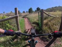
Classic short descending loop with easy(ish) access road climbing.
-
Parking depending on your preference to just get the climb out of the way early (BlueSky Lot), or to break the big climb in half and suffer again at the end (Horsetooth Mtn Lot).
-
Climb the south ridge access trail to the top of Horsetooth Mountain, pause to catch your breath, descend Wathen. Turn left at the junction at the bottom, skip the first right, and follow the drainage up to the second right, Spring Creek connection, to the Towers Access road. It's a short few hundred yards left (up) the Towers Access road to the top of Carey Springs.
-
Carey springs will spit you out on a traverse, just continue the direction you were going on Loggers road until you see the cabin on your left. That's the signal to descend sawmill. The bottom of sawmill requires you keep your head on and attention focused as there are occasionally people climbing it and you do not have infinite visibility. Optionally hit the skidder rocks technical exit to work on your handling skills and then right at the junction continuing down (south) to the valley bottom.
-
Either follow south on the Shoreline trail to exit the park if your legs are blown up, or (recommended) hit up Nomad for a bit more enjoyable singletrack.
-
After the Soderburg parking lot head back through the campground to BlueSky to complete the loop. (Or slog up the hill to Horsetooth if you didn't start at the bottom).
We hope you've been enjoying Trailforks!
Create a FREE account to view route comments and much more.
| 2 miles | |||||
| 456 ft | |||||
| 1 mile | |||||
| 2,280 ft | |||||
| 876 ft | |||||
| 732 ft | |||||
| 2,559 ft | |||||
| 1,322 ft | |||||
| 1 mile | |||||
| 1,411 ft | |||||
| 4,455 ft | |||||
| 623 ft | |||||
| 2,375 ft | |||||
| 1 mile | |||||
| 98 ft | |||||
| 502 ft |

Service Road Atlas is a free to use, community-driven service for viewing and creating reports on the numerous back-country service roads around B.C. and Alberta.
Save the current map location and zoom level as your default home location whenever this page is loaded.
Save