13.7 miles
Distance
2,578 ft
Climb
-2,547 ft
Descent
1 mile
High Point
31 ft
Altitude change
4,627 ft
Altitude min
4,628 ft
Altitude start
4,659 ft
Altitude end
-97.7%
Grade max
47.3%
Grade min
6 miles
Distance climb
6 miles
Distance down
1 mile
Distance flat

A figure 8:
Climb Ranger summit
Descent Bobcat
Ride Ridgeback to Snake and Ladders
Up to the top of Strange Brew and descent back to the WBC parking lot.

Detailed Description
WBC-Figure8 is a 14 mile popular intermediate route located near Bragg Creek Alberta. This mountain bike only route can be used one direction and has a hard overall physical rating. This route includes 11 trails. This route climbs 2,578 ft with a max elevation of 5,594 ft then descends -2,547 ft.

Trail Issues on Route

  • Significant Issue / Amber: 1 trail (newest: Oct 29, 2025)
  • Minor Issue / Yellow: 1 trail (newest: May 9, 2026)
Local Trail Association
Local trail association
Bragg Creek Trails (braggcreektrails.org)
Please consider joining or donating to the local riding association to support trail development & maintenance.
Donate to earn trail karma!

Stats

  • Distance
    14 miles
  • Avg time
    2 hr 1 min
  • Altitude min
    4,627 ft
  • Altitude start
    4,628 ft
  • Altitude end
    4,659 ft
  • Climb
    2,578 ft
  • Descent
    -2,547 ft
  • Grade max
    -97.7%
  • Grade min
    47.3%
  • Distance climb
    6 miles
  • Distance down
    6 miles
  • Distance flat
    1 mile

37 Reviews & Comments


We hope you've been enjoying Trailforks!

Create a FREE account to view route comments and much more.

Trails in Route

Details

  • Riding area
  • Primary Activity
    Mountain Bike
  • Difficulty rating
    Blue
  • Route Type
    Loop
  • Bike type
    XC
  • Direction
    One Direction
  • Physical rating
    Hard
  • Ridelogs
    838
no votes yet
close
3D
Trail Conditions
  • Unknown
  • Snow Groomed
  • Snow Packed
  • Snow Covered
  • Snow Cover Partial
  • Freeze/thaw Cycle
  • Icy
  • Prevalent Mud
  • Wet
  • Variable
  • Ideal
  • Dry
  • Very Dry
Trail Flow (Ridden Direction)
Trailforks scans users ridelogs to determine the most popular direction each trail is ridden. A good flowing trail network will have most trails flowing in a single direction according to their intension.
The colour categories are based on what percentage of riders are riding a trail in its intended direction.
  • > 96%
  • > 90%
  • > 80%
  • > 70%
  • > 50%
  • < 50%
  • bi-directional trail
  • no data
Trail Last Ridden
Trailforks scans ridelogs to determine the last time a trail was ridden.
  • < 2 days
  • < 1 week
  • < 2 weeks
  • < 1 month
  • < 6 months
  • > 6 months
Trail Ridden Direction
The intended direction a trail should be ridden.
  • Downhill Only
  • Downhill Primary
  • Both Directions
  • Uphill Primary
  • Uphill Only
  • One Direction
Contribute Details
Colors indicate trail is missing specified detail.
  • Description
  • Photos
  • Description & Photos
  • Videos
Trail Popularity ?
Trailforks scans ridelogs to determine which trails are ridden the most in the last 9 months. Trails are compared with nearby trails in the same city region with a possible 25 colour shades. Think of this as a heatmap, more rides = more kinetic energy = warmer colors.
  • most popular
  • popular
  • less popular
  • not popular
ATV/ORV/OHV Filter
Max Vehicle Width
inches
US Cell Coverage
Legend
cell carrier legend

Radar Time
Activity Recordings
Trailforks uses anonymized public activity data. ?
Activity Recordings
Trailforks uses anonymized public activity data. ?
Personal Heatmap
Activity Types
all / none
Options
2
Date range month
Winter Trails
Warning A routing network for winter maps does not exist. Selecting trails using the winter trails layer has been disabled.
Missing Trails
Most Popular
Least Popular
Trails are colored based on popularity. The more popular a trail is, the more red. Less popular trails trend towards green.
Jump Magnitude Heatmap
Heatmap of where riders jump on trails. Zoom in to see individual jumps, click circles to view jump details.
BC Backroad Status

Service Road Atlas is a free to use, community-driven service for viewing and creating reports on the numerous back-country service roads around B.C. and Alberta.

map legend
Slope Aspect
Direction the slope faces
Flat N NE E SE S SW W NW
Trails Deemphasized
Trails are shown in grey.
disable
Only show trails with no bike usage.
Enable
Suggested Layers
Based on selected activity type

    Save the current map location and zoom level as your default home location whenever this page is loaded.

    Save
    Trail transparency
    • Singletrack
    • Unpaved
    437
    542
    558
    404
    Mountain Biking Bragg Creek,  Alberta, South...
    Mountain Biking Bragg Creek, Alberta, South Sector: May 2025
    21:35 | 105 | comments: 0 | favs:
    May 26, 2025
    Mountain Biking Bragg Creek,  Alberta, South...
    Mountain Biking Bragg Creek, Alberta, South Sector: May 2025
    21:35 | 100 | comments: 0 | favs:
    May 26, 2025

    Recent Trail Reports Along Route

    statustraildateconditiondescription
    Boundary Ridge
    May 25, 2026 @ 3:39pm (America/Creston)
    May 25, 2026
    Ranger Summit
    May 25, 2026 @ 3:39pm (America/Creston)
    May 25, 2026
    Snakes & Ladders
    May 25, 2026 @ 3:39pm (America/Creston)
    May 25, 2026
    Strange Brew
    May 24, 2026 @ 9:00pm (America/Edmonton)
    May 24, 2026
    Ridgeback – R3
    May 9, 2026 @ 12:13pm (America/Edmonton)
    May 9, 2026
    more reports »
    • By EdmontonMountainBikeAllianceTF Pro EMBA & contributors
    • #2318 - 1,333 views

    Hit the Trail

    Open in App

    Get this route on your phone instantly.
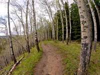
    Download Route

    Save to wishlist, Garmin & download.