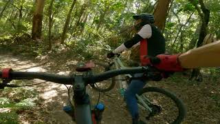
As of right now (beginning 2017) this is as easy as it gets on the westside of Parklands. This route is a good way to start off before taking on more of the blue trails.
By the end of this year there will be new green trails starting from the car park allowing novice/beginner riders better access to the trail network and allowing smoother progression to the more demanding trails.
Trail Issues on Route
- Minor Issue / Yellow: 1 trail (newest: Nov 23, 2019)
Local Trail Association
Bushrangers MTB Club Sunshine Coast (www.bushrangers.org)Stats
-
Distance4 miles
-
Avg time1 hr 48 min
-
Altitude min110 ft
-
Altitude start194 ft
-
Altitude end190 ft
-
Climb340 ft
-
Descent-344 ft
-
Grade max-26.6%
-
Grade min20%
-
Distance climb1 mile
-
Distance down2 miles
-
Distance flat2,087 ft
5 Reviews & Comments
We hope you've been enjoying Trailforks!
Create a FREE account to view route comments and much more.
- Unknown
- Snow Groomed
- Snow Packed
- Snow Covered
- Snow Cover Partial
- Freeze/thaw Cycle
- Icy
- Prevalent Mud
- Wet
- Variable
- Ideal
- Dry
- Very Dry
The colour categories are based on what percentage of riders are riding a trail in its intended direction.
- > 96%
- > 90%
- > 80%
- > 70%
- > 50%
- < 50%
- bi-directional trail
- no data
- < 2 days
- < 1 week
- < 2 weeks
- < 1 month
- < 6 months
- > 6 months
- Downhill Only
- Downhill Primary
- Both Directions
- Uphill Primary
- Uphill Only
- One Direction
- Description
- Photos
- Description & Photos
- Videos
- most popular
- popular
- less popular
- not popular
Service Road Atlas is a free to use, community-driven service for viewing and creating reports on the numerous back-country service roads around B.C. and Alberta.
Save the current map location and zoom level as your default home location whenever this page is loaded.
Save- Singletrack
- Unpaved
Photos
Videos
Recent Trail Reports Along Route
- By naturalnetworks & contributors
- #3296 - 1,336 views
