
Open in App
Get this route on your phone instantly.
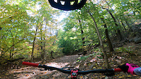
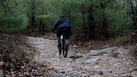
This Blue Hills loop connects most of the intermediate sections of both the white and yellow triangle trails. It avoids some of the more difficult sections but there is still some tough climbs and rocky descents. This is fairly easy to follow as most of the route follows the triangle markings on the trees.
You just need to pay attention to when the route diverts off of the trail markings from time to time. This is a great loop to connect to the Ponkapoag section of the Blue Hills. .
We hope you've been enjoying Trailforks!
Create a FREE account to view route comments and much more.
| 407 ft | |||||
| 1,437 ft | |||||
| 102 ft | |||||
| 230 ft | |||||
| 125 ft | |||||
| 1,854 ft | |||||
| 1,316 ft | |||||
| 850 ft | |||||
| 407 ft | |||||
| 781 ft | |||||
| 728 ft | |||||
| 358 ft | |||||
| 2,680 ft | |||||
| 1,240 ft | |||||
| 220 ft | |||||
| 105 ft | |||||
| 699 ft | |||||
| 266 ft | |||||
| 1,988 ft | |||||
| 233 ft | |||||
| 922 ft | |||||
| 584 ft | |||||
| 220 ft | |||||
| 909 ft | |||||
| 1,407 ft | |||||
| 830 ft | |||||
| 617 ft | |||||
| 1,811 ft | |||||
| 883 ft | |||||
| 118 ft | |||||
| 89 ft | |||||
| 2,343 ft | |||||
| 157 ft | |||||
| 98 ft | |||||
| 2,028 ft | |||||
| 407 ft |

Service Road Atlas is a free to use, community-driven service for viewing and creating reports on the numerous back-country service roads around B.C. and Alberta.
Save the current map location and zoom level as your default home location whenever this page is loaded.
Save