16.1 miles
Distance
1,634 ft
Climb
-1,623 ft
Descent
693 ft
High Point
9 ft
Altitude change
112 ft
Altitude min
113 ft
Altitude start
121 ft
Altitude end
-79.5%
Grade max
64.5%
Grade min
9 miles
Distance climb
6 miles
Distance down
1 mile
Distance flat

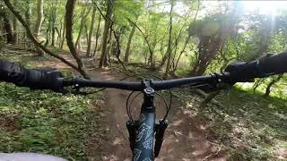
YT Mill Demo Ride Pre planned route.

Flow trails including berms and jumps that are able to be rolled.

Some technical terrain with steep hills and slippery when raining.

Detailed Description
YT 3 Hour Loop is a 16 mile moderately popular intermediate route located near Guildford. This mountain bike primary route can be used one direction and has a moderate overall physical rating. This route includes 5 trails. This route climbs 1,634 ft with a max elevation of 693 ft then descends -1,623 ft.
Local Trail Association
Please consider joining or donating to the local riding association to support trail development & maintenance.
Donate to earn trail karma!

Stats

  • Distance
    16 miles
  • Avg time
    2 hr 53 min
  • Altitude min
    112 ft
  • Altitude start
    113 ft
  • Altitude end
    121 ft
  • Climb
    1,634 ft
  • Descent
    -1,623 ft
  • Grade max
    -79.5%
  • Grade min
    64.5%
  • Distance climb
    9 miles
  • Distance down
    6 miles
  • Distance flat
    1 mile

13 Reviews & Comments


We hope you've been enjoying Trailforks!

Create a FREE account to view route comments and much more.

Trails in Route

Chantries Trail3,593 ft
Log Jump361 ft
No Danger in Netley2,352 ft
Trail3,031 ft
Curly Taco423 ft

Details

  • Riding area
  • Primary Activity
    Mountain Bike
  • Other Activities
    • E-Bike
  • Difficulty rating
    Blue
  • Route Type
    Loop
  • eBike Allowed
  • Bike type
    AM, XC
  • Direction
    One Direction
  • Physical rating
    Moderate
no votes yet
close
3D
Trail Conditions
  • Unknown
  • Snow Groomed
  • Snow Packed
  • Snow Covered
  • Snow Cover Partial
  • Freeze/thaw Cycle
  • Icy
  • Prevalent Mud
  • Wet
  • Variable
  • Ideal
  • Dry
  • Very Dry
Trail Flow (Ridden Direction)
Trailforks scans users ridelogs to determine the most popular direction each trail is ridden. A good flowing trail network will have most trails flowing in a single direction according to their intension.
The colour categories are based on what percentage of riders are riding a trail in its intended direction.
  • > 96%
  • > 90%
  • > 80%
  • > 70%
  • > 50%
  • < 50%
  • bi-directional trail
  • no data
Trail Last Ridden
Trailforks scans ridelogs to determine the last time a trail was ridden.
  • < 2 days
  • < 1 week
  • < 2 weeks
  • < 1 month
  • < 6 months
  • > 6 months
Trail Ridden Direction
The intended direction a trail should be ridden.
  • Downhill Only
  • Downhill Primary
  • Both Directions
  • Uphill Primary
  • Uphill Only
  • One Direction
Contribute Details
Colors indicate trail is missing specified detail.
  • Description
  • Photos
  • Description & Photos
  • Videos
Trail Popularity ?
Trailforks scans ridelogs to determine which trails are ridden the most in the last 9 months. Trails are compared with nearby trails in the same city region with a possible 25 colour shades. Think of this as a heatmap, more rides = more kinetic energy = warmer colors.
  • most popular
  • popular
  • less popular
  • not popular
ATV/ORV/OHV Filter
Max Vehicle Width
inches
US Cell Coverage
Legend
cell carrier legend

Radar Time
Activity Recordings
Trailforks uses anonymized public activity data. ?
Activity Recordings
Trailforks uses anonymized public activity data. ?
Personal Heatmap
Activity Types
all / none
Options
2
Date range month
Winter Trails
Warning A routing network for winter maps does not exist. Selecting trails using the winter trails layer has been disabled.
Missing Trails
Most Popular
Least Popular
Trails are colored based on popularity. The more popular a trail is, the more red. Less popular trails trend towards green.
Jump Magnitude Heatmap
Heatmap of where riders jump on trails. Zoom in to see individual jumps, click circles to view jump details.
BC Backroad Status

Service Road Atlas is a free to use, community-driven service for viewing and creating reports on the numerous back-country service roads around B.C. and Alberta.

map legend
Slope Aspect
Direction the slope faces
Flat N NE E SE S SW W NW
Trails Deemphasized
Trails are shown in grey.
disable
Only show trails with no bike usage.
Enable
Suggested Layers
Based on selected activity type

    Save the current map location and zoom level as your default home location whenever this page is loaded.

    Save
    Trail transparency
    • Singletrack
    289
    199
    265
    542
    Thrinstone Woods
    Thrinstone Woods
    trail: Log Jump
    9:09 | 230 | comments: 1 | favs:
    Sep 25, 2011
    Starting at top of hill descending down to road (log jump not done this time) follows on down to arched bridge.

    Recent Trail Reports Along Route

    statustraildateconditiondescription
    Trail
    Jun 19, 2026 @ 6:21pm (Europe/London)
    Jun 19, 2026
    Curly Taco
    Oct 1, 2025 @ 12:41pm (Europe/London)
    Oct 1, 2025
    No Danger in Netley
    May 1, 2025 @ 5:54pm
    May 1, 2025
    Log Jump
    Nov 24, 2024 @ 1:26pm
    Nov 24, 2024
    Chantries Trail
    Oct 25, 2023 @ 8:30am
    Oct 25, 2023
    more reports »
    • By ReubshredsTF Pro & contributors
    • #28319 - 3,344 views

    Hit the Trail

    Open in App

    Get this route on your phone instantly.

    Download Route

    Save to wishlist, Garmin & download.