more stats
5,233 ft
Distance
133 ft
Climb
-156 ft
Descent
00:11:37
Avg time
-23 ft
Altitude change
379 ft
Altitude min
501 ft
Altitude max
500 ft
Altitude start
476 ft
Altitude end
-0.4%
Grade
-33.2%
Grade max
20.8%
Grade min
2,415 ft
Distance climb
2,087 ft
Distance down
732 ft
Distance flat
00:11:37
Avg time

2K Details

  • Activities
    • Mountain Bike
    • E-Bike
    • Hike
    • Trail Running
  • Riding Area
    Bukit Kiara
    Kuala Lumpur
  • Difficulty Rating
  • Voted Difficulty
    Blue (1 vote)
  • Local Popularity
    100 in Mountain Biking [+]
    • 100 in E-Biking
    • 45 in Trail Running
    • 50 in Hiking
  • Global Ranking
    #19368 in Mountain Biking [+]
    • #2512 in E-Biking
    • #107855 in Trail Running
    • #99683 in Hiking
  • Trail Type
    Singletrack
  • Bike Type
    AM, XC
  • Climb Difficulty
    Blue
  • Physical Rating
    Moderate
  • Trail Visibility
    Always easy to follow
  • Dogs Allowed
    Yes
  • eBike Allowed
    Yes up to Class 1
  • TTFs on Trail
    Berm, Drop, Jump, Gap Jump
  • Ride in Rain
    Yes

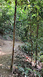
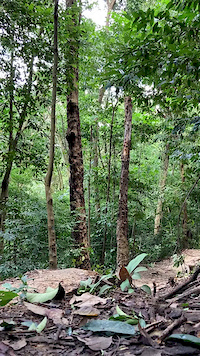
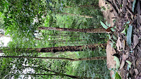
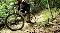
This trail is the mainstay of Bukit Kiara. Recently a few wooden features have been added to 2K, namely a drop and a gap jump. Be advised that this is an intermediate trail, as such please exercise caution when attempting to ride these features.

Disclaimer

Ride within your limits. No helmet, no ride!

Local Trail Association

Recent Activity on Trail

Past Week
  • 2 rides
  • 12.4 km average
6 Months
  • 50 rides
  • 13.3 km avg distance
All
  • 570 rides
  • Last: Jun 13, 2026
c1c2c3c4
January
February
March
April
May
June
July
August
September
October
November
December
update trails status or condition

2K Trail Reports

statusdatedescription
Dec 14, 2024 @ 8:16am
Dec 14, 2024
Jan 27, 2024 @ 1:28am
Jan 27, 2024
Massive widowmaker across the trail right after the 2 jumps!
Aug 11, 2023 @ 5:42am
Aug 11, 2023
Apr 2, 2023 @ 4:37pm
Apr 2, 2023
Large tree down across trail, go over!
Oct 7, 2022 @ 3:50am
Oct 7, 2022
Large tree down across trail, blocking trail. Up & over!
more »
Status:
on Dec 14, 2024
Ideal
Avg: 3.88 (3 votes)
Your vote: 0

view (12,391)
close
3D
Trail Conditions
  • Unknown
  • Snow Groomed
  • Snow Packed
  • Snow Covered
  • Snow Cover Partial
  • Freeze/thaw Cycle
  • Icy
  • Prevalent Mud
  • Wet
  • Variable
  • Ideal
  • Dry
  • Very Dry
Trail Flow (Ridden Direction)
Trailforks scans users ridelogs to determine the most popular direction each trail is ridden. A good flowing trail network will have most trails flowing in a single direction according to their intension.
The colour categories are based on what percentage of riders are riding a trail in its intended direction.
  • > 96%
  • > 90%
  • > 80%
  • > 70%
  • > 50%
  • < 50%
  • bi-directional trail
  • no data
Trail Last Ridden
Trailforks scans ridelogs to determine the last time a trail was ridden.
  • < 2 days
  • < 1 week
  • < 2 weeks
  • < 1 month
  • < 6 months
  • > 6 months
Trail Ridden Direction
The intended direction a trail should be ridden.
  • Downhill Only
  • Downhill Primary
  • Both Directions
  • Uphill Primary
  • Uphill Only
  • One Direction
Contribute Details
Colors indicate trail is missing specified detail.
  • Description
  • Photos
  • Description & Photos
  • Videos
Trail Popularity ?
Trailforks scans ridelogs to determine which trails are ridden the most in the last 9 months. Trails are compared with nearby trails in the same city region with a possible 25 colour shades. Think of this as a heatmap, more rides = more kinetic energy = warmer colors.
  • most popular
  • popular
  • less popular
  • not popular
ATV/ORV/OHV Filter
Max Vehicle Width
inches
US Cell Coverage
Legend
cell carrier legend

Radar Time
Activity Recordings
Trailforks uses anonymized public activity data. ?
Activity Recordings
Trailforks uses anonymized public activity data. ?
Personal Heatmap
Activity Types
all / none
Options
2
Date range month
Winter Trails
Warning A routing network for winter maps does not exist. Selecting trails using the winter trails layer has been disabled.
Missing Trails
Most Popular
Least Popular
Trails are colored based on popularity. The more popular a trail is, the more red. Less popular trails trend towards green.
Jump Magnitude Heatmap
Heatmap of where riders jump on trails. Zoom in to see individual jumps, click circles to view jump details.
BC Backroad Status

Service Road Atlas is a free to use, community-driven service for viewing and creating reports on the numerous back-country service roads around B.C. and Alberta.

map legend
Slope Aspect
Direction the slope faces
Flat N NE E SE S SW W NW
Trails Deemphasized
Trails are shown in grey.
disable
Only show trails with no bike usage.
Enable
Suggested Layers
Based on selected activity type

    Save the current map location and zoom level as your default home location whenever this page is loaded.

    Save
        Directions to 2k trailhead (3.151910, 101.637470)

        Photos

        71 more »
        29 |
        Jul 19, 2025 @ 8:22pm
        Jul 19, 2025
        33 |
        Aug 12, 2022 @ 12:40am
        Aug 12, 2022
        29 |
        Aug 5, 2022 @ 8:33pm
        Aug 5, 2022
        20 |
        Aug 5, 2022 @ 8:31pm
        Aug 5, 2022

        Videos

        4 more »
        New drop
        0:14 | 31 | May 30, 2022 , Kuala Lumpur
        2K Drop
        0:11 | 51 | Oct 18, 2020 , Kuala Lumpur
        2K Box drop
        0:11 | | Jul 26, 2020 , Kuala Lumpur
        Ronin in Kiara
        4:30 | 890 | Aug 14, 2014 , Kuala Lumpur

        1 Review & Comments


        We hope you've been enjoying Trailforks!

        Create a FREE account to view trail comments and much more.

        Frequently Asked Questions About 2K

        Where is 2K located?
        2K is located in Bukit Kiara, Kuala Lumpur, Malaysia. It is part of the Bukit Kiara trail network. The trailhead is located at coordinates 3.15191, 101.63747.
        How hard is 2K?
        2K is rated as Blue difficulty. The physical rating is Moderate. The average grade is 0.4%. The climb difficulty is rated Blue.
        What is the elevation gain for 2K?
        2K has 133 ft of elevation gain. The trail has 156 ft of elevation descent. The elevation ranges from 379 ft to 501 ft.
        How long is 2K?
        2K is 5,233 ft long. The trail type is singletrack.

        Hit the Trail

        Open in App

        Get this trail on your phone instantly.
        open trail in app

        Download Trail

        Save to wishlist, Garmin & download.
        save the trail

        Find Related Routes

        Find routes and users activities that include this trail.
        find routes for this trail

        You must enter a description before submitting.