more stats
2.8 miles
Distance
176 ft
Climb
-254 ft
Descent
00:24:38
Avg time
-77 ft
Altitude change
862 ft
Altitude min
975 ft
Altitude max
939 ft
Altitude start
863 ft
Altitude end
-0.5%
Grade
-21%
Grade max
17.2%
Grade min
3,491 ft
Distance climb
1 mile
Distance down
1 mile
Distance flat
00:24:38
Avg time

AC⚡DC Details

  • Activities
    • Mountain Bike
    • E-Bike
    • Hike
    • Trail Running
  • Riding Area
    Knoxville Urban Wilderness
    Knoxville, Tennessee
  • Difficulty Rating
  • Voted Difficulty
    Blue (1 vote)
  • Local Popularity
    75 in Mountain Biking [+]
    • 80 in E-Biking
    • 65 in Trail Running
    • 65 in Hiking
  • Global Ranking
    #15552 in Mountain Biking [+]
    • #43123 in Trail Running
    • #34297 in Hiking
  • Trail Type
    Singletrack
  • Bike Type
    AM, XC
  • Direction
    Downhill Primary
    Popular Direction Shown
  • Climb Difficulty
    Blue
  • Physical Rating
    Hard
  • Dogs Allowed
    Yes
  • eBike Allowed
    Yes up to Class 1
  • TTFs on Trail
    Berm, Bridge, Wallride

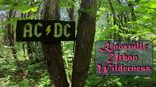
Great little used, hard pack, single track with a few man made features. One wall, 7 bridges, a few a good ways off the ground.(Bridges are considered black diamond). Trail offers some nice flowy sections with enough roots and rocks to keep your attention. No long climbs but the short ones there can be on the technical side. This is a little ridden gem among the trails in Knoxville's Urban Wilderness.

Local Trail Association

Recent Activity on Trail

Past Week
  • 5 rides
  • 12 miles average
6 Months
  • 72 rides
  • 12 miles avg distance
All
  • 466 rides
  • Last: Jun 19, 2026
c1c2c3c4
January
February
March
April
May
June
July
August
September
October
November
December
update trails status or condition

AC⚡DC Trail Reports

Status:
on May 25, 2025
Ideal
Avg: 4.18 (11 votes)
Your vote: 0

view (2,625)
close
3D
Trail Conditions
  • Unknown
  • Snow Groomed
  • Snow Packed
  • Snow Covered
  • Snow Cover Partial
  • Freeze/thaw Cycle
  • Icy
  • Prevalent Mud
  • Wet
  • Variable
  • Ideal
  • Dry
  • Very Dry
Trail Flow (Ridden Direction)
Trailforks scans users ridelogs to determine the most popular direction each trail is ridden. A good flowing trail network will have most trails flowing in a single direction according to their intension.
The colour categories are based on what percentage of riders are riding a trail in its intended direction.
  • > 96%
  • > 90%
  • > 80%
  • > 70%
  • > 50%
  • < 50%
  • bi-directional trail
  • no data
Trail Last Ridden
Trailforks scans ridelogs to determine the last time a trail was ridden.
  • < 2 days
  • < 1 week
  • < 2 weeks
  • < 1 month
  • < 6 months
  • > 6 months
Trail Ridden Direction
The intended direction a trail should be ridden.
  • Downhill Only
  • Downhill Primary
  • Both Directions
  • Uphill Primary
  • Uphill Only
  • One Direction
Contribute Details
Colors indicate trail is missing specified detail.
  • Description
  • Photos
  • Description & Photos
  • Videos
Trail Popularity ?
Trailforks scans ridelogs to determine which trails are ridden the most in the last 9 months. Trails are compared with nearby trails in the same city region with a possible 25 colour shades. Think of this as a heatmap, more rides = more kinetic energy = warmer colors.
  • most popular
  • popular
  • less popular
  • not popular
ATV/ORV/OHV Filter
Max Vehicle Width
inches
US Cell Coverage
Legend
cell carrier legend

Radar Time
Activity Recordings
Trailforks uses anonymized public activity data. ?
Activity Recordings
Trailforks uses anonymized public activity data. ?
Personal Heatmap
Activity Types
all / none
Options
2
Date range month
Winter Trails
Warning A routing network for winter maps does not exist. Selecting trails using the winter trails layer has been disabled.
Missing Trails
Most Popular
Least Popular
Trails are colored based on popularity. The more popular a trail is, the more red. Less popular trails trend towards green.
Jump Magnitude Heatmap
Heatmap of where riders jump on trails. Zoom in to see individual jumps, click circles to view jump details.
BC Backroad Status

Service Road Atlas is a free to use, community-driven service for viewing and creating reports on the numerous back-country service roads around B.C. and Alberta.

map legend
Slope Aspect
Direction the slope faces
Flat N NE E SE S SW W NW
Trails Deemphasized
Trails are shown in grey.
disable
Only show trails with no bike usage.
Enable
Suggested Layers
Based on selected activity type

    Save the current map location and zoom level as your default home location whenever this page is loaded.

    Save
        Directions to ac--dc trailhead (35.928880, -83.855470)

        Photos

        8 more »
        250 |
        Nov 15, 2021 @ 6:03pm
        Nov 15, 2021
        242 |
        Oct 17, 2020 @ 10:48am
        Oct 17, 2020
        261 |
        Sep 11, 2020 @ 7:57pm
        Sep 11, 2020
        218 |
        Sep 11, 2020 @ 7:57pm
        Sep 11, 2020

        Videos

        2 more »
        AC⚡DC - Knoxville Urban Wilderness -...
        4:21 | 588 | Jun 27, 2021 , Knoxville
        Bridges
        0:39 | 1201 | Jul 29, 2018 , Knoxville

        Routes with this trail

        3.6 21 miles 2,148 ft 19 Loop
        This route is intended for the Appalachian Mountain Bike Club's Fall Festival Advanced Group Ride. >...
        17 miles 1,575 ft 13
        Route created for Roam Fest Knoxville. Starts in Preserve and rides over to year round get down, both of...
        17 miles 1,780 ft 28 Point to Point
        This is On Your Own ride will not be Guided. Get after it! This route will test your fitness and skills,...

        2 Reviews & Comments


        We hope you've been enjoying Trailforks!

        Create a FREE account to view trail comments and much more.

        Frequently Asked Questions About AC⚡DC

        Where is AC⚡DC located?
        AC⚡DC is located in Knoxville Urban Wilderness, Knoxville, Tennessee, United States. It is part of the Knoxville Urban Wilderness trail network. The trailhead is located at coordinates 35.92888, -83.85547.
        How hard is AC⚡DC?
        AC⚡DC is rated as Blue difficulty. The physical rating is Hard. The average grade is 0.5%. The climb difficulty is rated Blue.
        What is the elevation gain for AC⚡DC?
        AC⚡DC has 54 m of elevation gain. The trail has 77 m of elevation descent. The elevation ranges from 263 m to 297 m.
        Is AC⚡DC a point to point trail?
        AC⚡DC is not a point to point trail. The direction is Downhill Primary. The trail type is singletrack.

        Hit the Trail

        Open in App

        Get this trail on your phone instantly.
        open trail in app

        Download Trail

        Save to wishlist, Garmin & download.
        save the trail

        Find Related Routes

        Find routes and users activities that include this trail.
        find routes for this trail

        You must enter a description before submitting.